
Chaba Trail to Fortress Lake
This is one of the trips I’ve been dreaming about for a long time, and preparing mentally and physically for. I’ve been doing lots of research on the area, and I’m really excited to finally go.
Hamber Park is pretty rarely visited by hikers in summer. Most of the year you can’t reach it on foot, because the snow cover melts and the river gets too big. The bridge over the Athabasca River was washed out years ago and Parks hasn’t repaired it. So officially Hamber Provincial Park is “not accessible” (they put signs everywhere), but you can still get there by crossing the river on foot in early May, when snowmelt isn’t in full swing, or sometime in October when it calms down. Between May and October you can also get there by kayak or raft if you have the skill and the right equipment. In winter you can get there on snow (ski, snowshoe, snowmobile, etc.).
What do you need for this trip: knowing how to cross rivers, some navigation skills (nothing crazy), willingness to do a bit of bushwhacking, and being bear aware of course. Fortress Lake campground has bear lockers, no hangers required. The campground is free and first come first serve.
Anyway, if you decide to go, do it at your own risk. Take all the precautions you need. Tell someone where you’re going. Leave a trip plan on your windshield. Don’t forget an emergency communication plan. Stay safe and have fun.
So with that being said, the drive from Calgary is about 4 hours, and it’s 15 km to the river ford. I book the Athabasca Crossing campsite just in case the river isn’t fordable, and I hit the road around 4-5 am.
Day 1
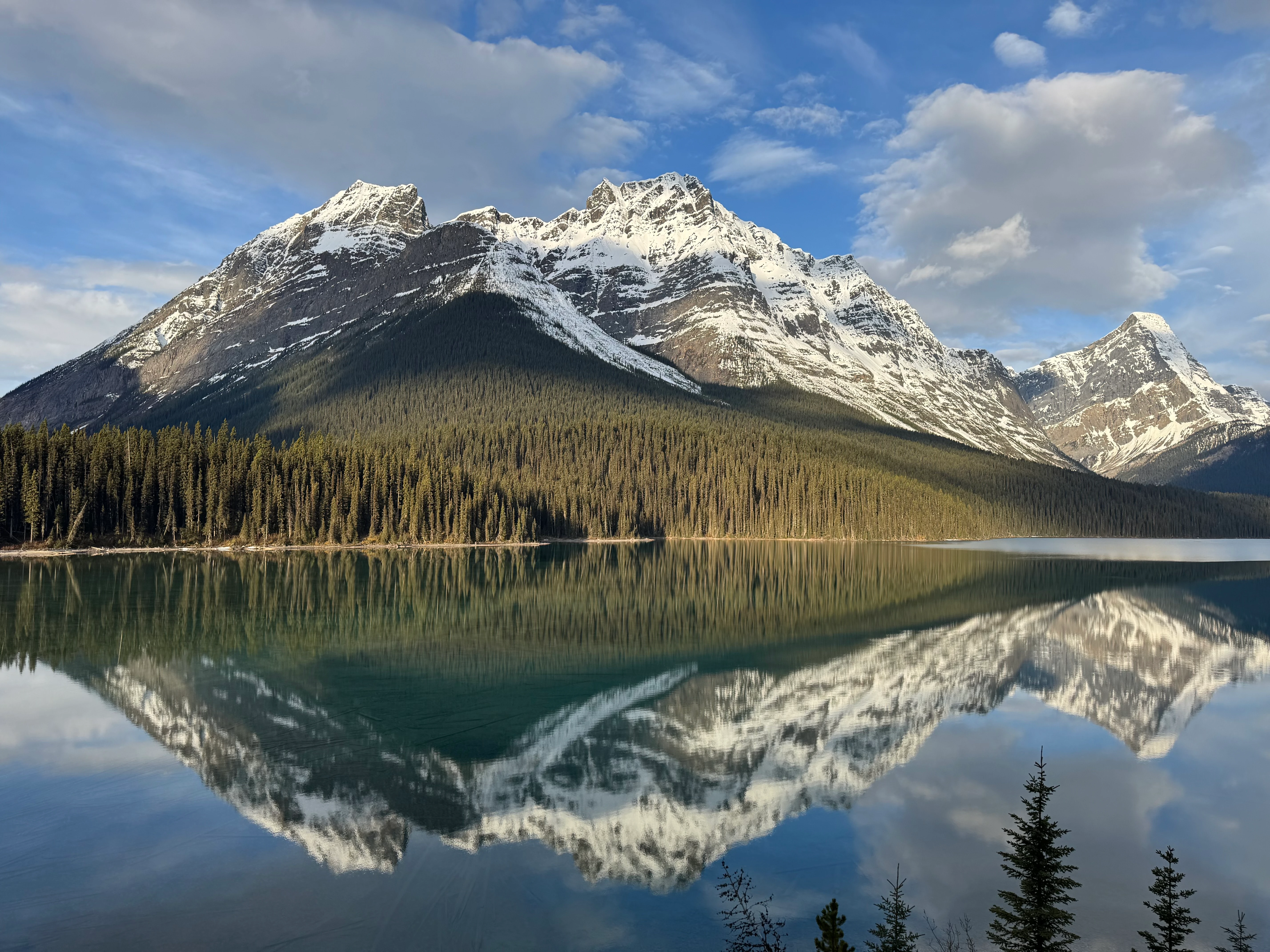
The drive is great, the Rockies are absolutely charming this time of the year. The peaks are still snowcapped and some high-altitude lakes are still frozen. The air is crisp. I stop at the Icefields Parkway viewpoint to breathe that sweet mountain air. No one around. Still early morning.
View from the Icefields Parkway viewpoint
The weather forecast is a bit iffy, but it still looks like a good day for the hike.
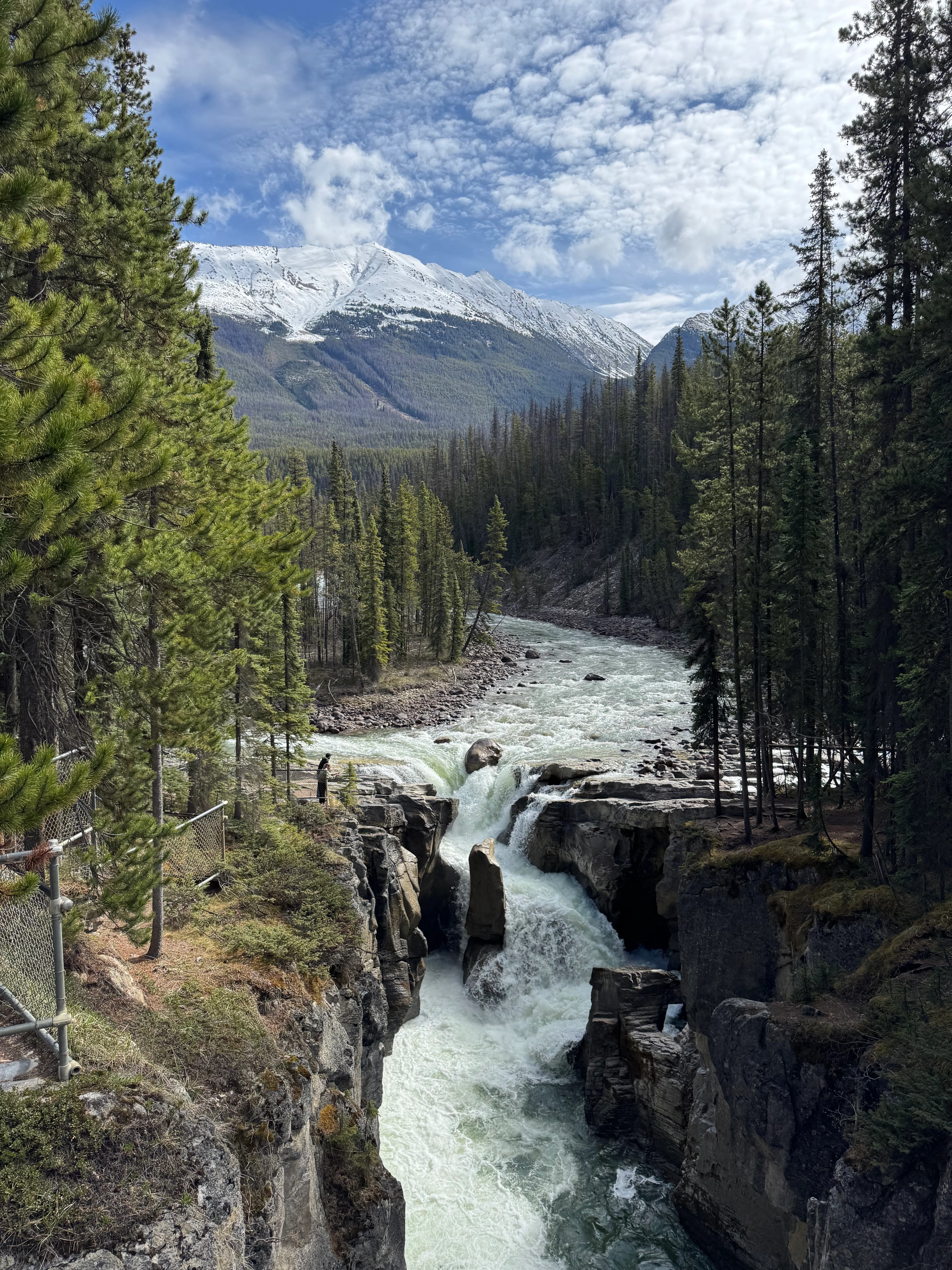
I park at Sunwapta Falls and decide to check out both falls, upper and lower. It’s around 9:30 now. People start coming in. Lots of tourists. The waterfalls are amazing. The flow is huge, the sound is calming, and the splashing is refreshing. Feels good to be here.

Upper Sunwapta Falls from the bridge. Mount Morden Long and Mount Confederation to the right if I'm not mistaken
I hit the Chaba Trail now. Not long after, there’s the park warning sign telling you not to attempt the Athabasca River crossing. I appreciate the effort to keep people safe, but I’m not turning back anyway. I have a backup plan in case the river isn’t fordable, so I don’t need to hike back 15 km.
I never get into the water if it’s not safe. I never overestimate my skills and never underestimate the risks. Nature can be unforgiving, and it makes you think twice before you act.
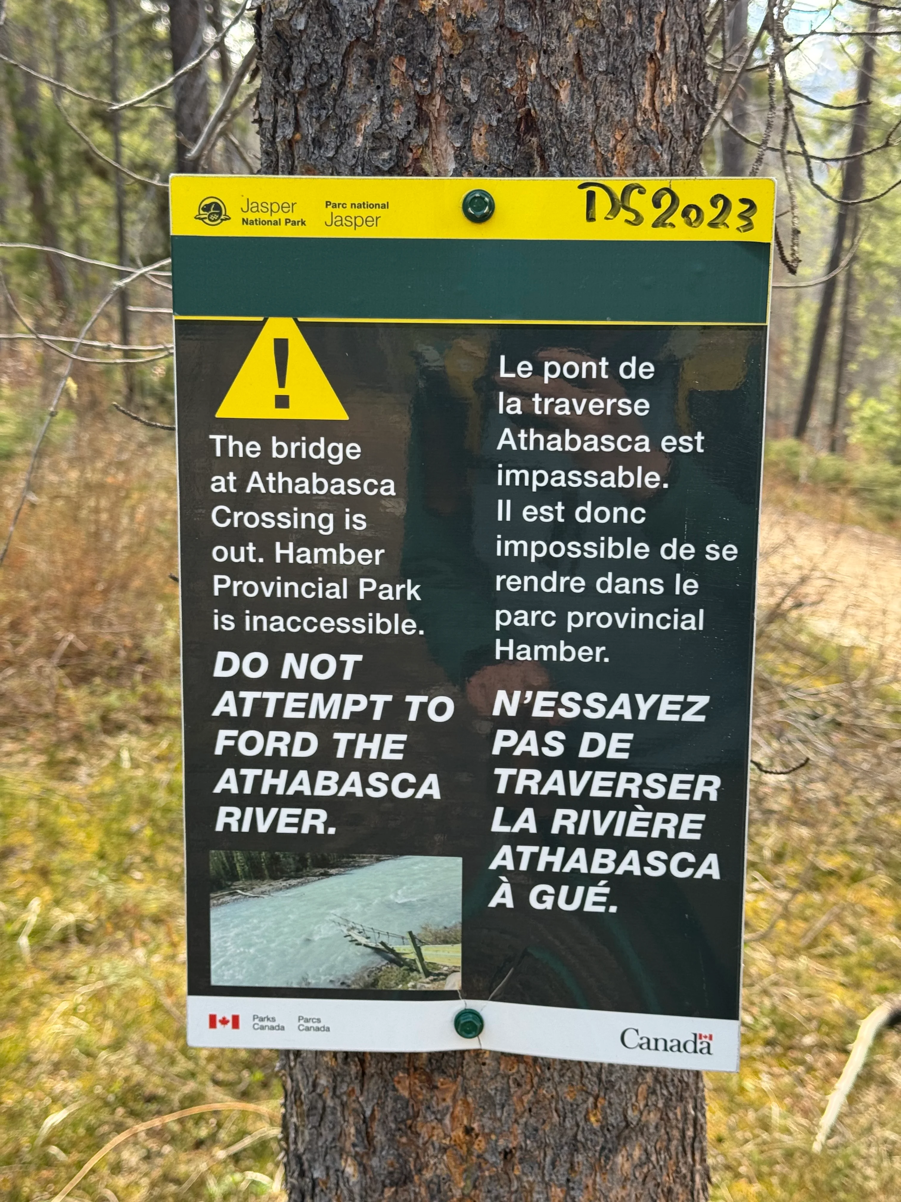
Warning sign to not attempt the Athabasca River crossing

The trail goes through the woods. It’s quite wide and a popular place for mountain biking.
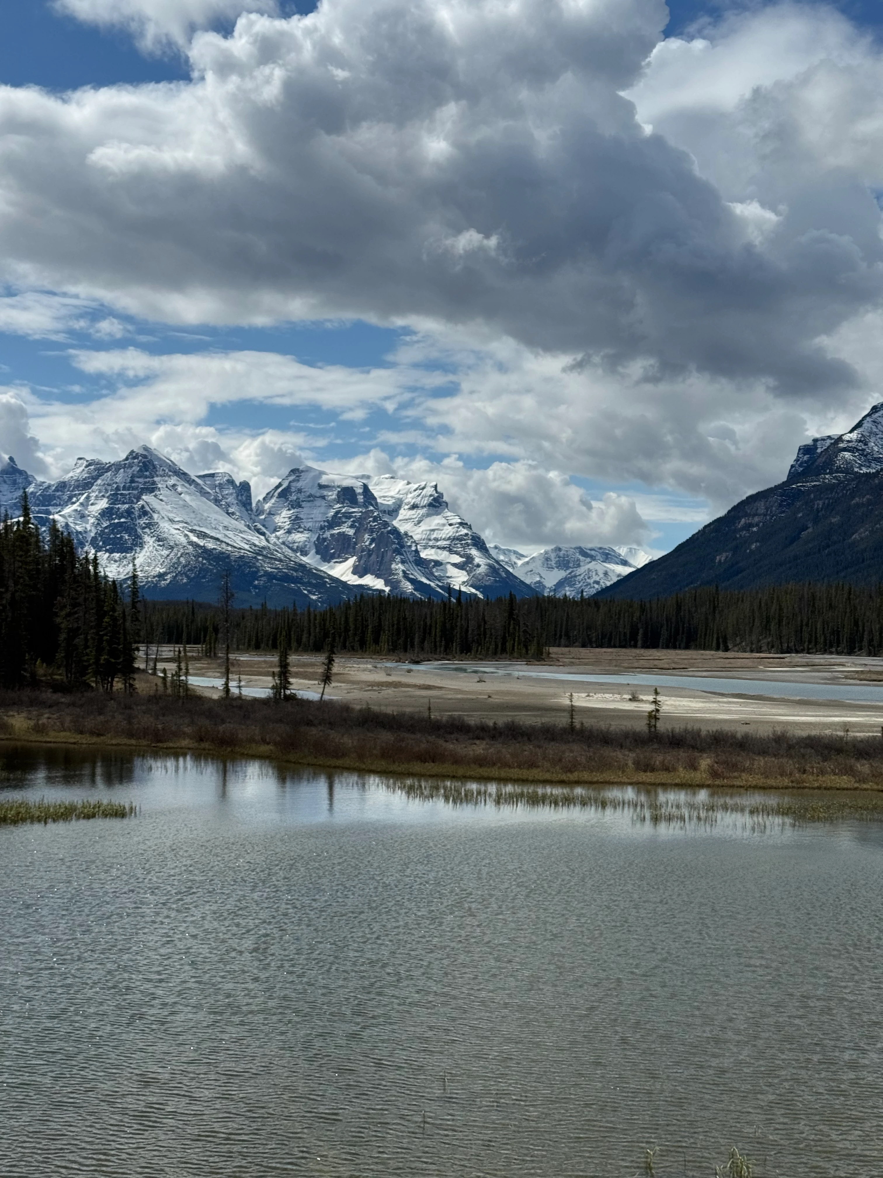
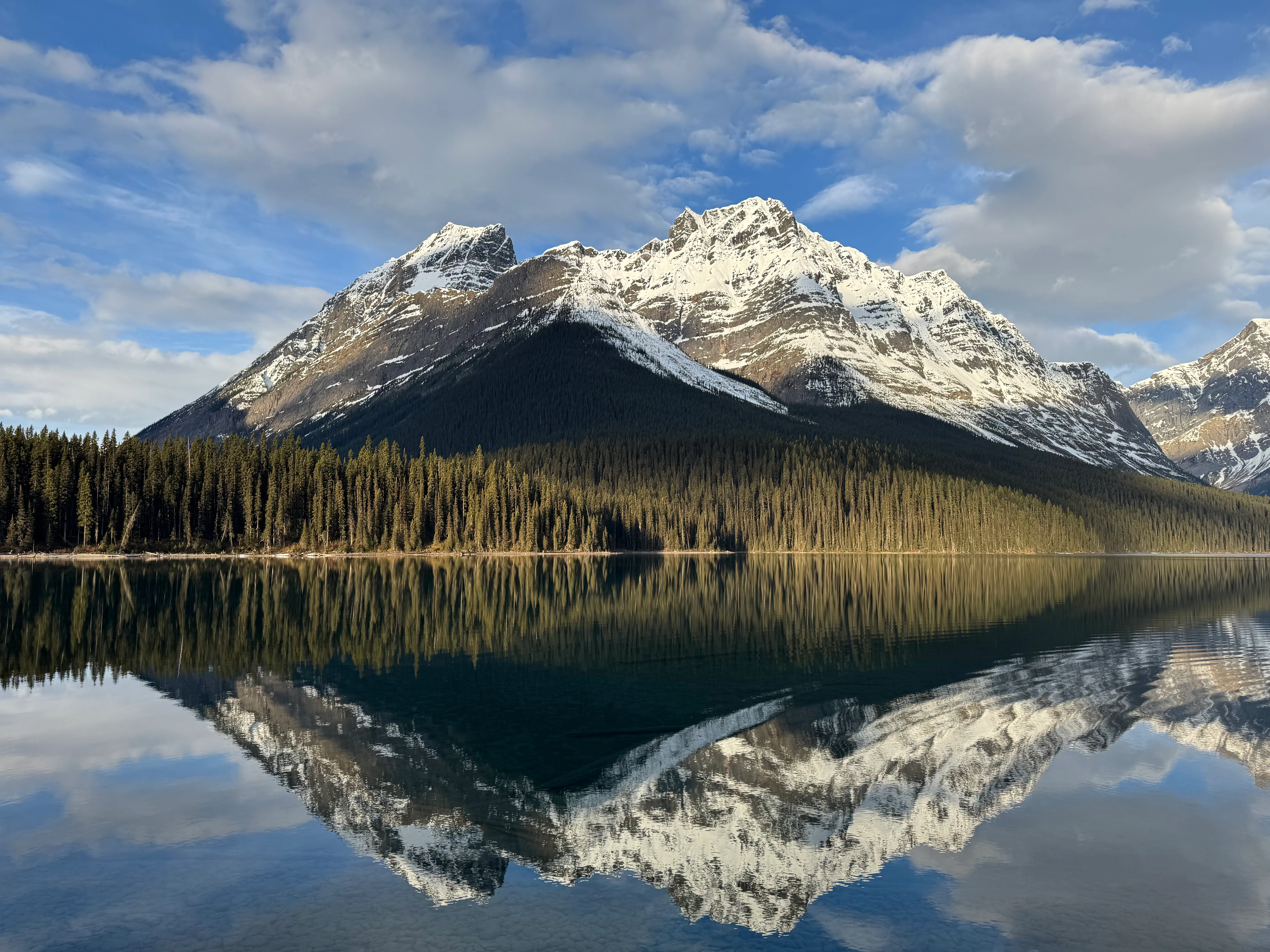
I reach Big Bend campground. It’s a popular campground because it’s close to the trailhead. Many people with kids and dogs chill here. It’s SO stunning here, right on the Athabasca River floodplain. You can see big peaks right in front of you.
Dragon Peak and Catacombs Mountain from Big Bend campground

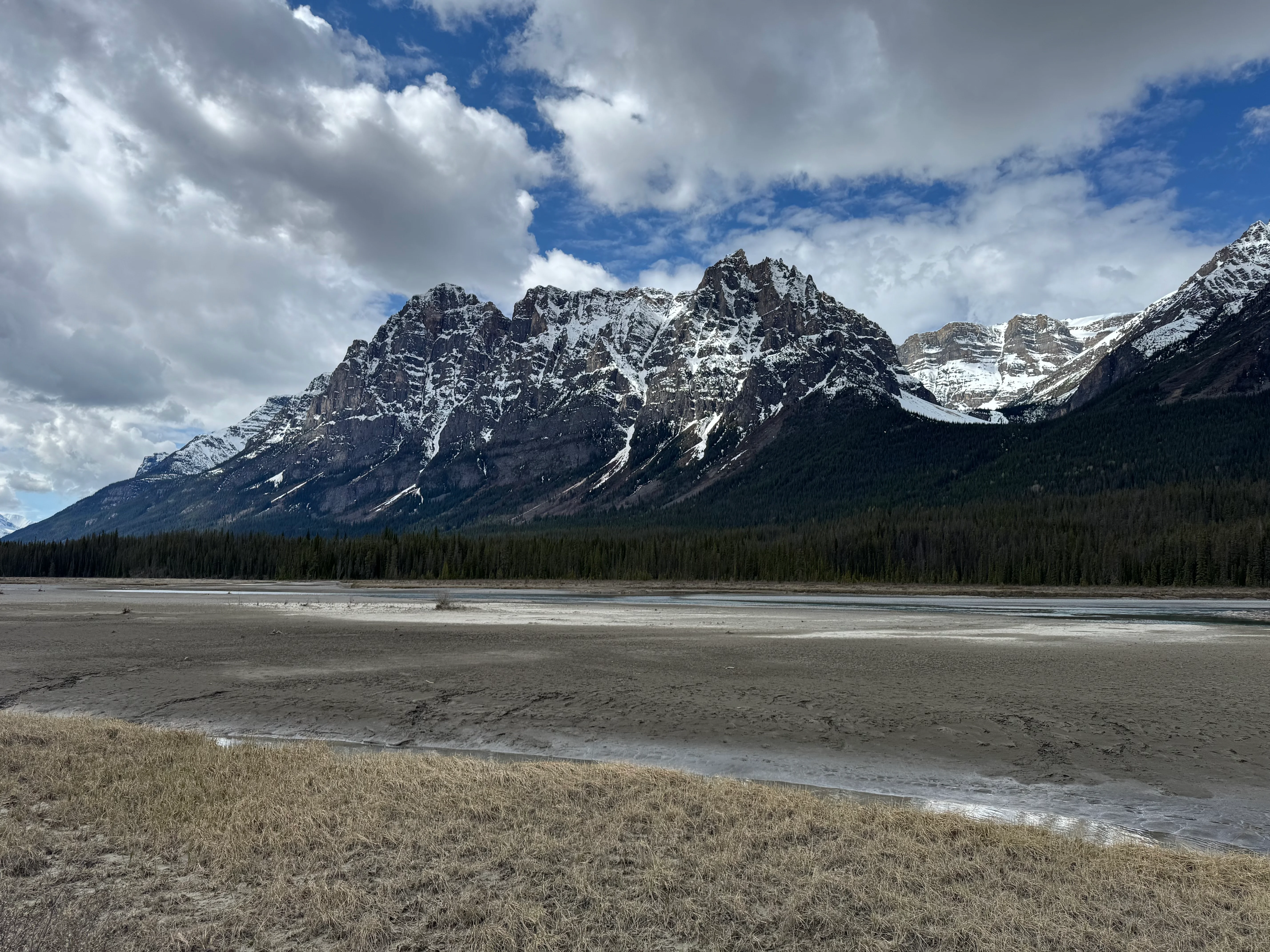
After Big Bend, the Chaba-Athabasca river floodplain opens up. Snowcapped peaks are way out in the distance, sharp and dramatic. The view is breathtaking.

Mount Sadlier, more likely?
I keep going. The trail narrows down to a single track. Almost nothing to see until I reach the Athabasca River crossing. I was so excited to be here that I didn’t take any photos. I just jumped right in. It’s not very deep, but it’s wide. The current is okay-ish. I didn’t even wet my knees.
To cross the river, hike a little bit upstream and there’ll be a very obvious spot where the current isn’t so strong and you can cross easily. I promise to upload photos next time I go there, sorry about that. I keep going. The trail is a bit bushwhacked and I have to use my trekking poles to navigate through the bushes.
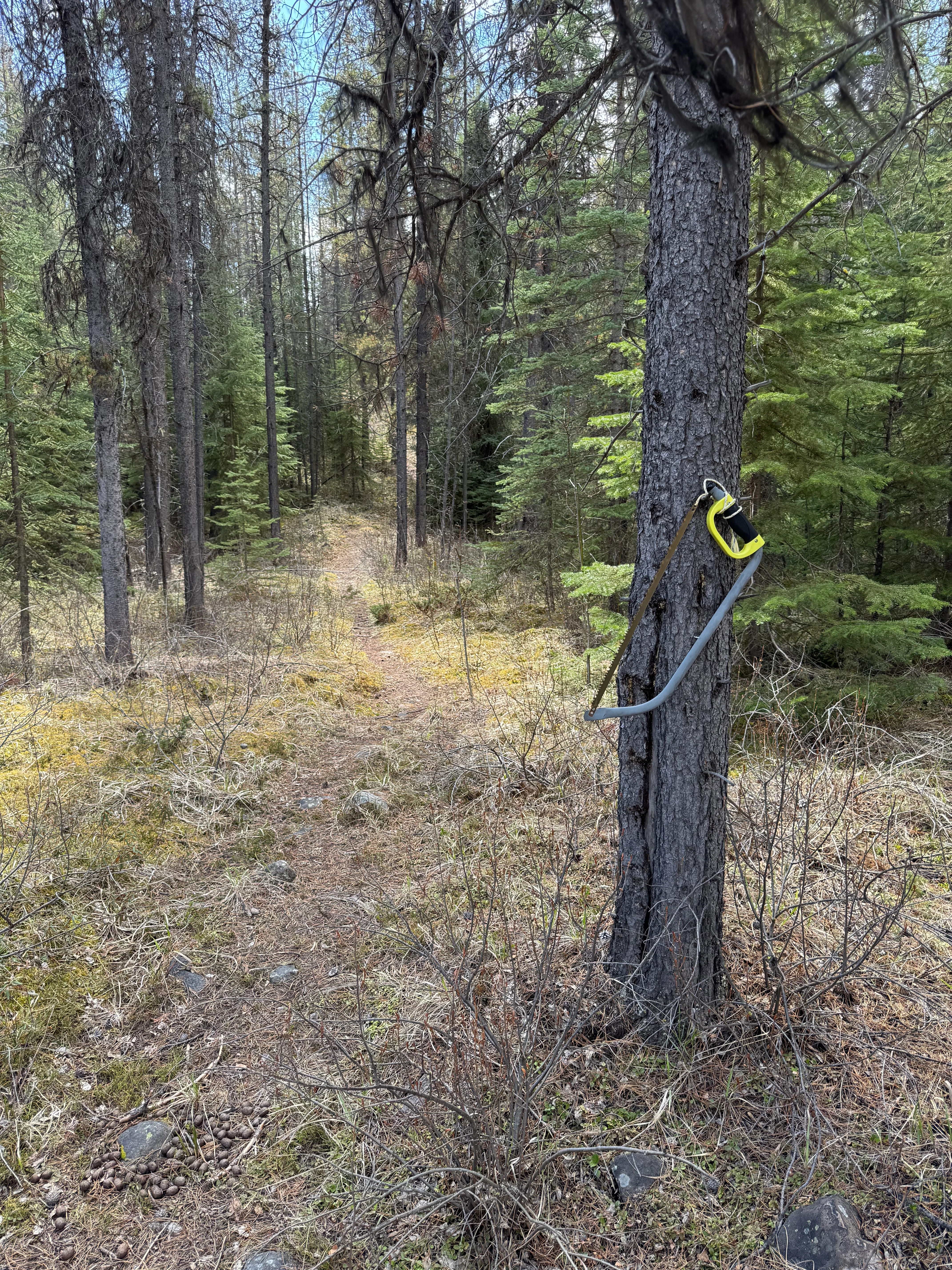
Someone was here before me and cut fallen trees to make way. Huge thanks to you stranger, whoever you are. You’re awesome, the true trail hero!

Saws grow naturally on trees in this area
Lots of moose sign all over the place. Make noise, hike on.
Chaba River is wide. I’d rather say it’s a whole system of streams spread across the floodplain before it merges with the Athabasca. The “crossing” is ankle deep in most places. It’s MUCH colder than the Athabasca. In less than 10 seconds I feel the cold pain in my feet and my skin is burning. Walking on the floodplain is not fun. The rocks are sharp.
Someone put flagging tape marking the way across Chaba. Thanks again, trail hero!
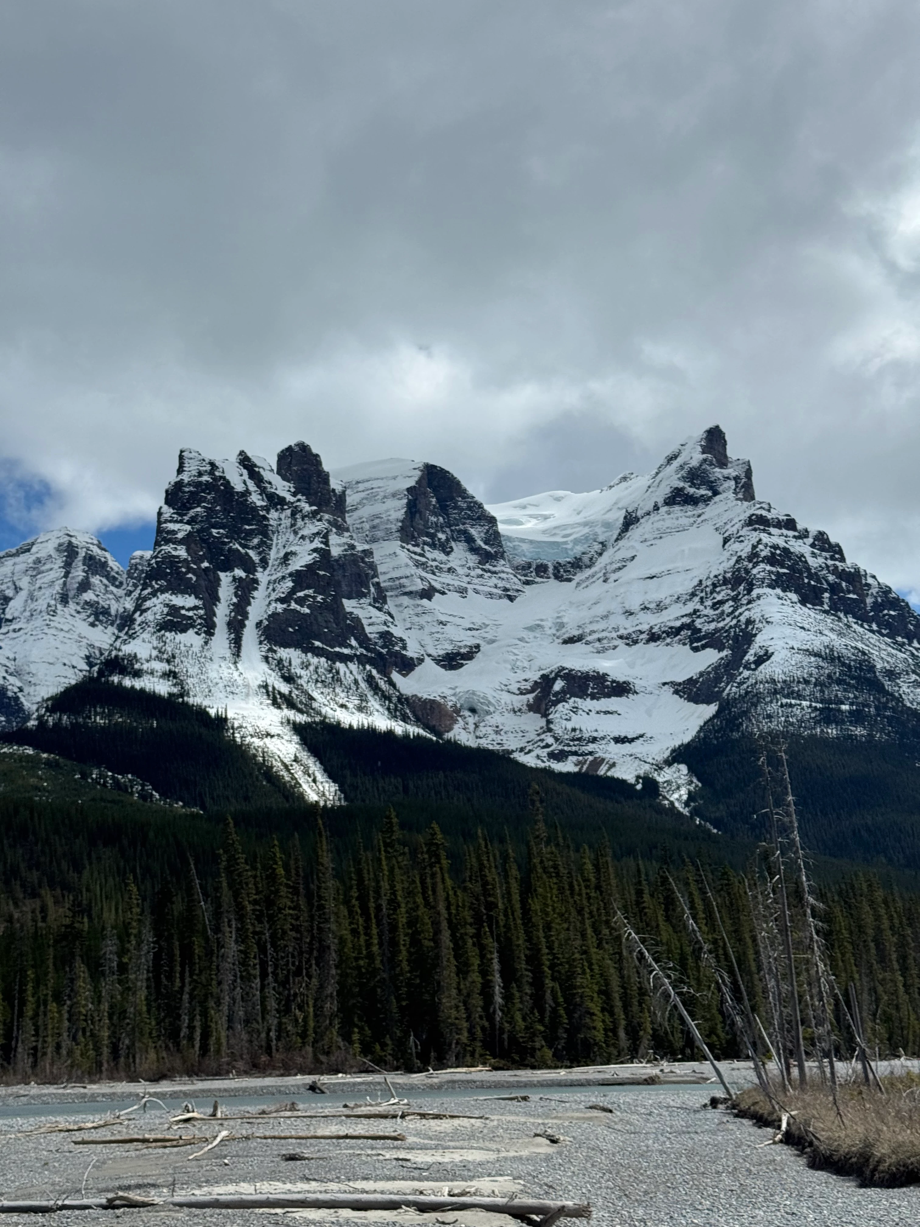
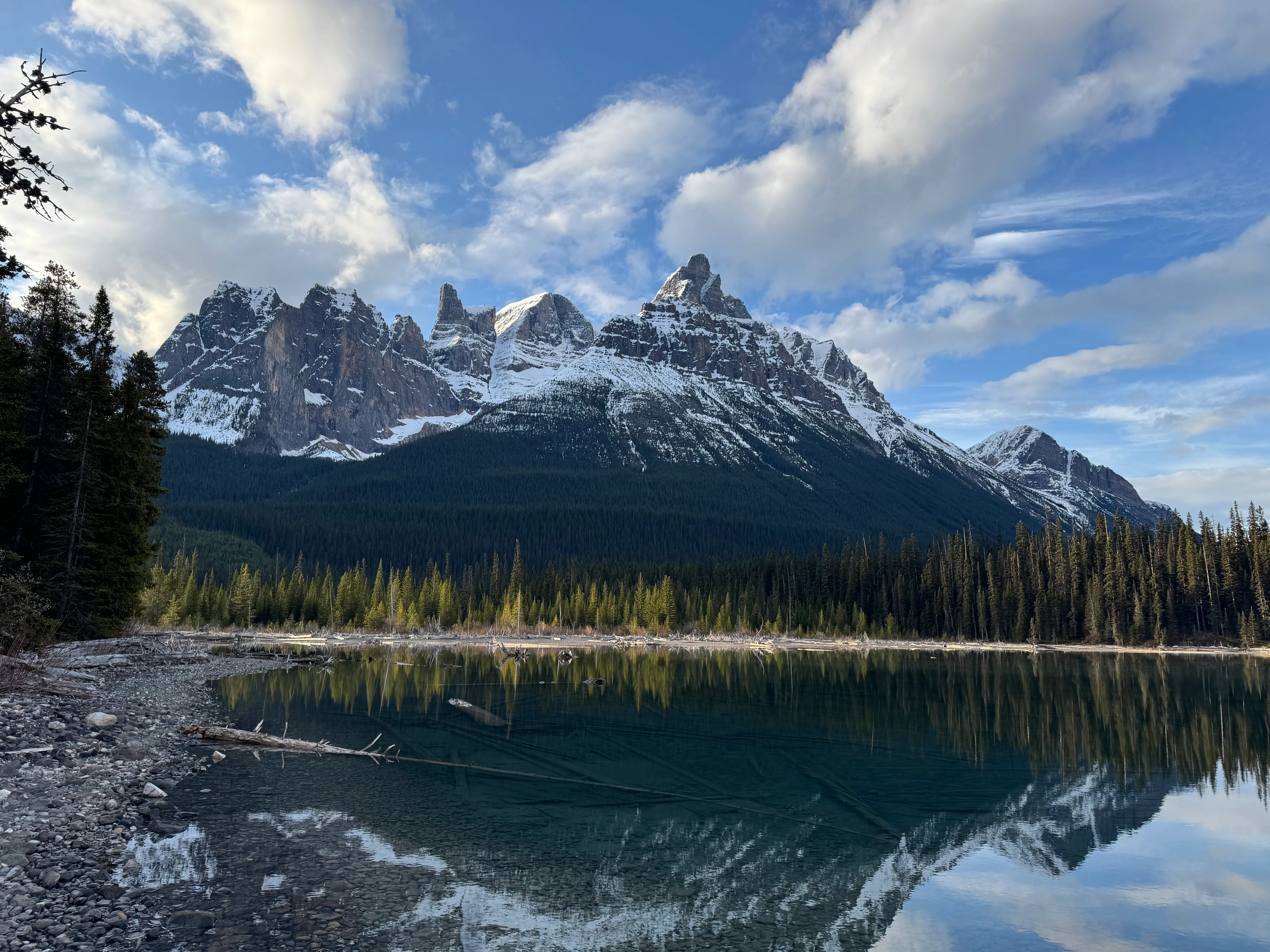
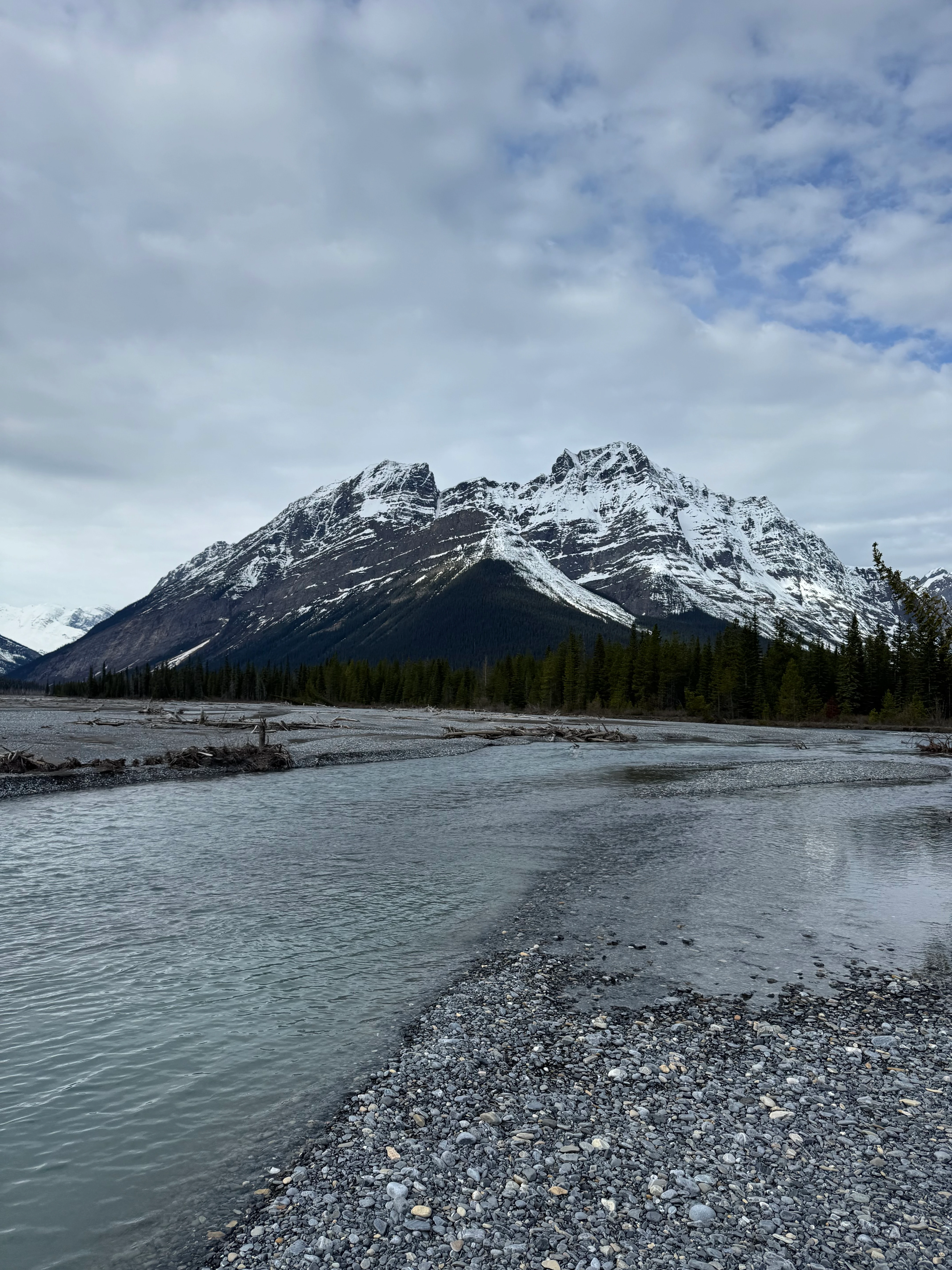
I make it to the other side. Mount Quincy is showing off its sharp snowcapped crown-like peaks with the glacier tongue hanging out.

Mount Quincy and the glacier tongue
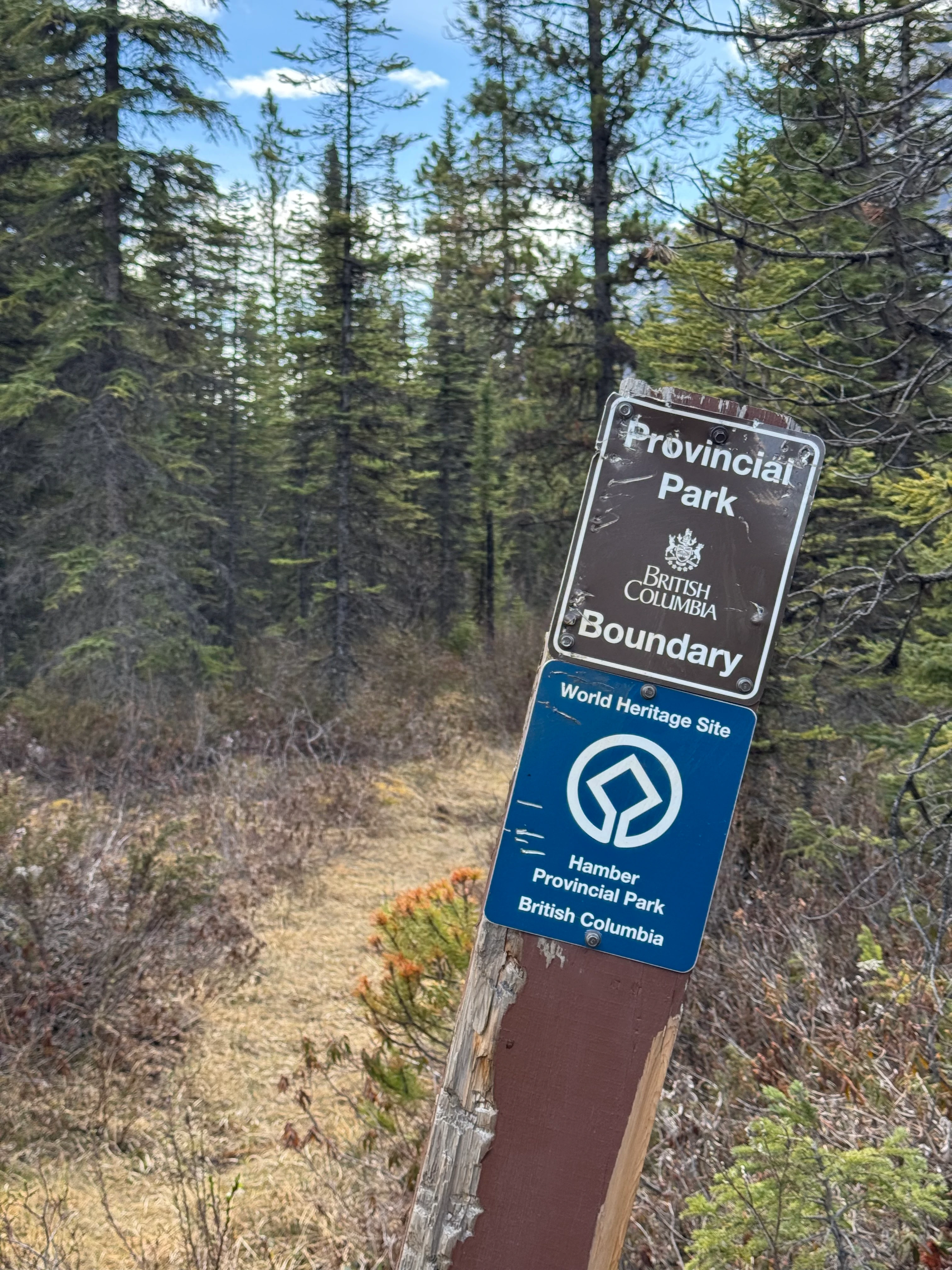
A bit more walking and I make it to the border of Hamber Provincial Park. I’m in!

Provincial Park Boundary
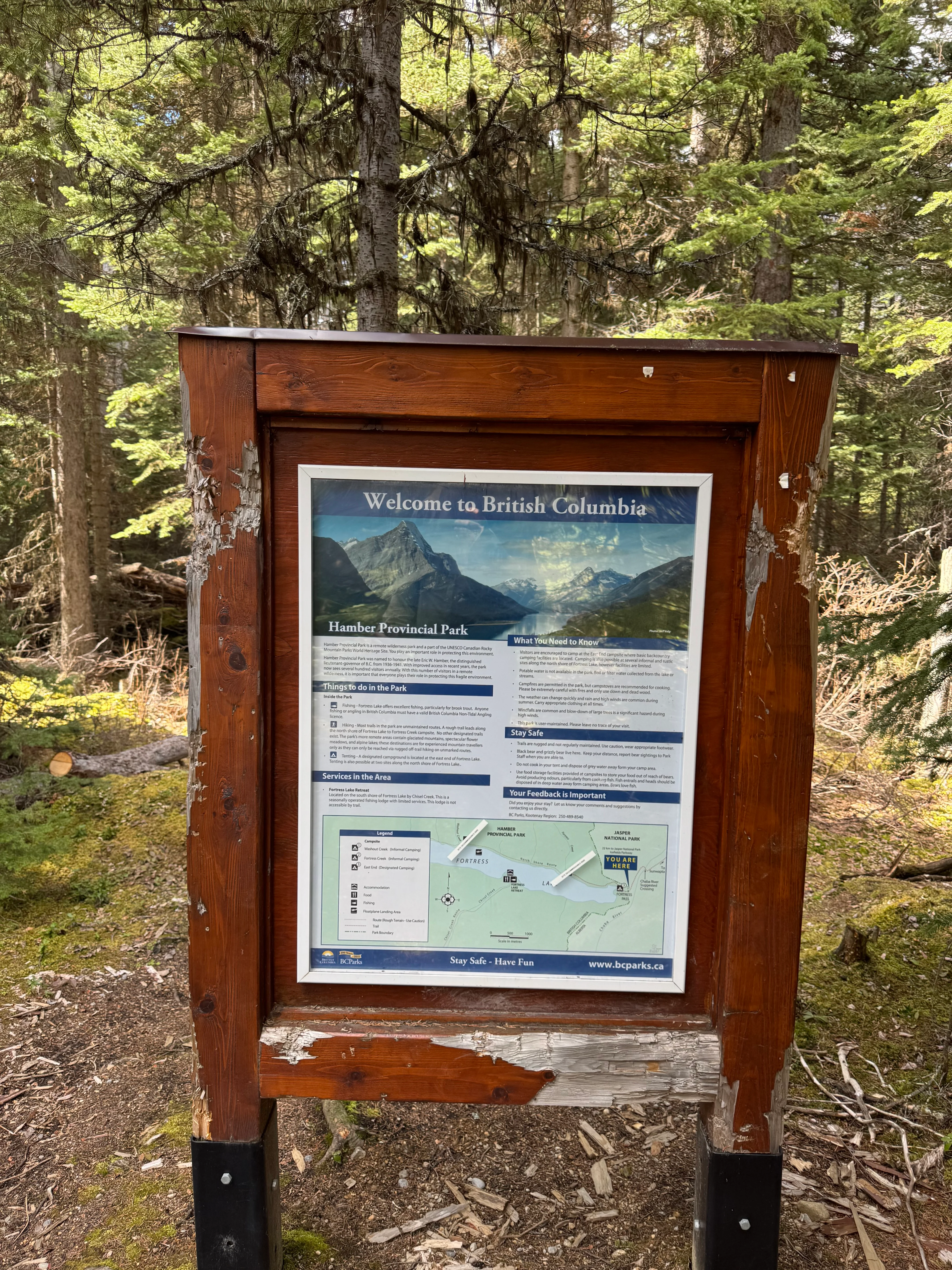
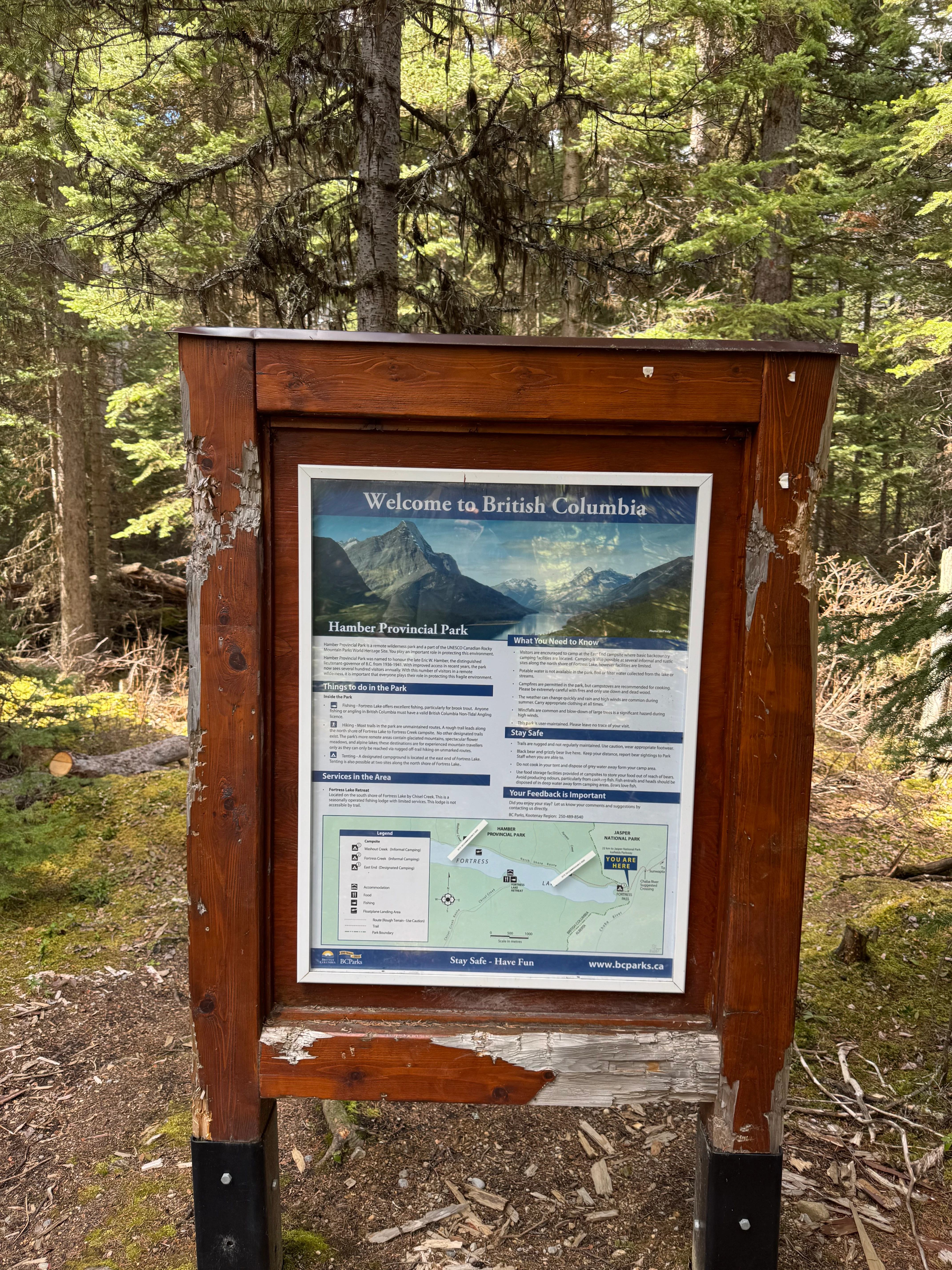
Information stand at Hamber PP, BC
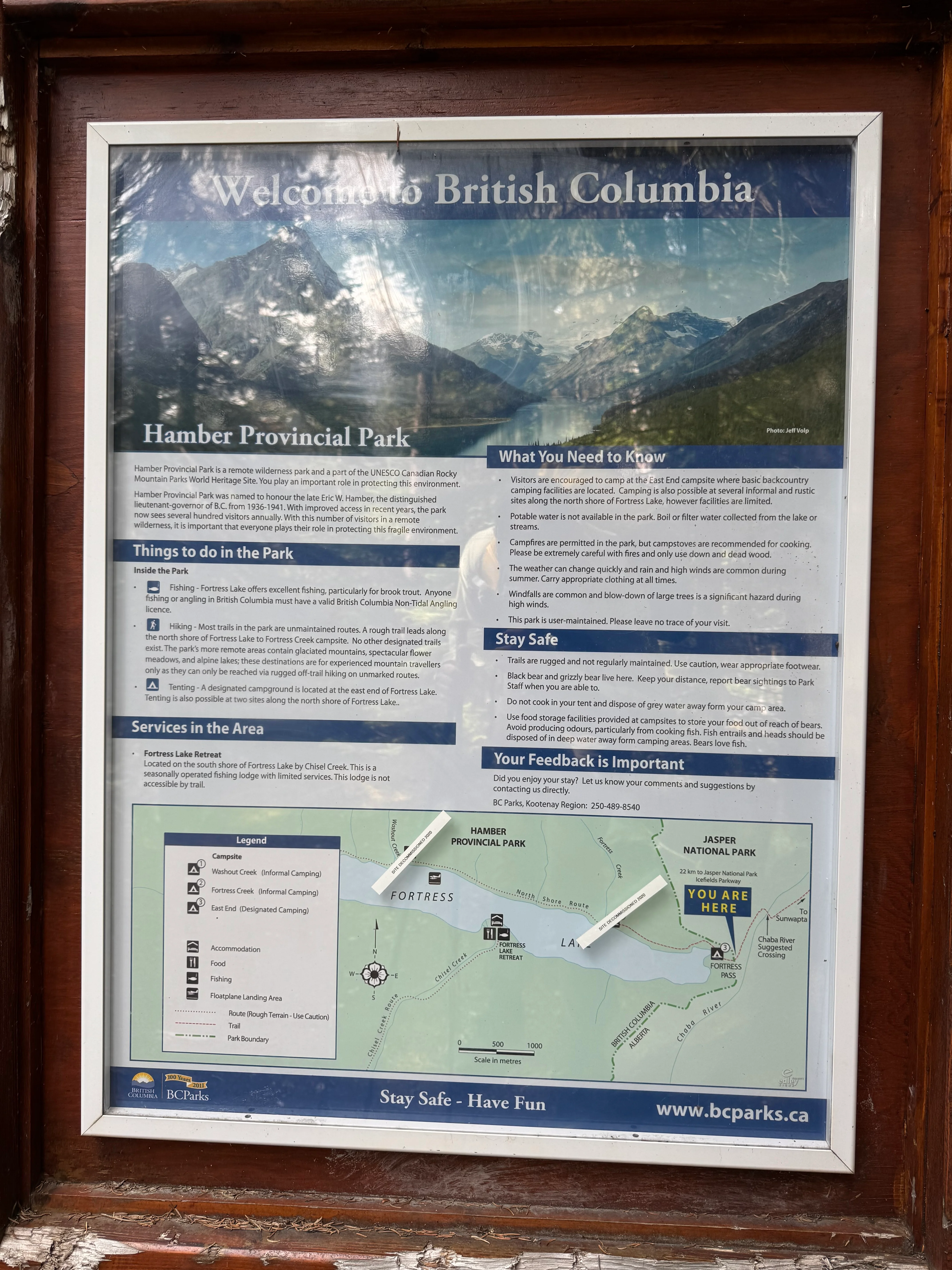
Information stand at Hamber PP, BC

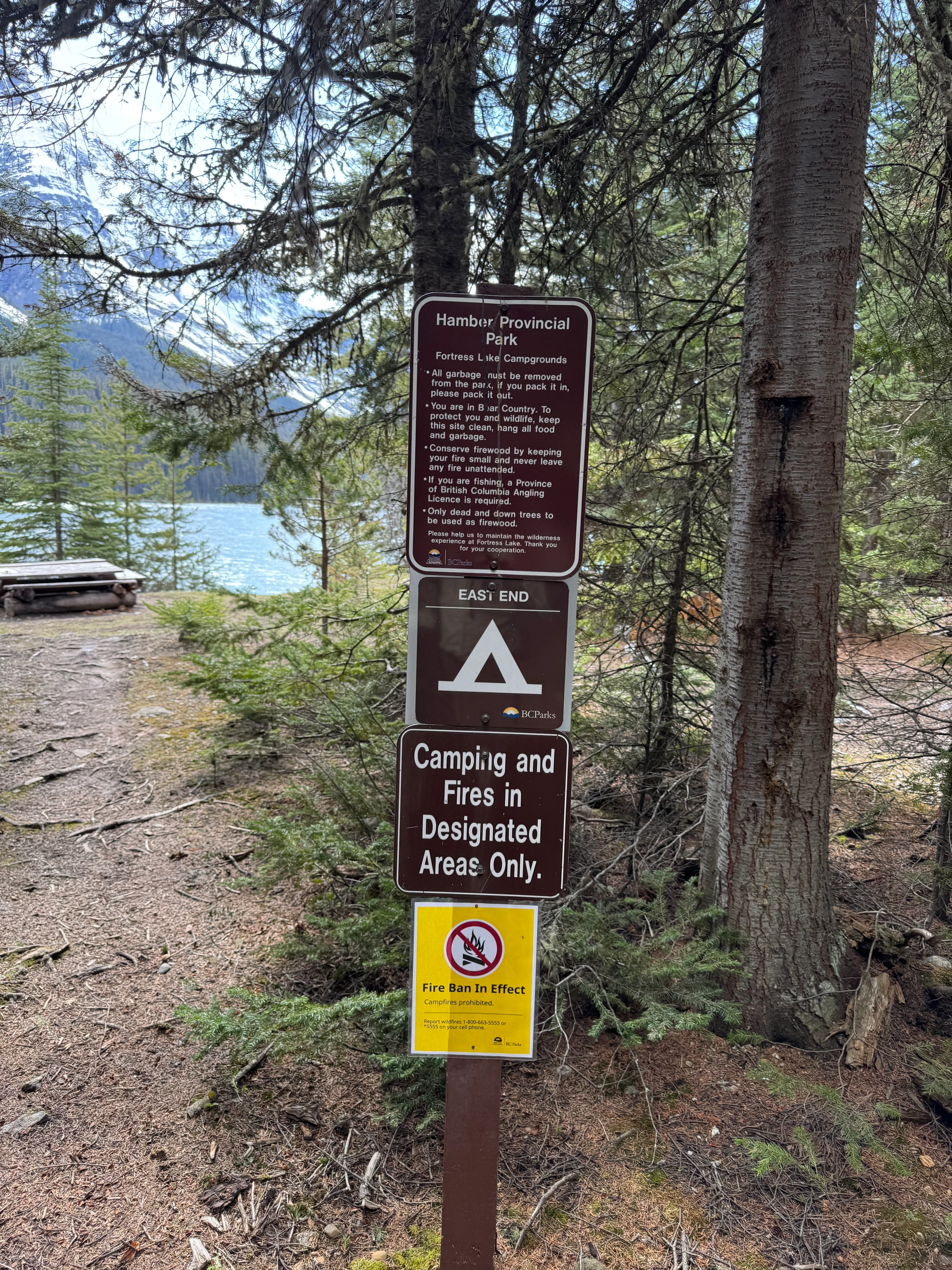
Fortress Lake campground entrance. They forgot to take down the Fire Ban sign.

I’m at camp. I drop my pack and take my shoes off. The weather is amazing. My socks will dry in a few hours because it’s a bit windy, but the sun is shining and I’m feeling good.
The campsite is rarely visited by others, so I feel like I’m completely alone here, ready to strip down and skinny-dip in the lake. That’s when I notice, in the corner of my eye, some movement. By the size of it, it’s not a squirrel for sure, so I take my bear spray and yell “Hello?!” In response, I receive “AAAAARGH”. JFK I scared the crap out of another person in the campsite!
Turns out another hiker came in earlier today and he’s been setting up his tent. I came in quiet and scared him. He didn’t expect to see or hear anyone out there, and neither did I. It was pretty funny. We laughed and talked. Good vibes! It was probably the busiest this campsite ever gets this time of year, lol.
Someone also left some logs and there’s a fire ring, so I start a fire to feel at home and add some of that “hikers perfume” on me to wear for the next few days. It always feels good coming home smelling like a campfire.
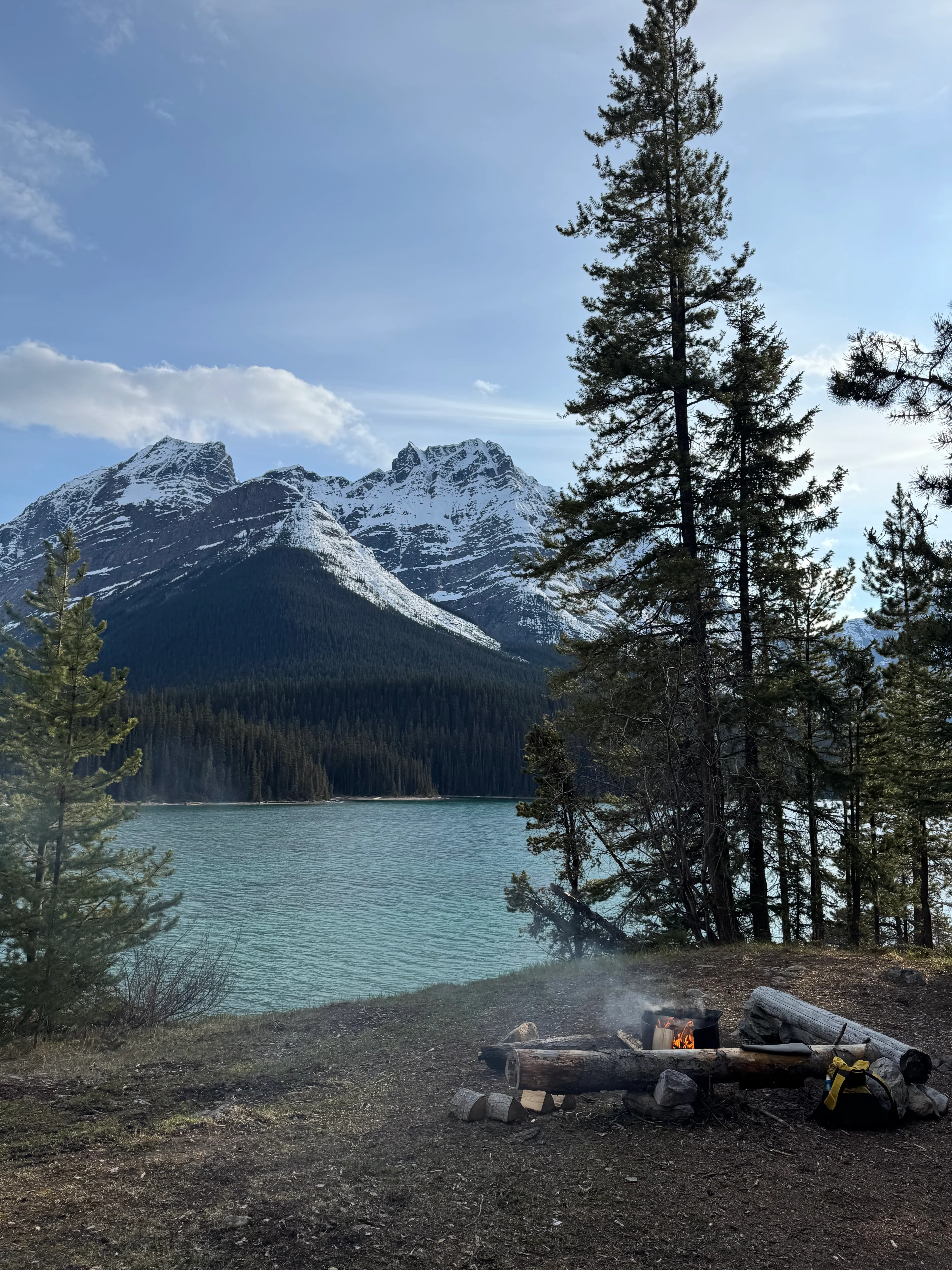
Fire ring and some logs
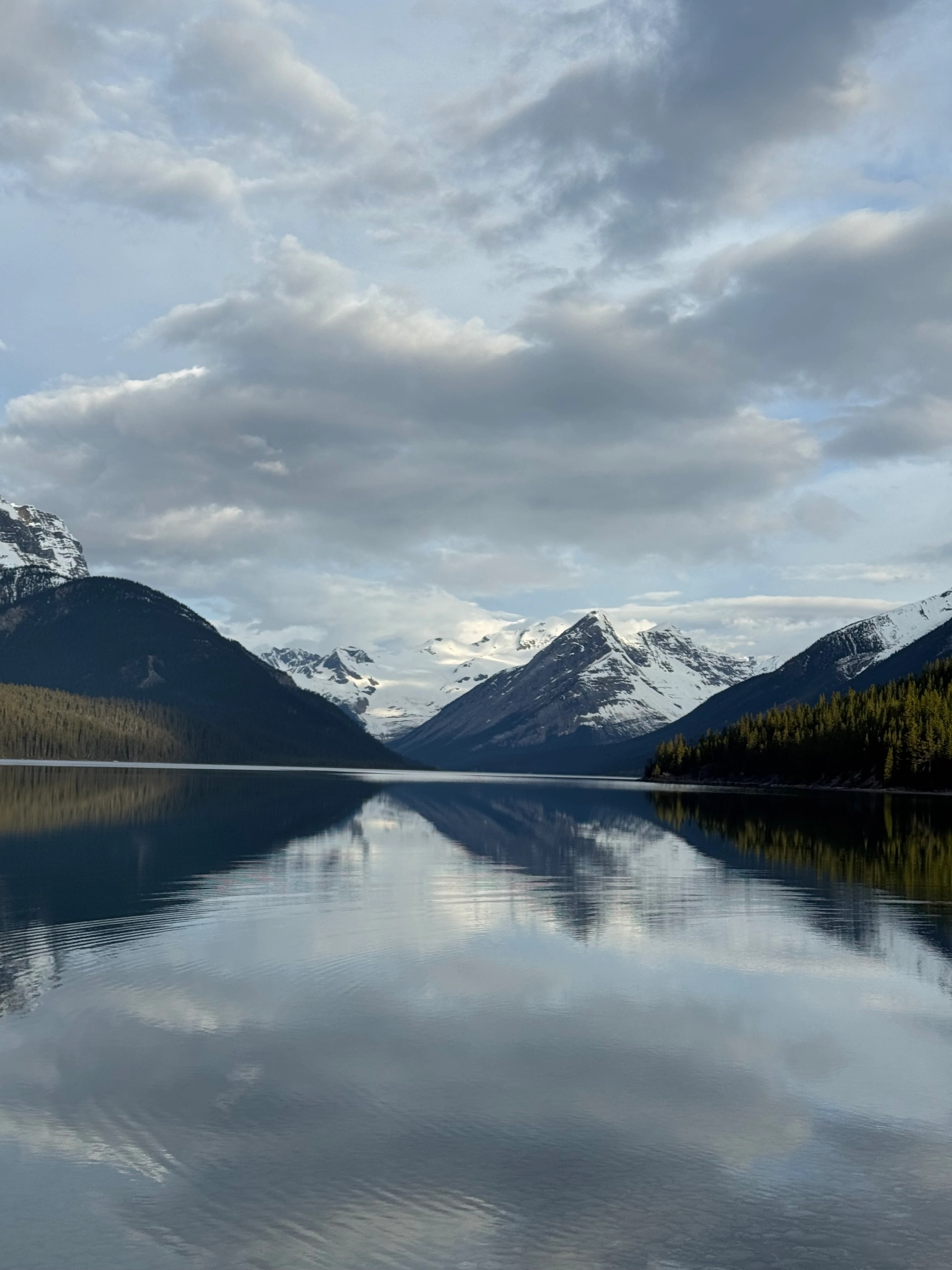
Fortress Lake is absolutely stunning. The water is crystal clear, the mountains are towering over the lake, and the sun is setting. People say it’s good fishing here. I’ll have to try some other time.
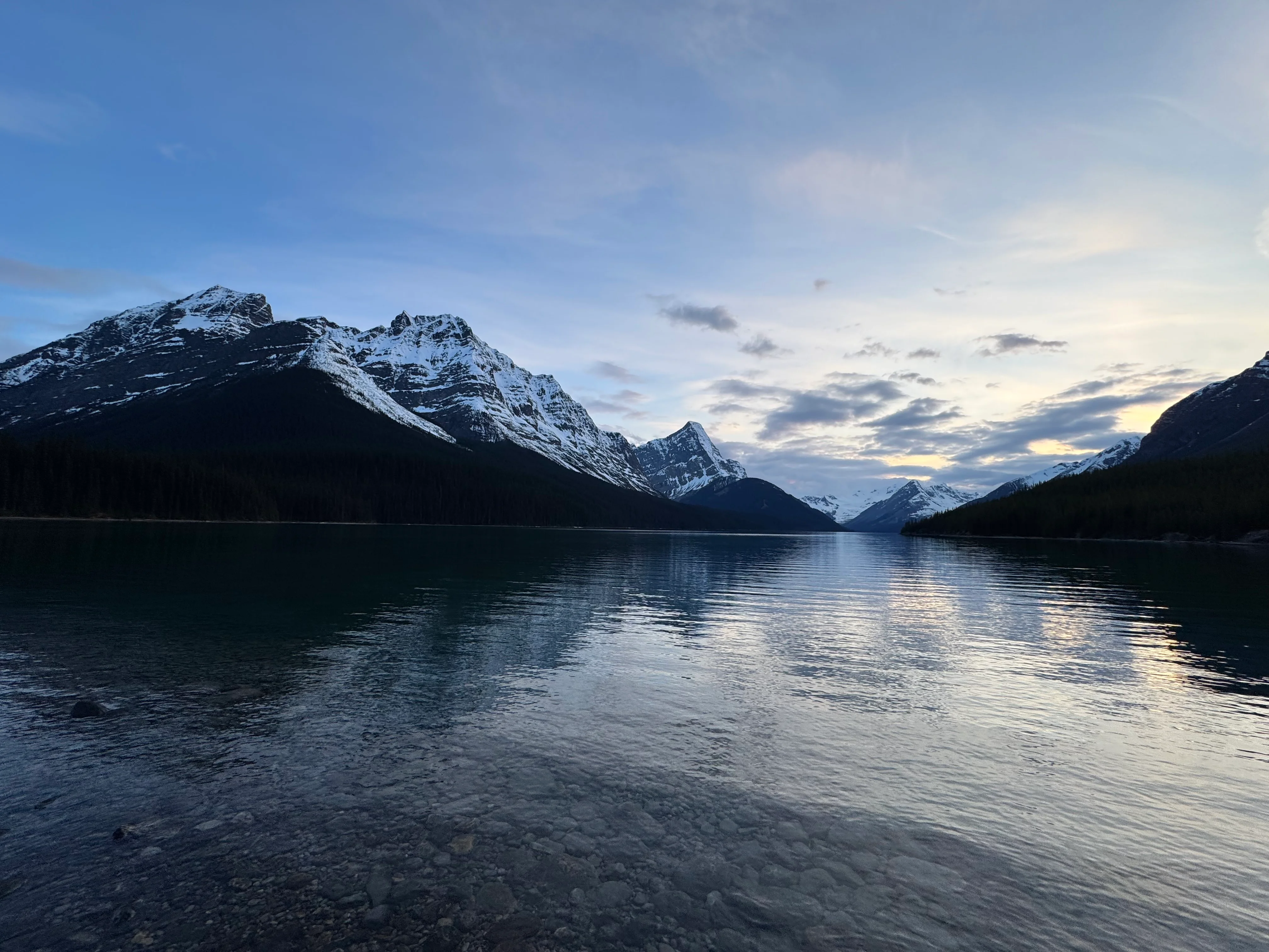
Fortress Lake after sunset

I eat dinner, set up my tent, and go to bed. The night is quiet, the stars are shining, the air is crisp, and I’m feeling good.
It was one of the best nights I’ve had in the backcountry. Probably because I was up too early, had some mental peace and solitude, and the weather was perfect. I slept like a baby without waking up once. Ready to hike back the next day.
Day 2
The morning starts chill and calm. The lake is still and peaceful. I make breakfast and sit by the water on a log. Nothing more to dream about. I feel complete.
I take a few photos and then I need to move. The day will be long, so I want an early start. The other visitor unpacks his raft, inflates it, and he’s already out there exploring the lake.

Mount Quincy in the morning

Mount Sadlier in the morning
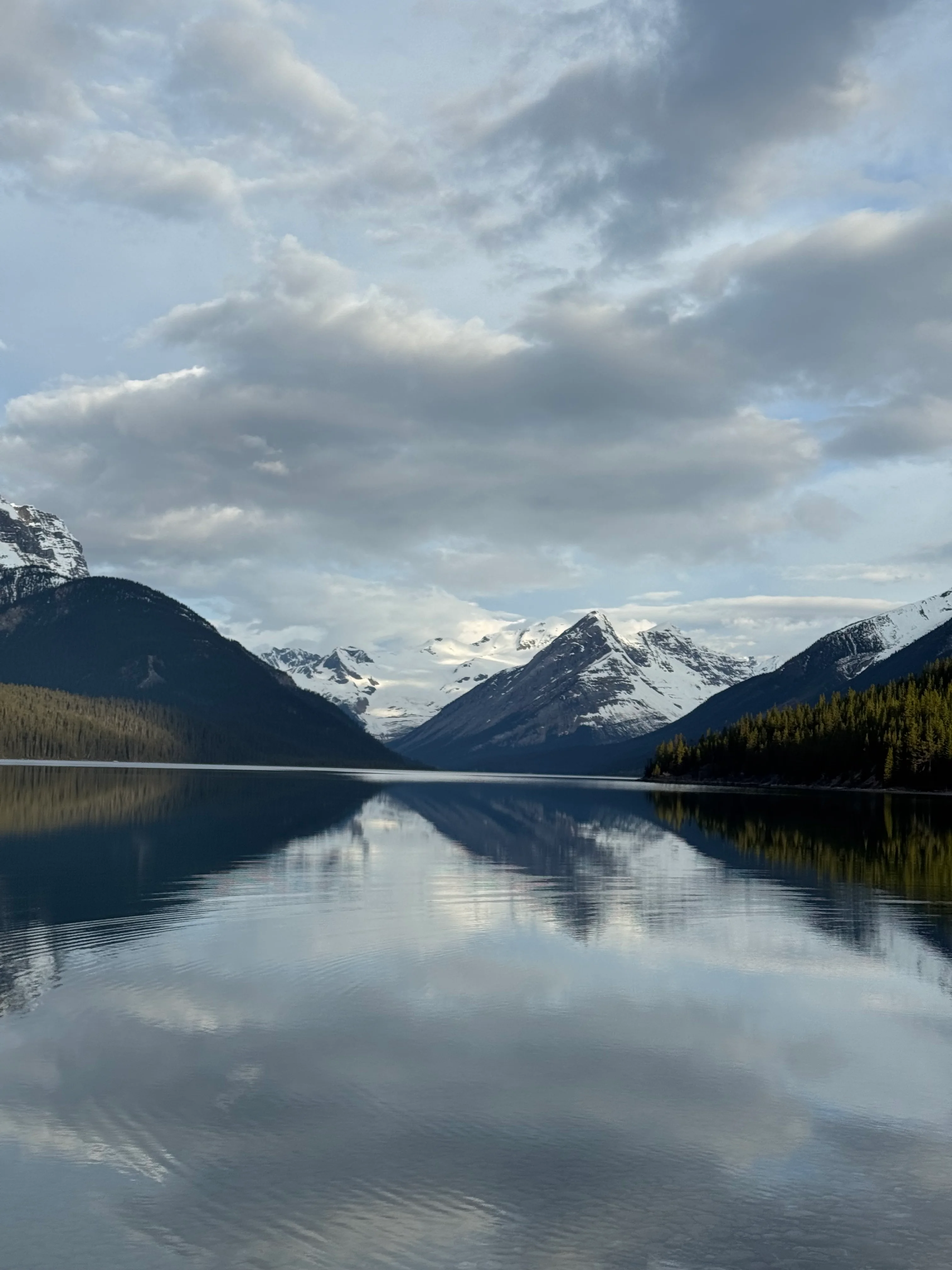
Serenity Mountains far away with glaciers
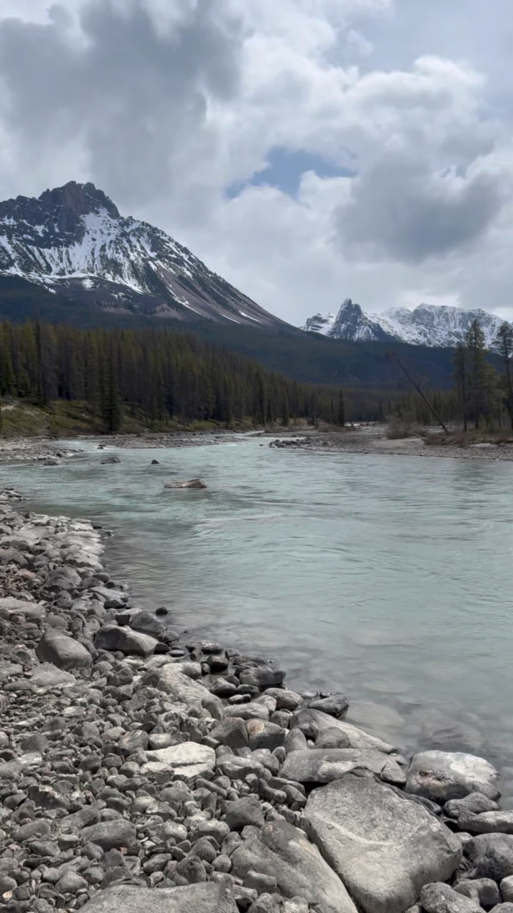
I start the hike back. Chaba River is higher today and MUCH colder than it was yesterday. I literally run through the channels because anything longer than 5 seconds in that ice water burns my skin.

Chaba River in the morning
The hike to the Athabasca River crossing is uneventful. I see some fresh bear scat along the way, but no bears.
Then I make it to the Athabasca River crossing, and it’s way higher than yesterday. Stronger, wider, and the spot I crossed yesterday is washed out. It’s deep enough that I can’t even see the bottom. It’s a beast of a river.
So I decide to hike upstream and look for a better spot. Mistake. The river comes straight from the mountains and glacier, and upstream it’s even faster and more powerful. I walk the rocks for about 2-3 km, then I give up and turn back. Nowhere to cross.
Next, I go downstream. Worst case, I can cross Chaba on the floodplain and keep hiking until I find something. While going downstream along the Athabasca, I spot a section where it spreads out wider. I can see the bottom and the current looks calmer. That’s my spot.
It ends up hip deep, so yeah, I soak my pants this time. I made a video after crossing where I speak some nonsense in a foreign language, so I won’t attach that. But I exported one frame from it, sorry about the quality. I’ll post more photos next time I go there.

Athabasca River crossing (frame export from a video)
Now I’m on the other side of the Athabasca River. I hike to the Athabasca Crossing campground. It’s still booked for me, so if I wanted I could stay one more night, but it’s only around 1 pm and I have no idea what I’d do there alone. I’m not a fan of sitting around in camp. I eat lunch and head out.
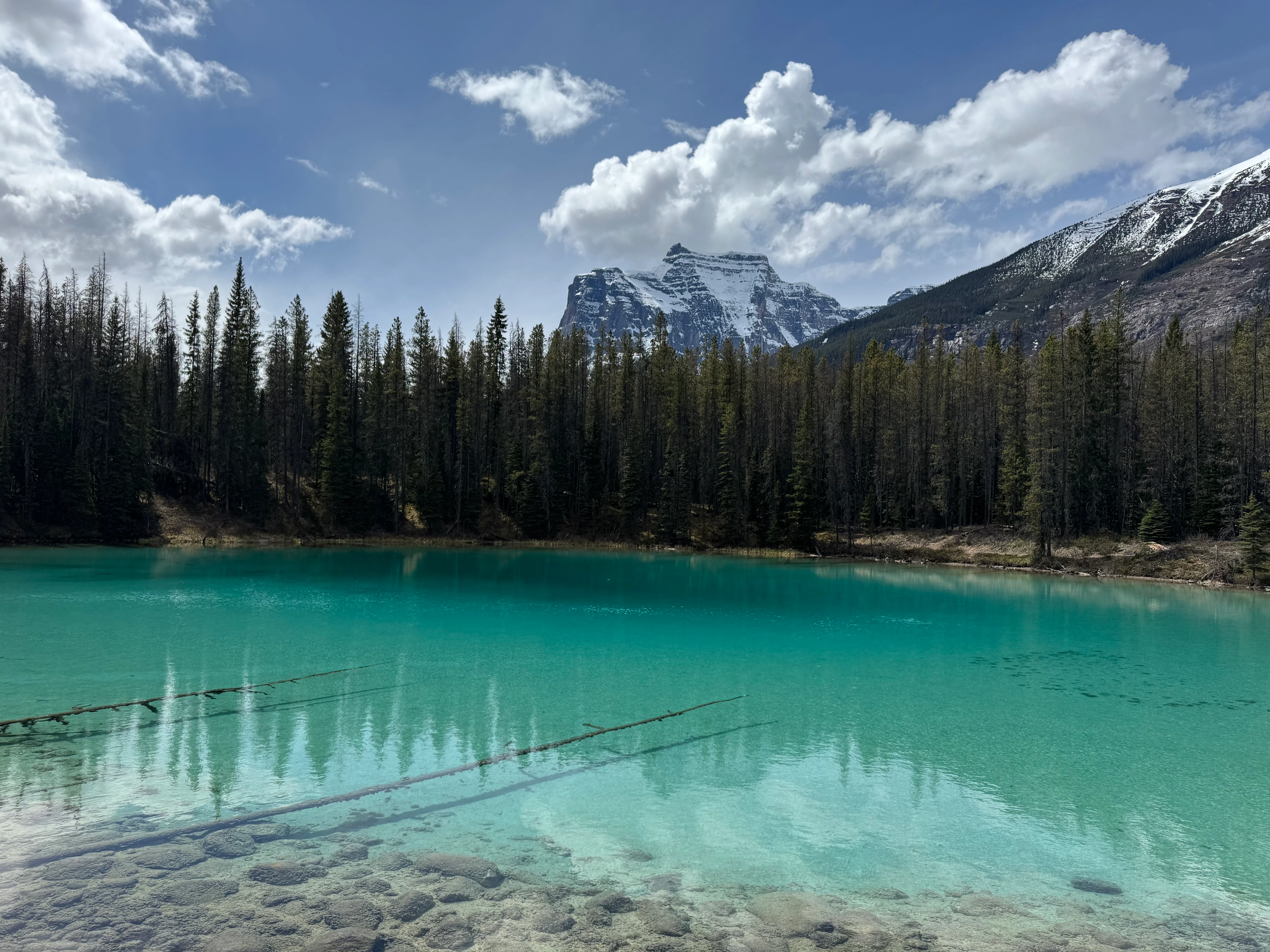
On the way back I stop by some small lagoon-like pools. The turquoise water is stunning. People start showing up here and there.

Small turquoise lagoon
Long day out. I take breaks here and there. I’m completely dry, including socks and shoes, by the time I reach the parking lot.
And then: a million tourists at Sunwapta Falls, busy roads, and a 4-hour drive home.
I really hope to come back in 2026. I liked this trail a lot. There’s a ton to explore in Hamber Park. Next time I want to make Fortress Lake a base for 3-4 days and just explore the area by hiking the floodplains.
Stay safe, stay wild!