
Molar-Pipestone-Dolomite Traverse
This route has everything. Dense forests, big peaks, endless views. Meadows full of wildflowers, crystal-clear lakes. Steep climbs, sketchy river crossings, and camp wherever you want (almost). Real backpacking in the Canadian Rockies.
This isn’t a popular route. Very few people do it each year. You need to be comfortable crossing rivers without bridges and navigating off-trail sections.
Prime grizzly habitat. Exercise all the usual precautions - bear spray, make noise, hang your food. There are no bear lockers or hang points past Fish Lakes, so bring a canister or a grizzly-rated bag (Ursack/Adotek).
Day 1
Hitchhike aside, this was supposed to be an easy day, and it was. Some hiking, some elevation gain, a good warm-up.
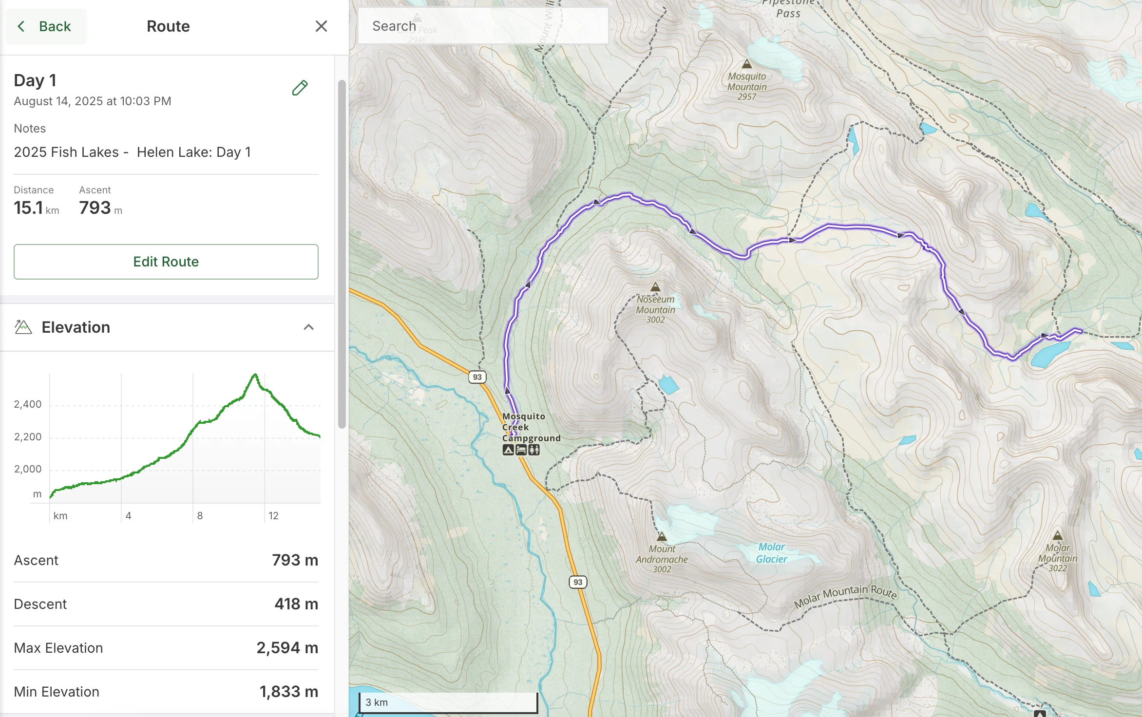
Day 1 route overview
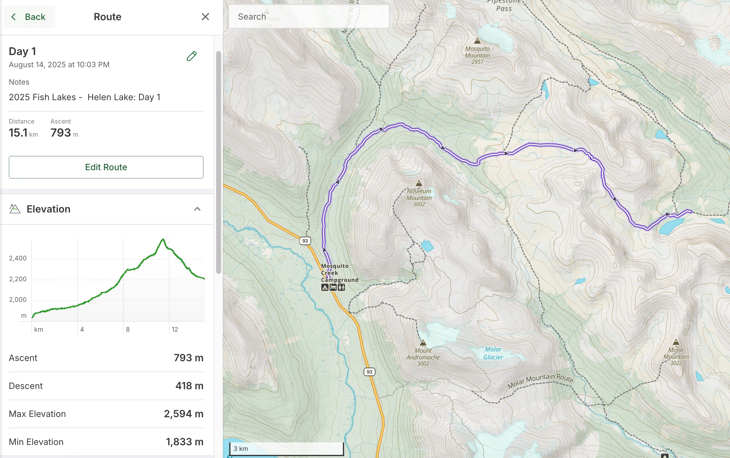
It started with a two-hour drive from Calgary to the Helen Lake trailhead, where I parked. The trail isn’t a loop, although with some effort it can be turned into one (my plan for 2026).
I left the car and went to catch a ride. After some effort (meh, Alberta truly sucks for hitchhiking), I managed to get one. It’s just 9 km to Mosquito Creek trailhead, where I finally hit the trail around 5 pm.
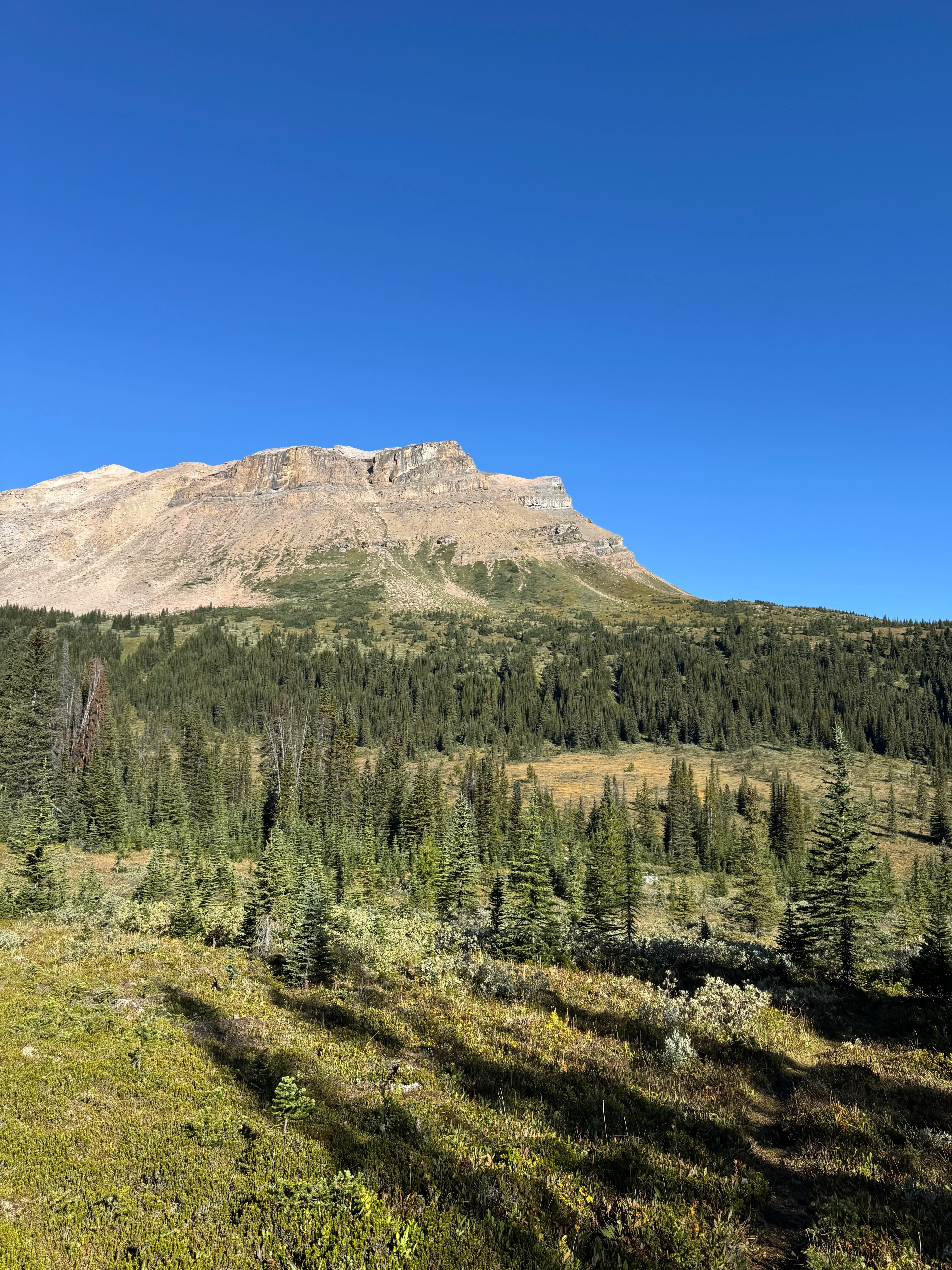
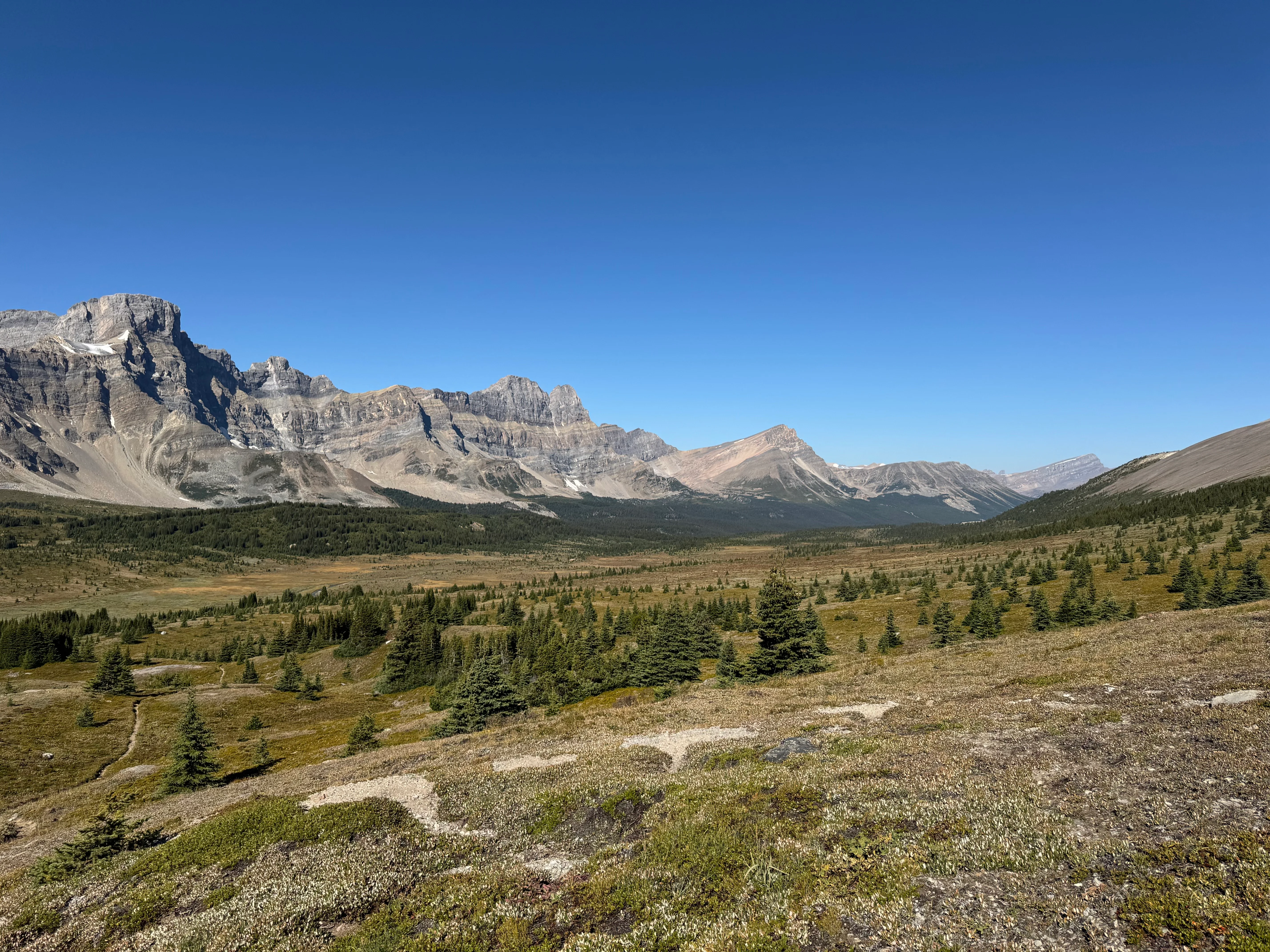
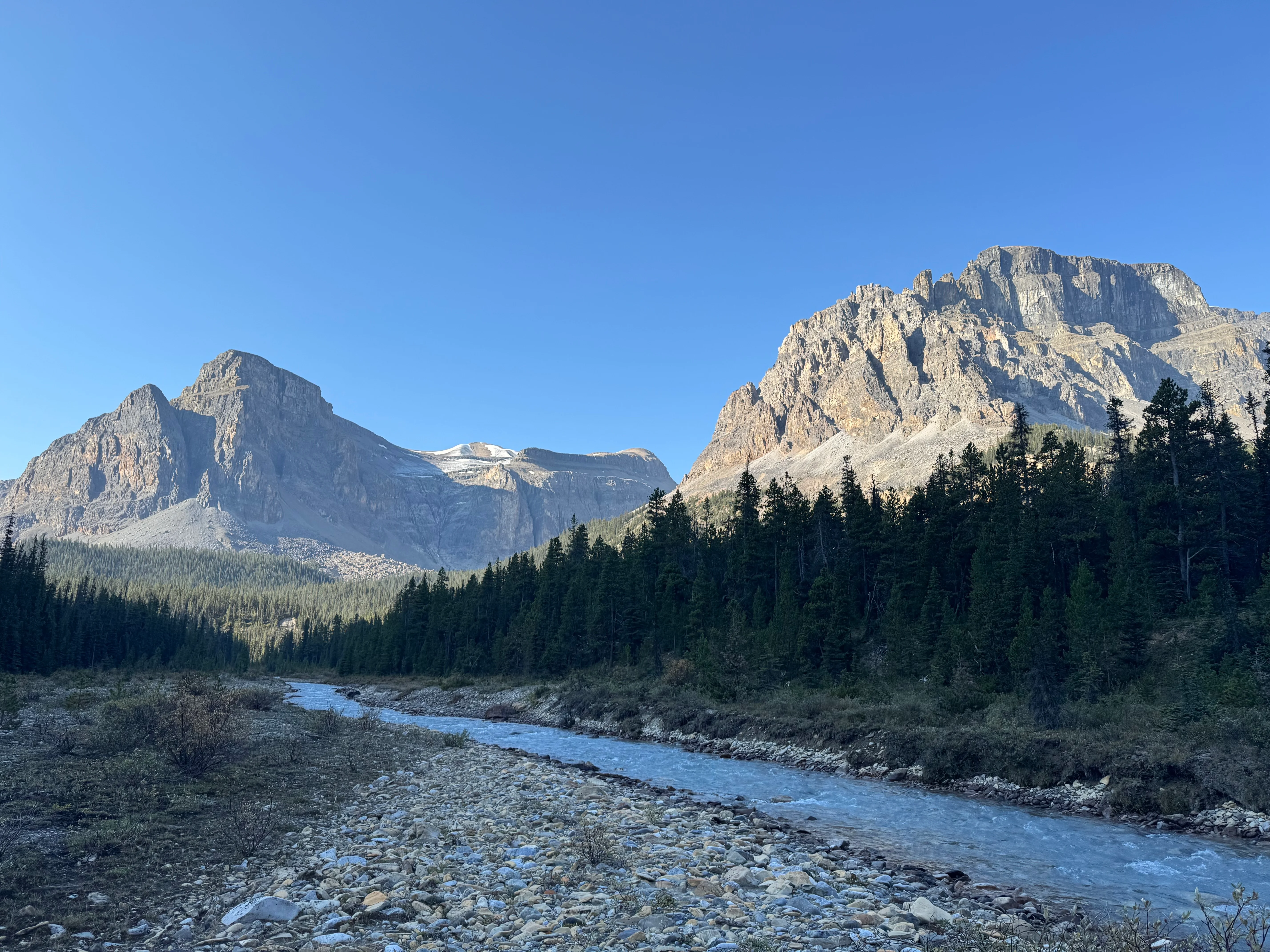
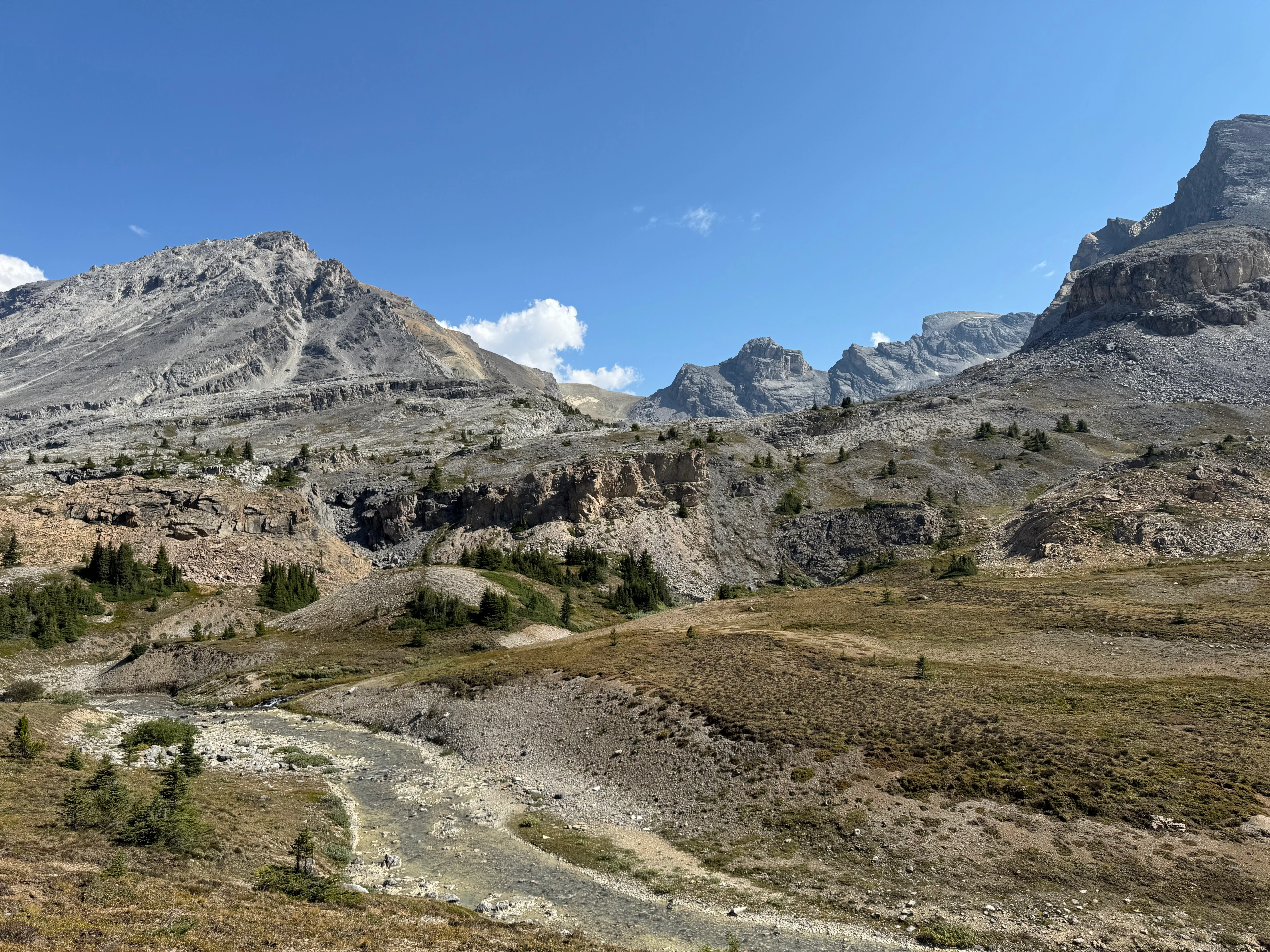
The first stretch was pretty uneventful, following Mosquito Creek until the uphill climb to North Molar Pass.
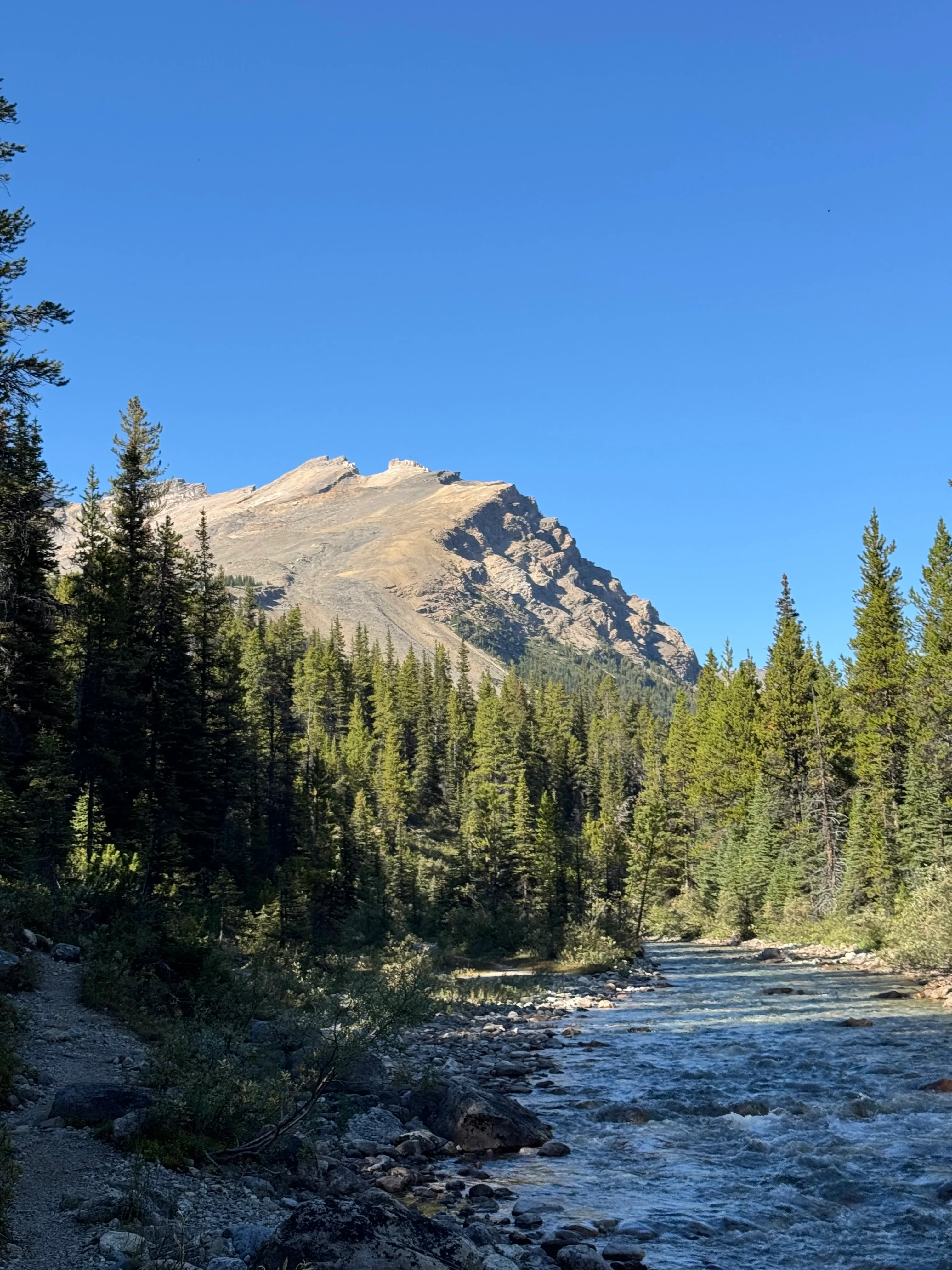
Hiking the first stretch along Mosquito Creek

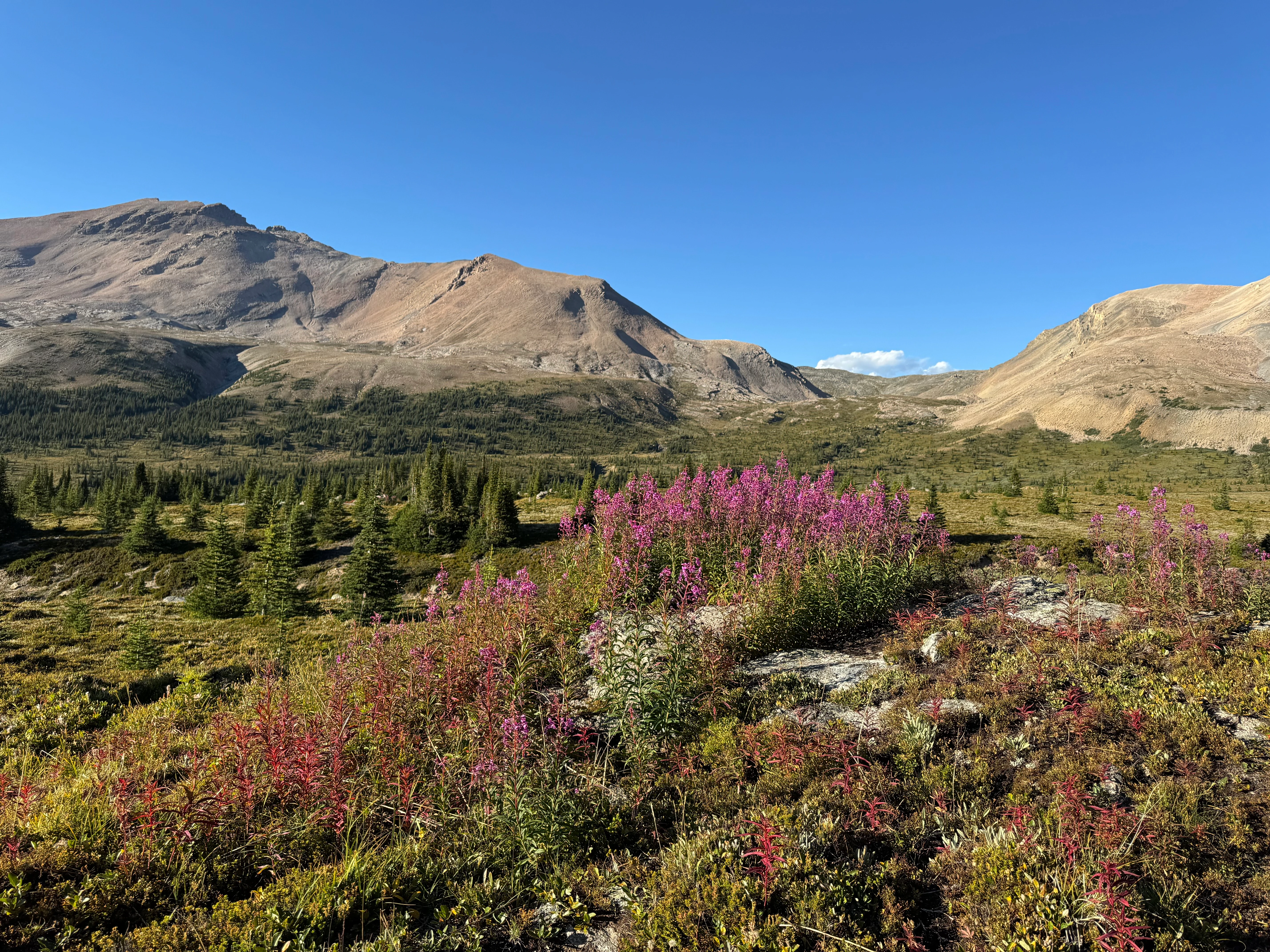
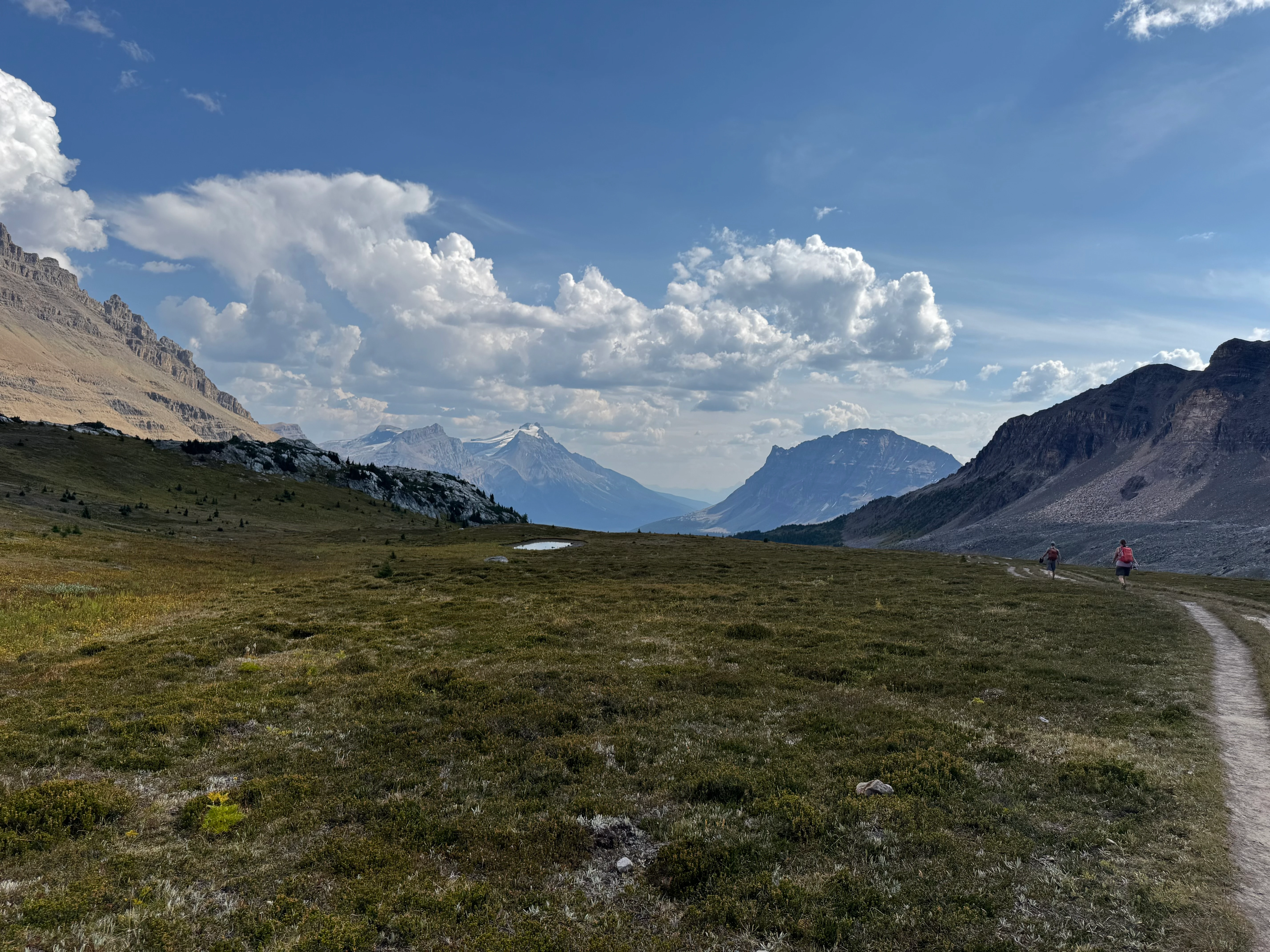
North Molar Pass is stunning. Alpine flowers and rounded peaks all around. The sun was out, and after weeks of humidity and rain, it finally felt like the perfect time for an adventure. Even the mosquitos were almost gone.

Flowers in bloom on the slopes of North Molar Pass
I passed an unnamed lake and a small unnamed peak along the way.

Unnamed lake beneath the ridges
The final push to the top was steep. I checked in at 2601 m (8,533 ft), which is high compared to most of the lower-elevation hikes in Banff.
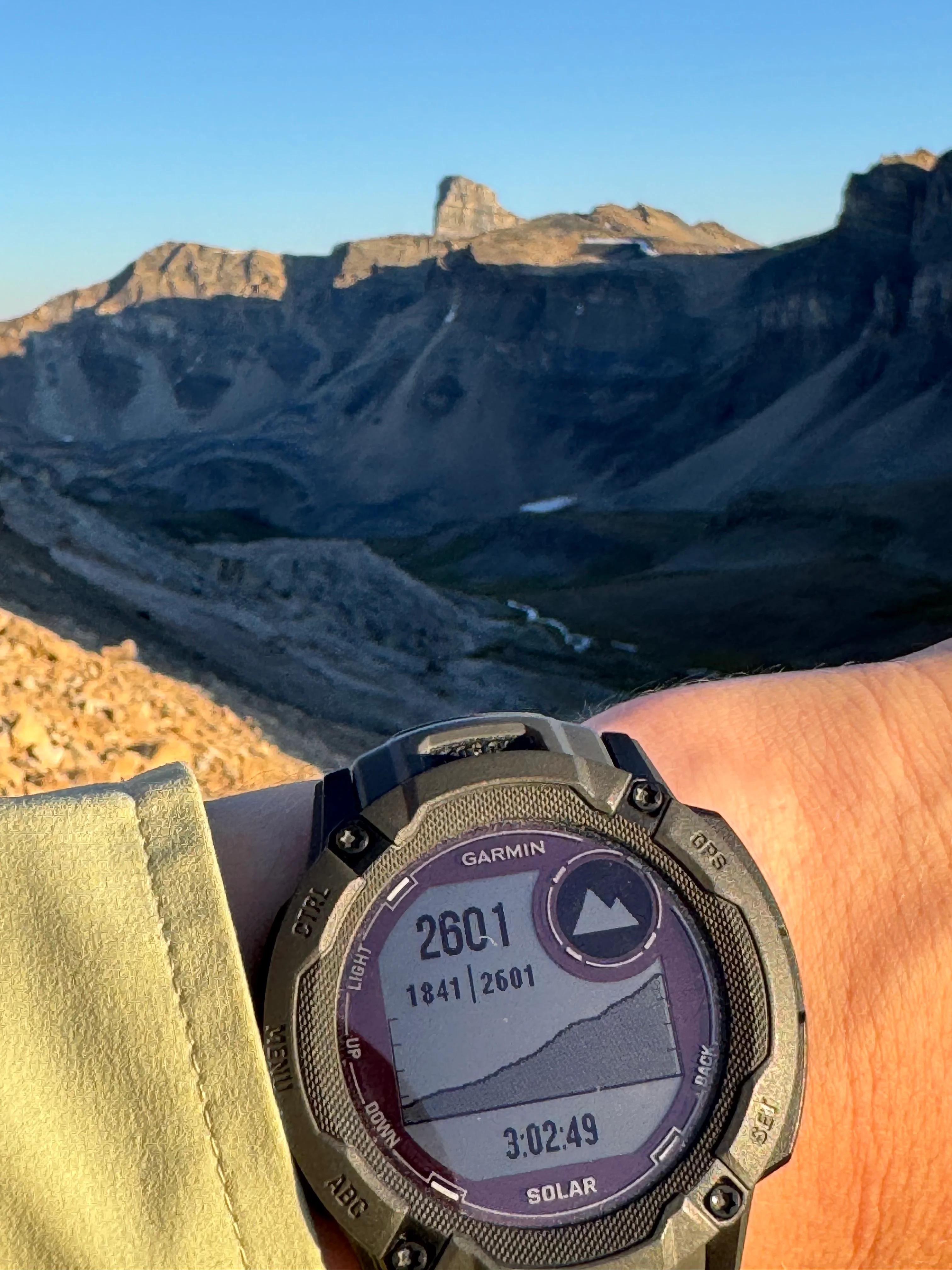
Elevation check at 2601 m

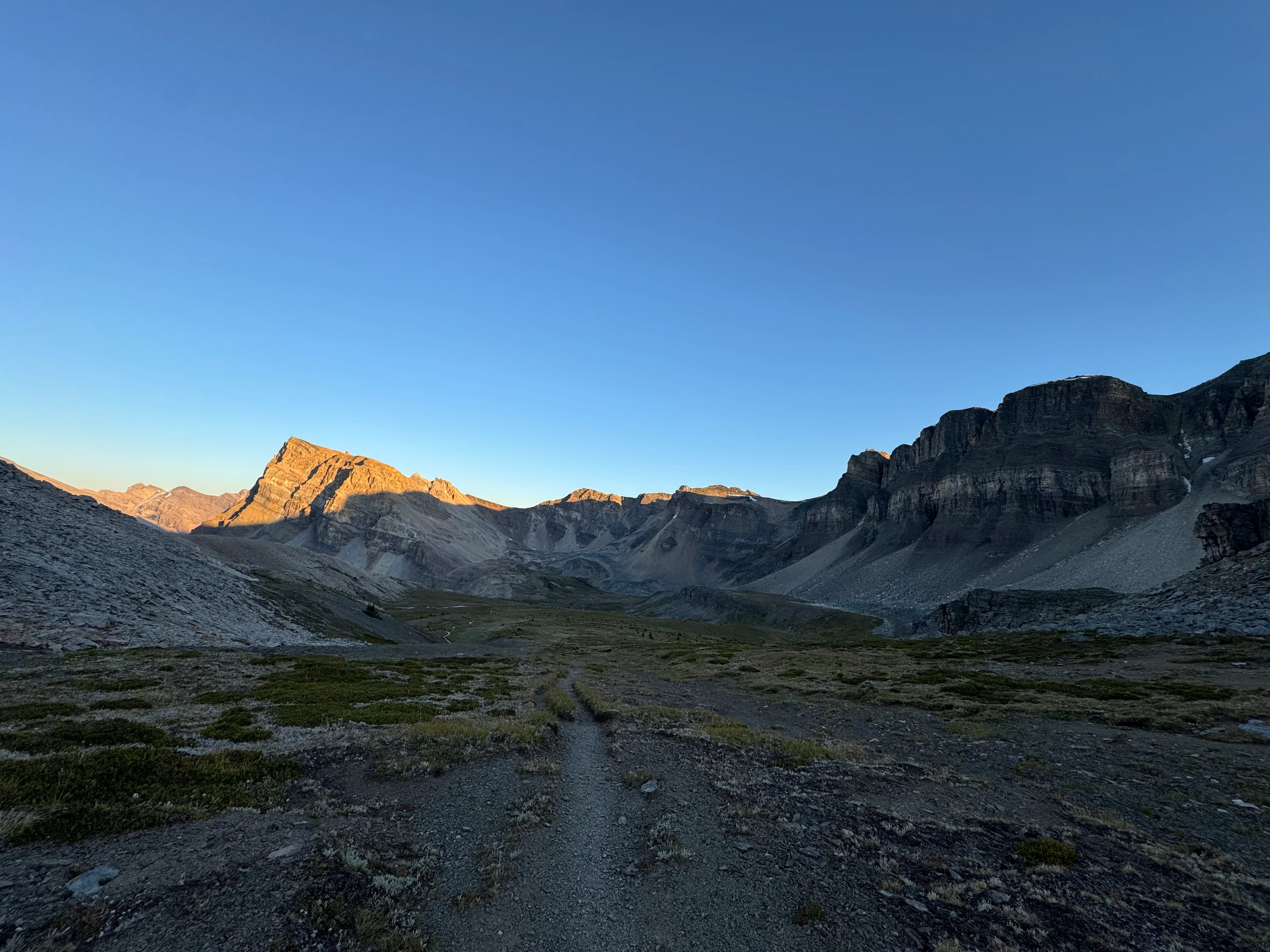
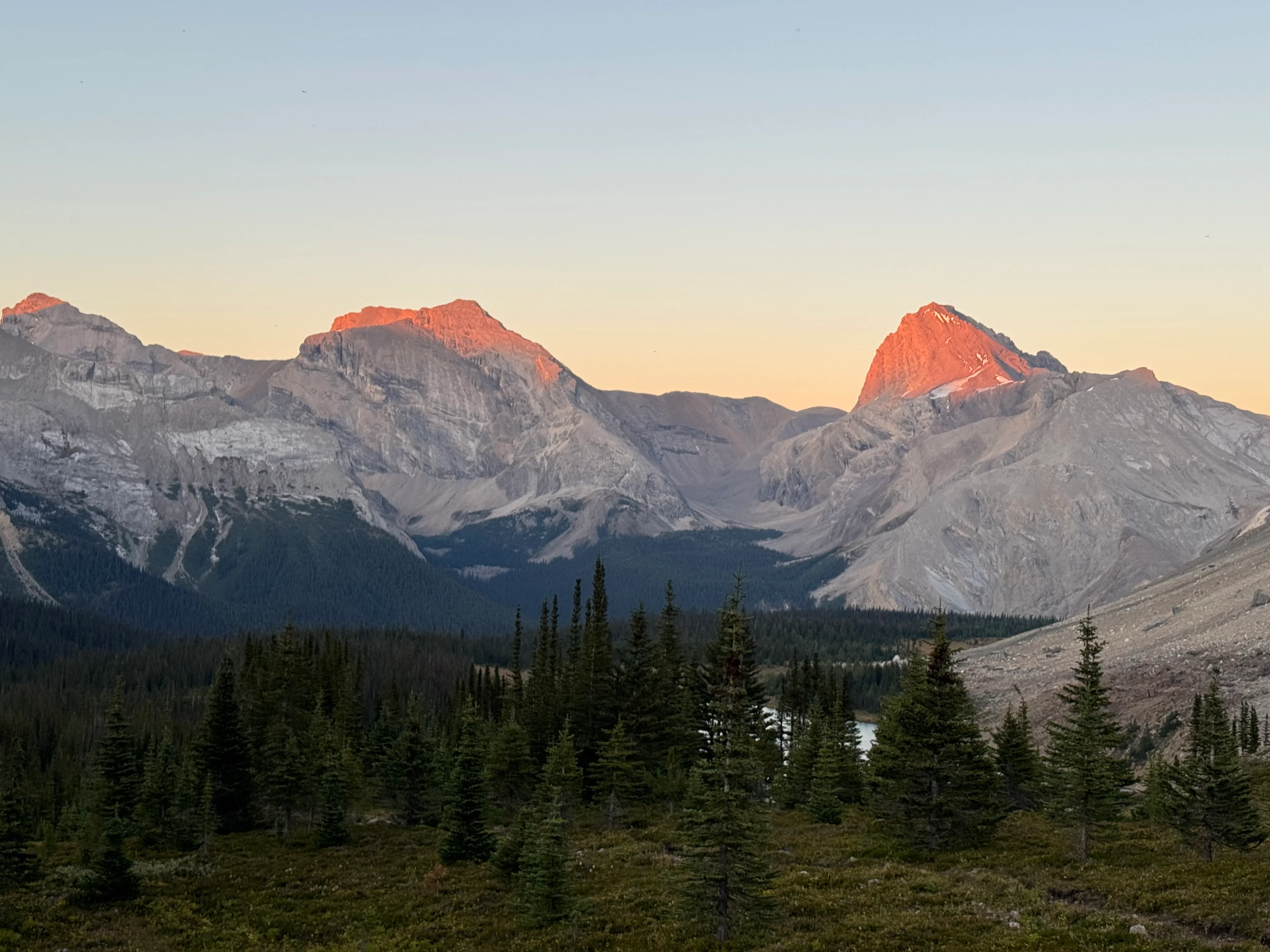
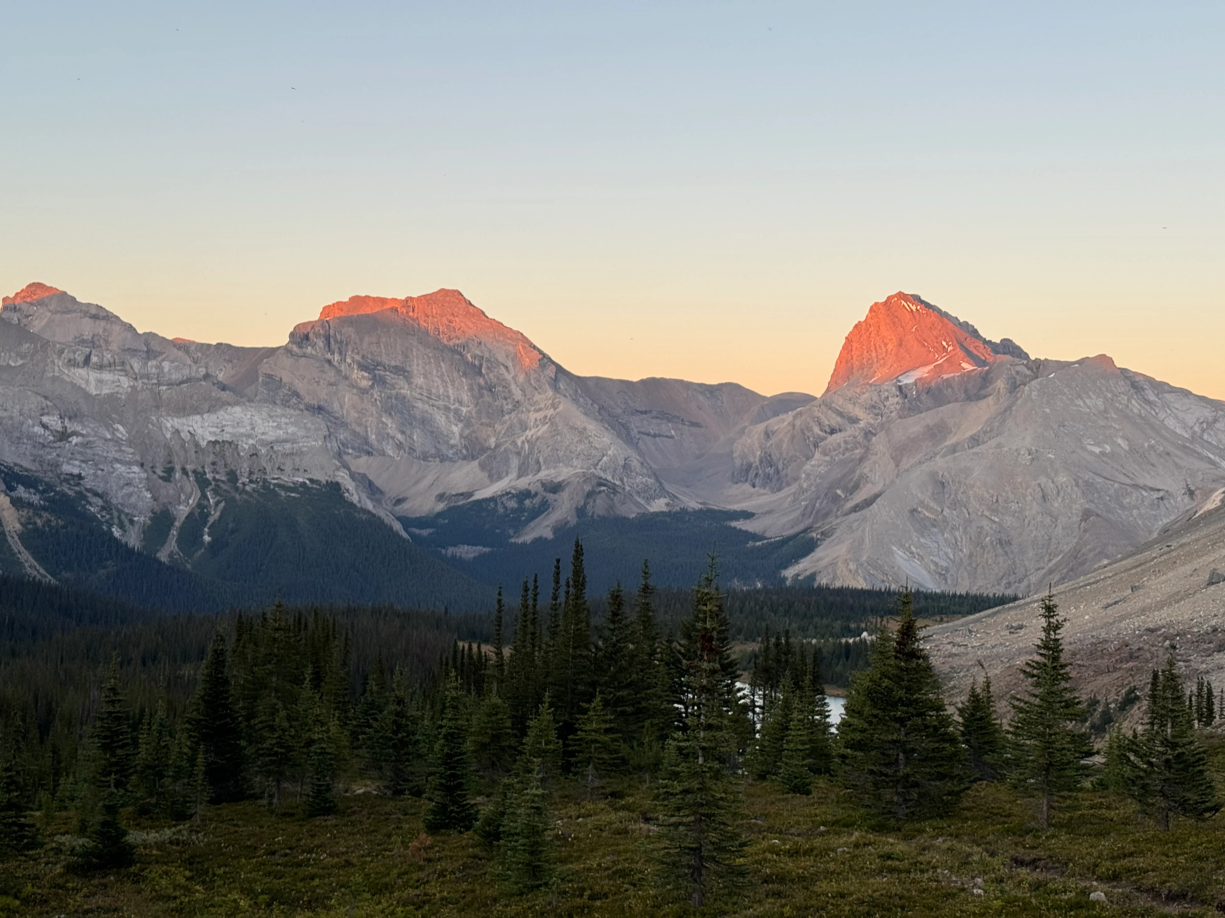
By then the sun was almost gone, and the pass leading toward Fish Lakes was already falling into shadow.

Evening light fading over North Molar Pass
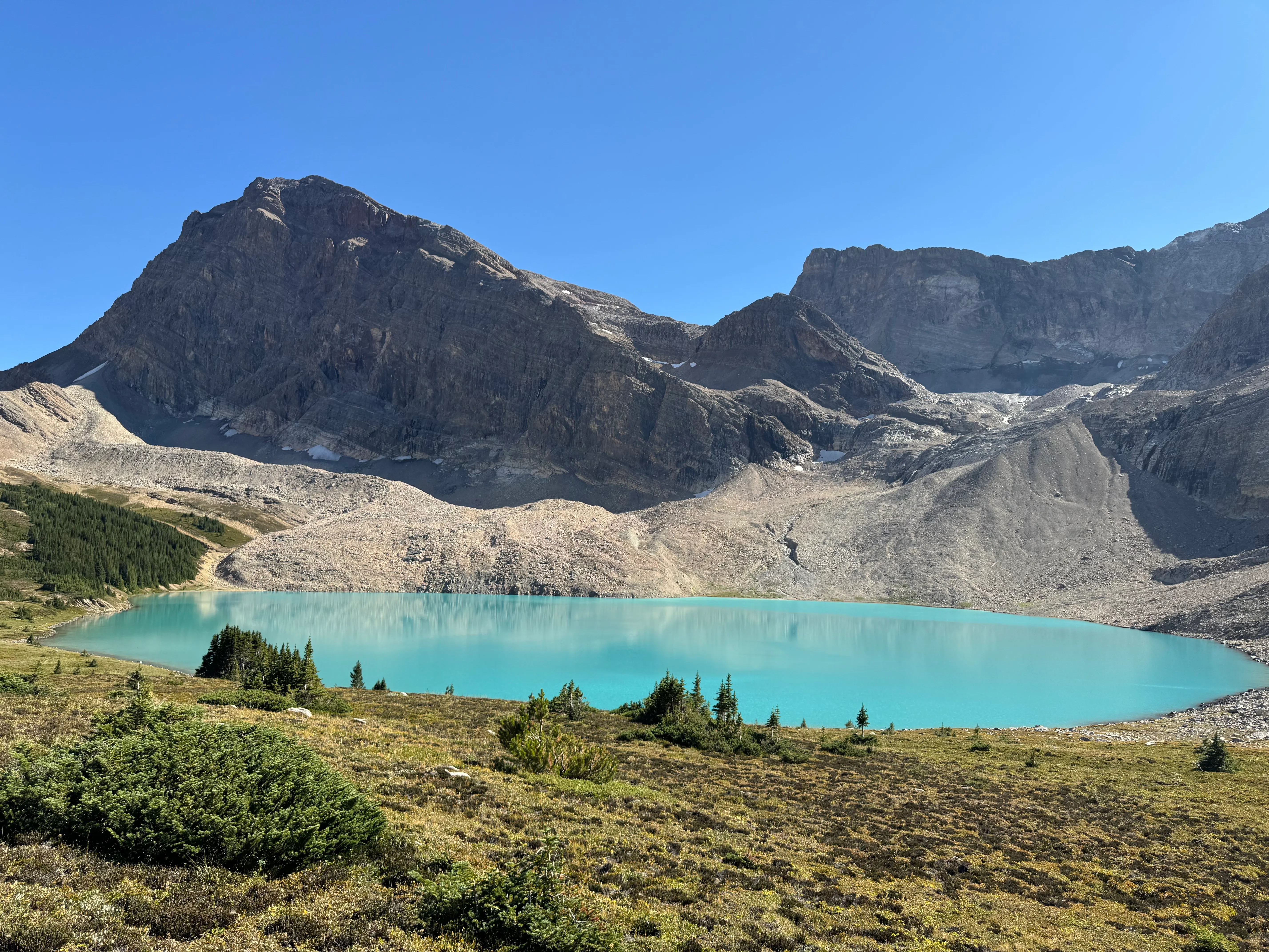
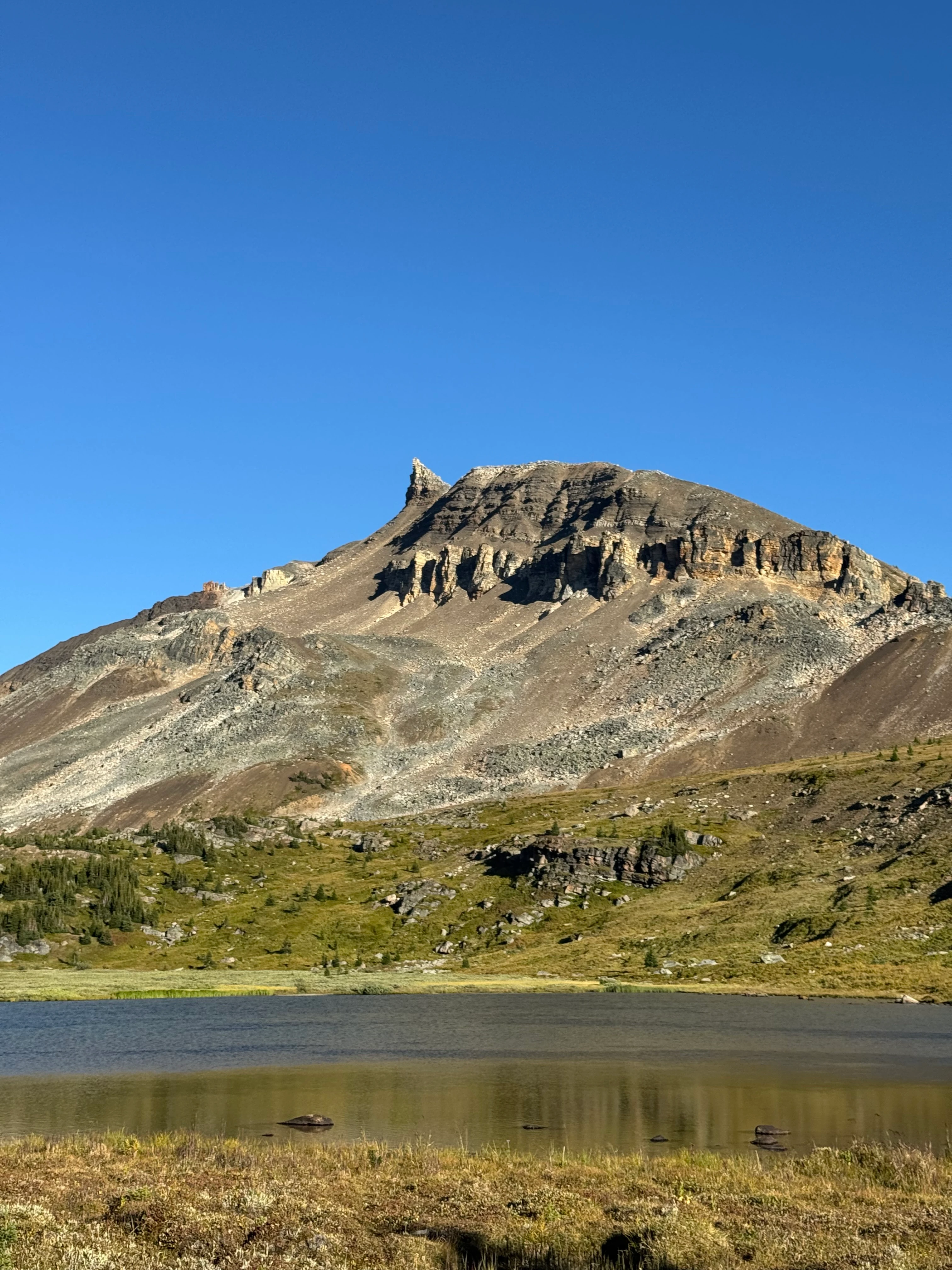
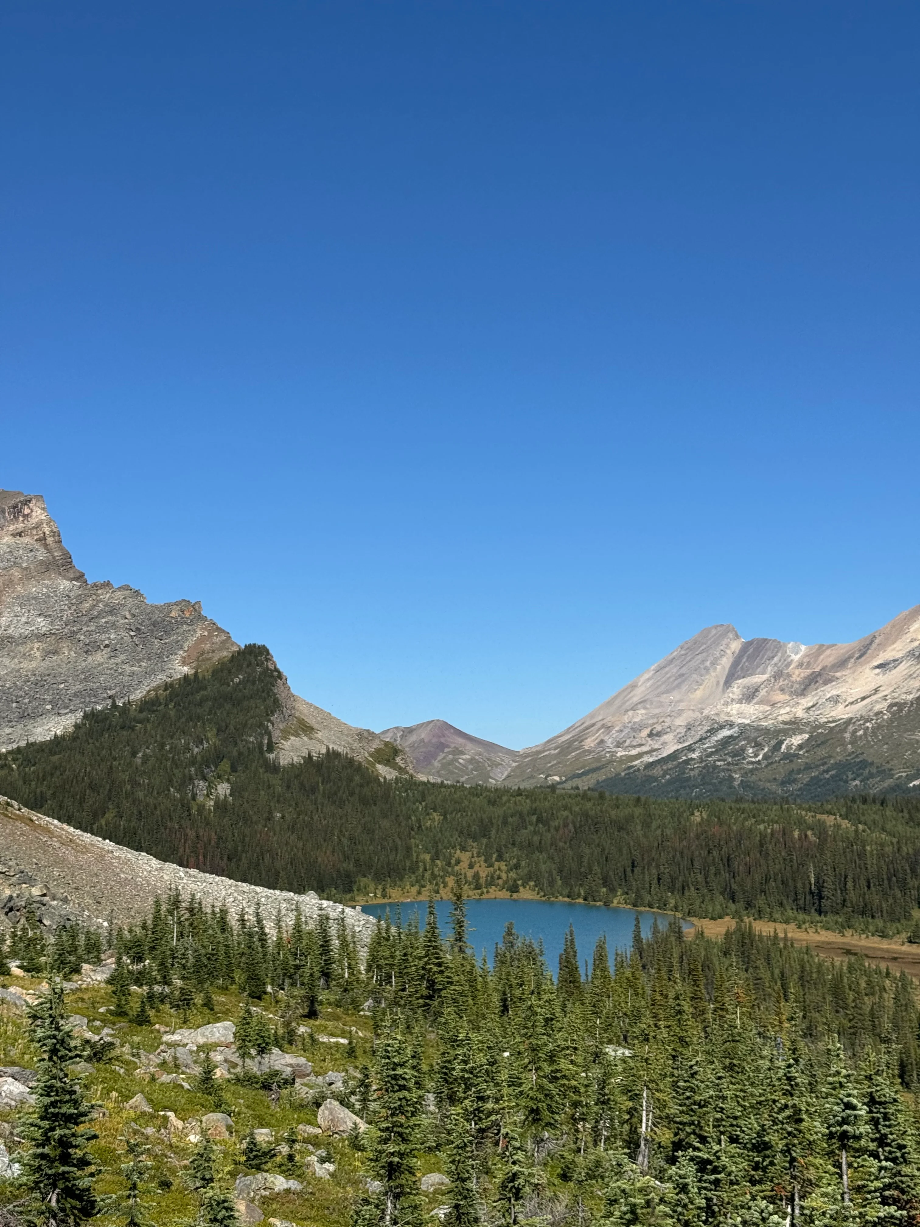
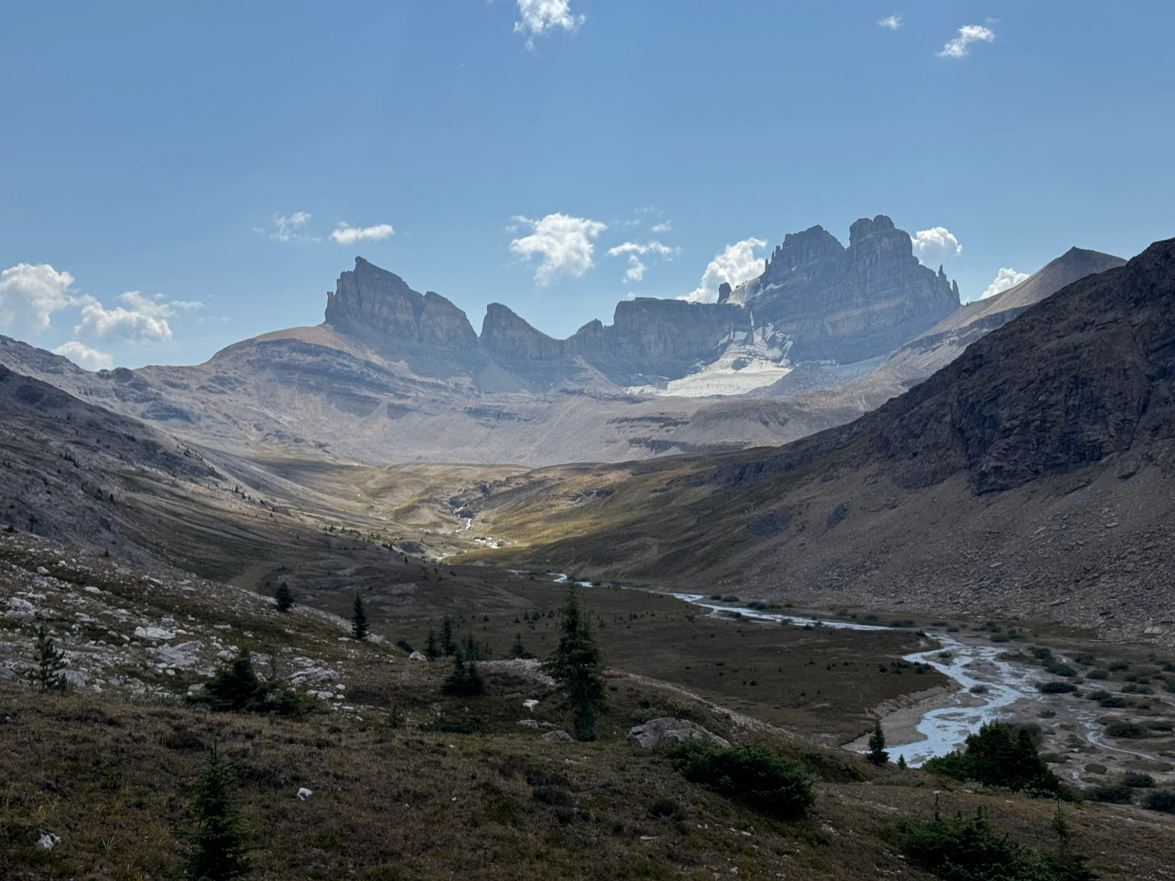
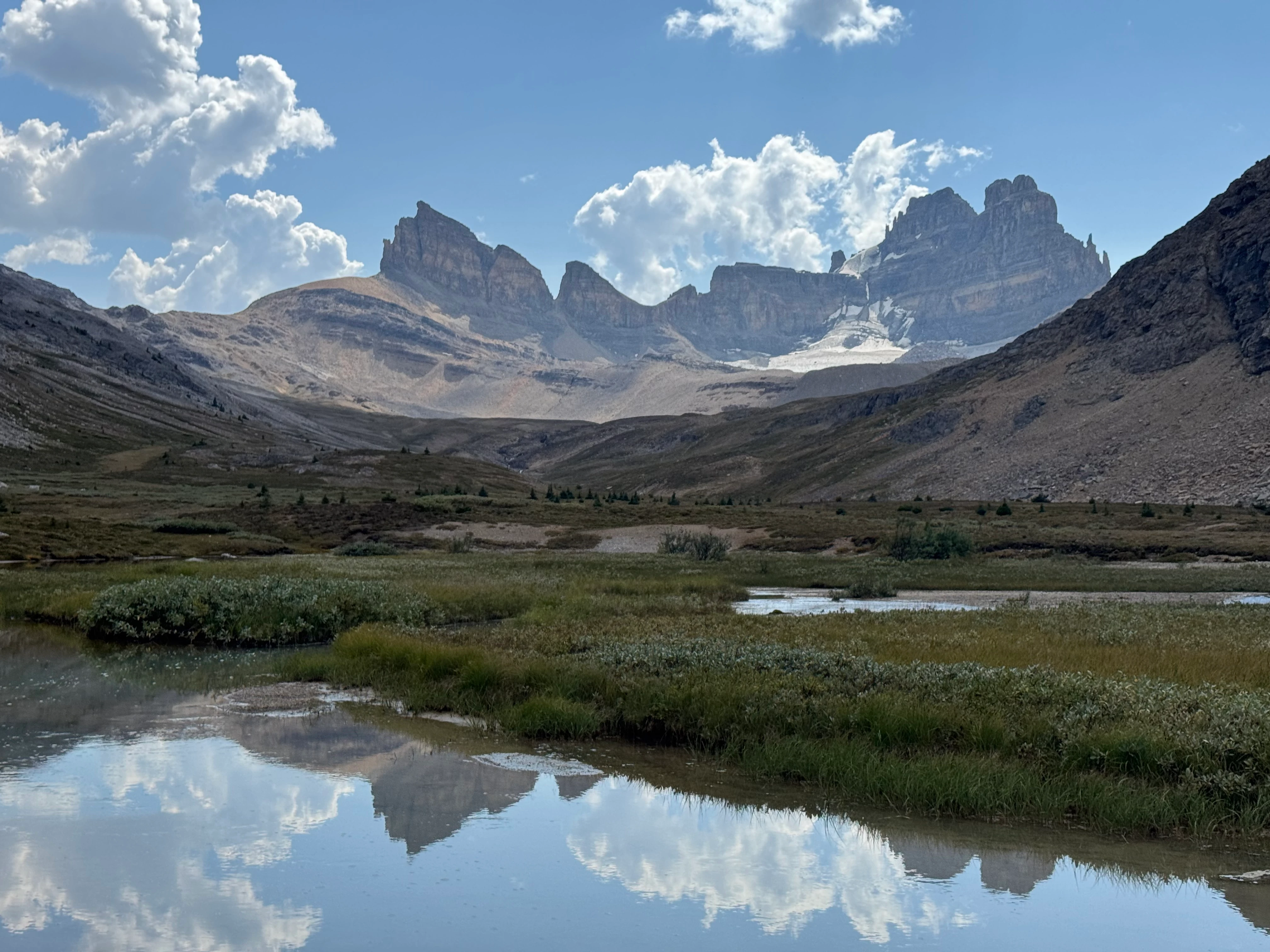
From the pass, I got my first view of Fish Lakes far below. In the distance: the Three Brothers, Little Cataract, and Cataract Peak.
Fish Lakes, the pass beyond, and peaks including the Three Brothers, Little Cataract, and Cataract Peak
Not long after, I reached camp. This site requires reservations and is usually hard to get, but I had managed to secure a spot. The campground was full, and by the time I arrived at 9 pm, I went straight to bed.
Day 2
Today’s route: over Pipestone Pass and down to Devon Lakes. One of the best stretches in Banff backcountry.
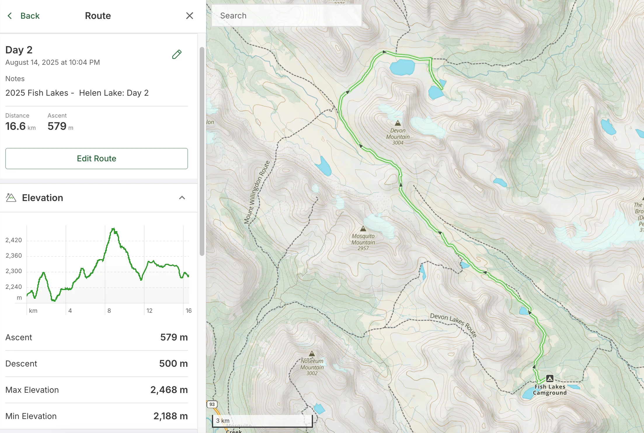
Route from Fish Lakes over Pipestone Pass to Devon Lakes

From here, no more people. I wouldn’t see anyone for almost three days, not until Helen Lake trailhead.
Fish Lakes was beautiful at dawn, but the campsite sucked. Tents crammed side by side, I woke up to every cough, zipper, and shuffle. Earplugs are a must in reserved backcountry zones.
I was up around 7:00, ready for breakfast until I remembered I hadn’t soaked it overnight. I don’t carry a stove from May to October - I cold-soak everything. Easy fix: swap breakfast and lunch.
So breakfast became instant potatoes, bacon bits, coconut milk, roasted sunflower seeds, pre-toasted German multigrain bread, and Tuscany-style sausages. Not a bad way to start the day. The sunrise over Fish Lakes made it even better.

Morning light at Fish Lakes
Packed up and headed for Devon Lakes. Plan was to push to the lower lakes, which looked way better than the upper basin on satellite imagery. From here on, all random camping, but permits are still required.
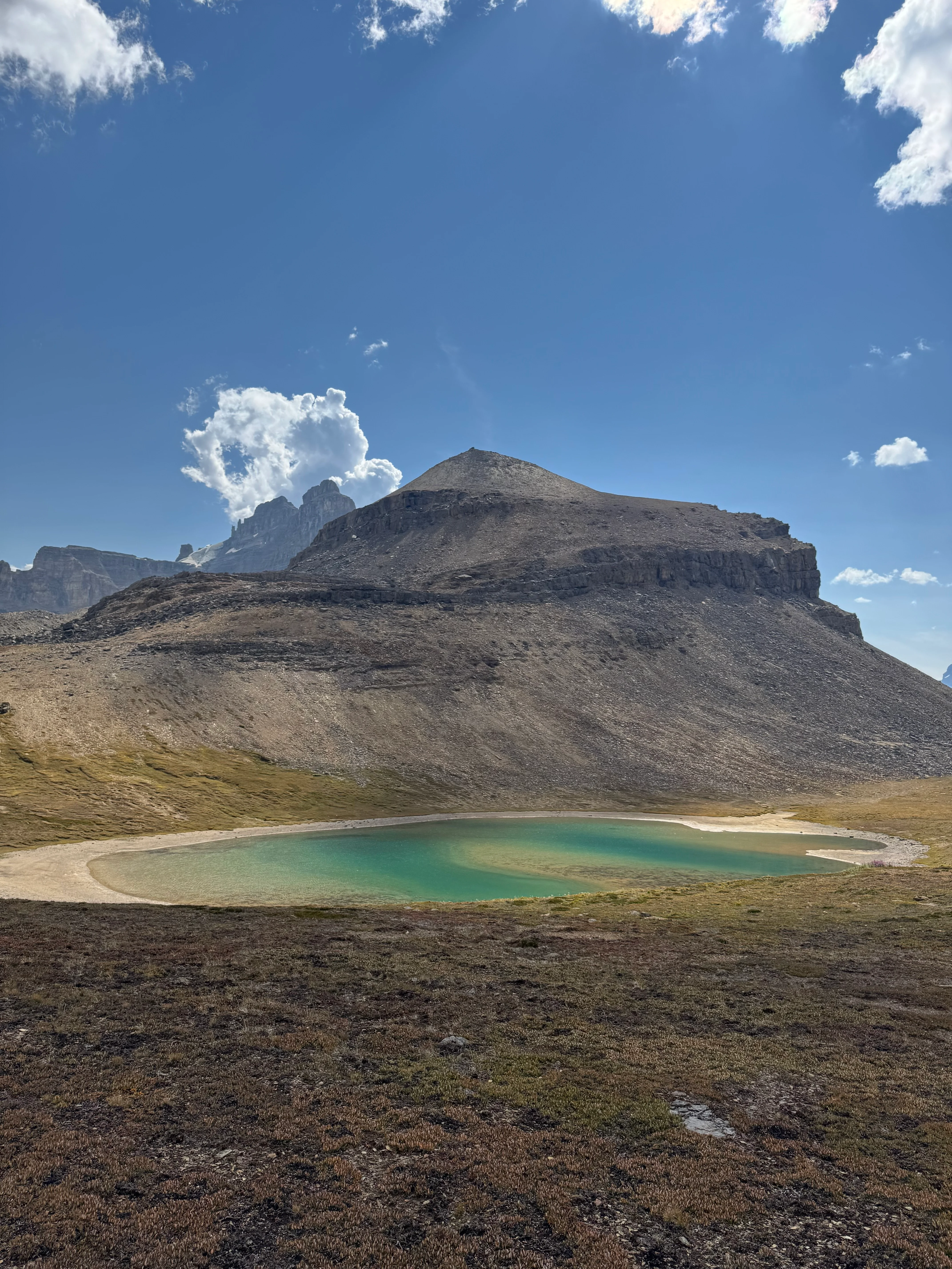
Morning started with a steady climb. I detoured through a meadow to a hidden lake. A small stream came out of it, so I filled a bottle before heading back toward the ridge.

Leaving the trail to explore a meadow and hidden lake
A hidden alpine lake above the main trail

The ridge dropped back toward the official route at Moose Lake. From above it looked perfect for a swim on a hot day.
Moose Lake from above

The trail stayed high above the Valley of Abundance - lush, remote, and thick with bear sign. Parks Canada warns hikers to avoid it. I still plan a return trip here someday.

Bear country below the trail
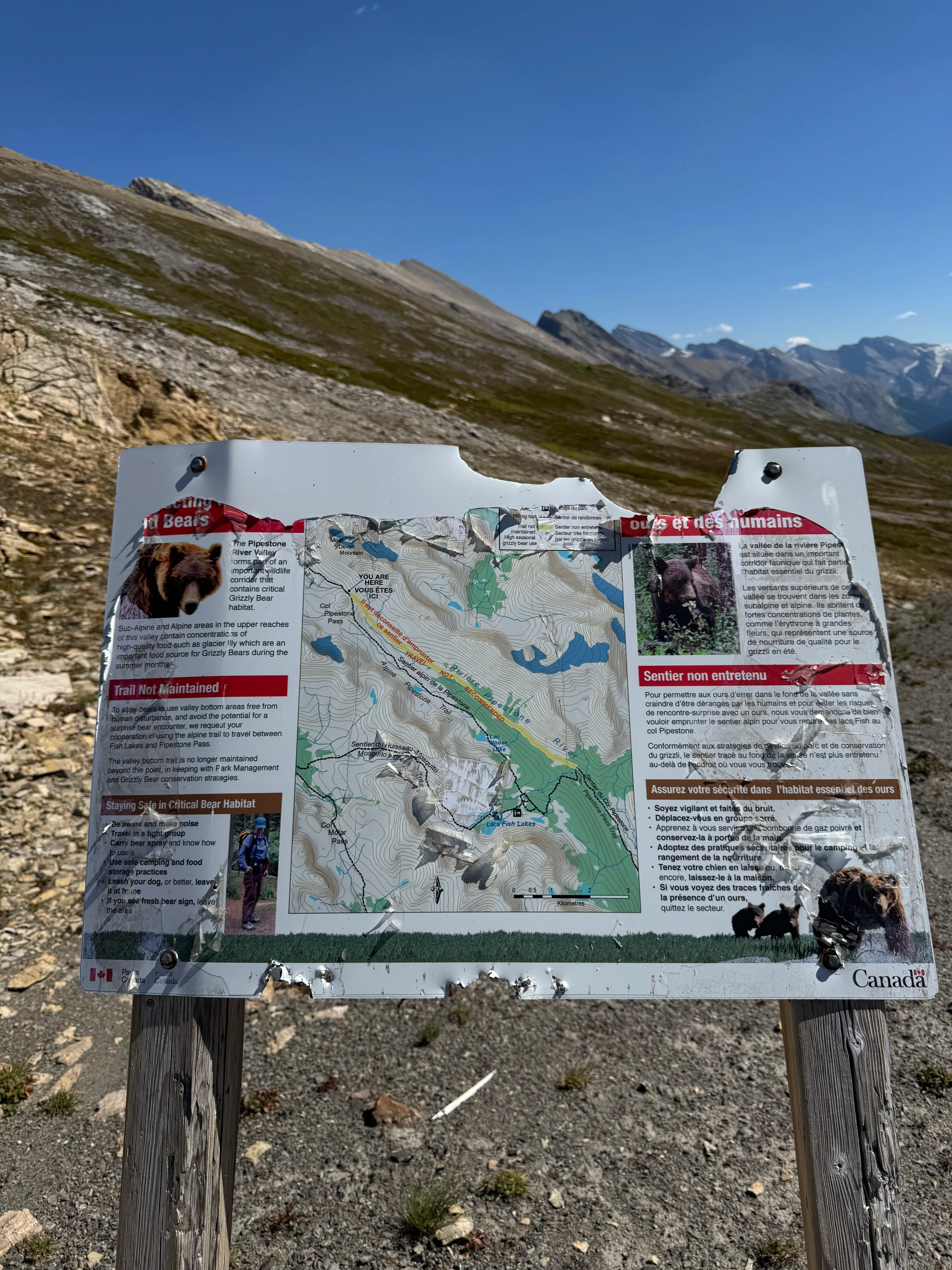
Warning about heavy bear activity

Moose Lake was quiet, tucked off the maps in most apps. I stripped down, dove in, cold water felt amazing. Washed my shirt too - wet fabric helps on the uphill.
Cool waters of Moose Lake

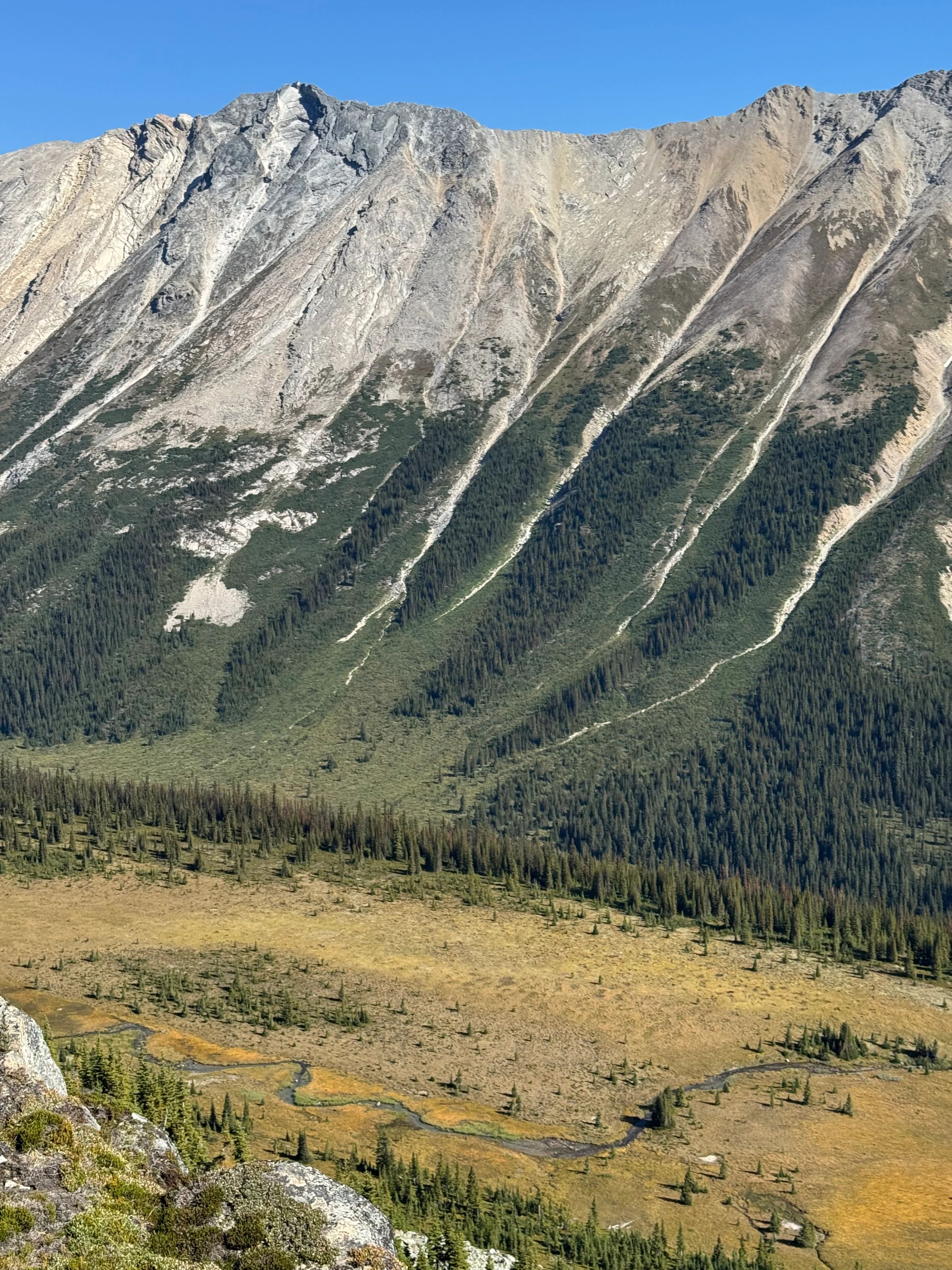
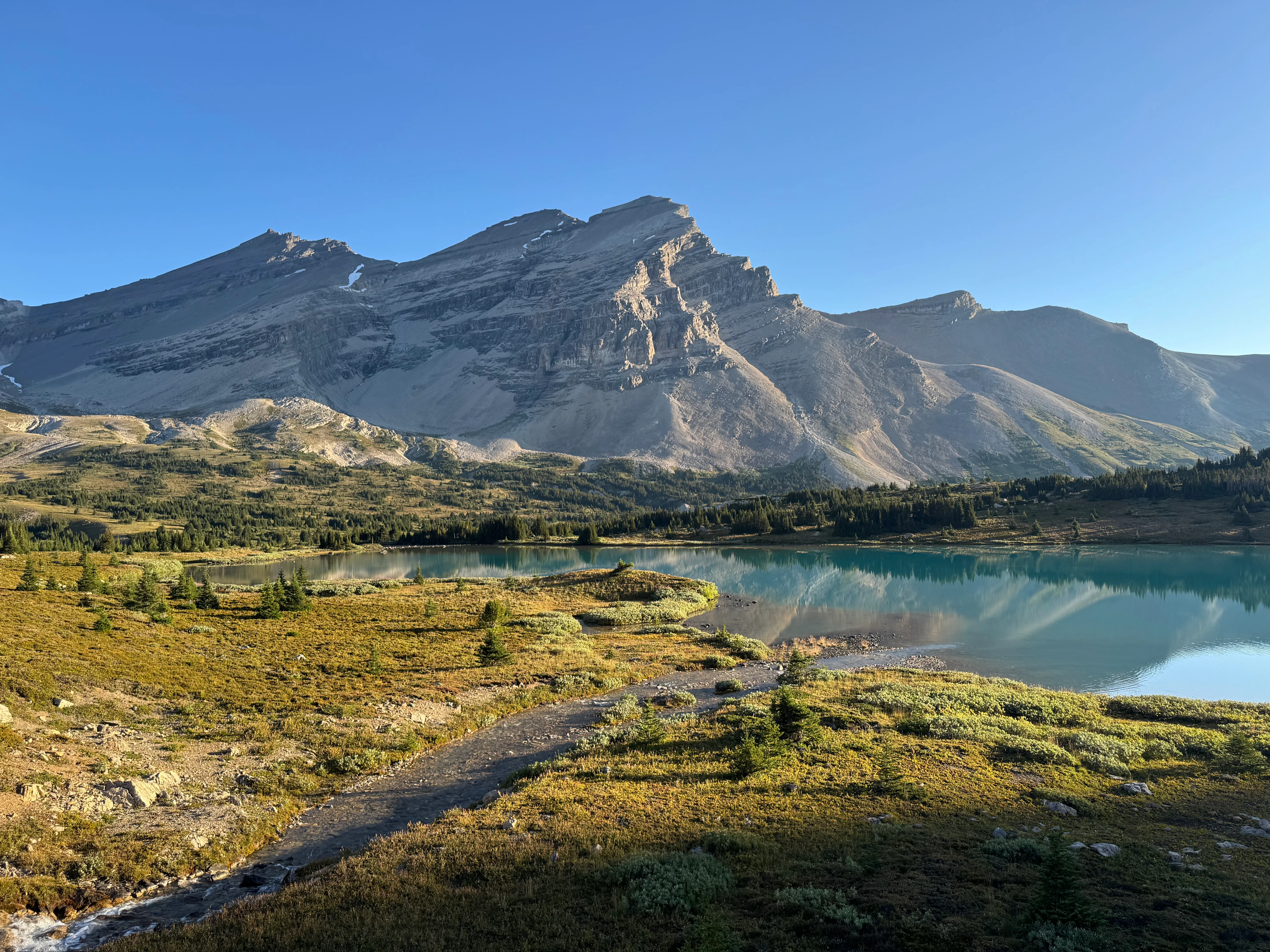
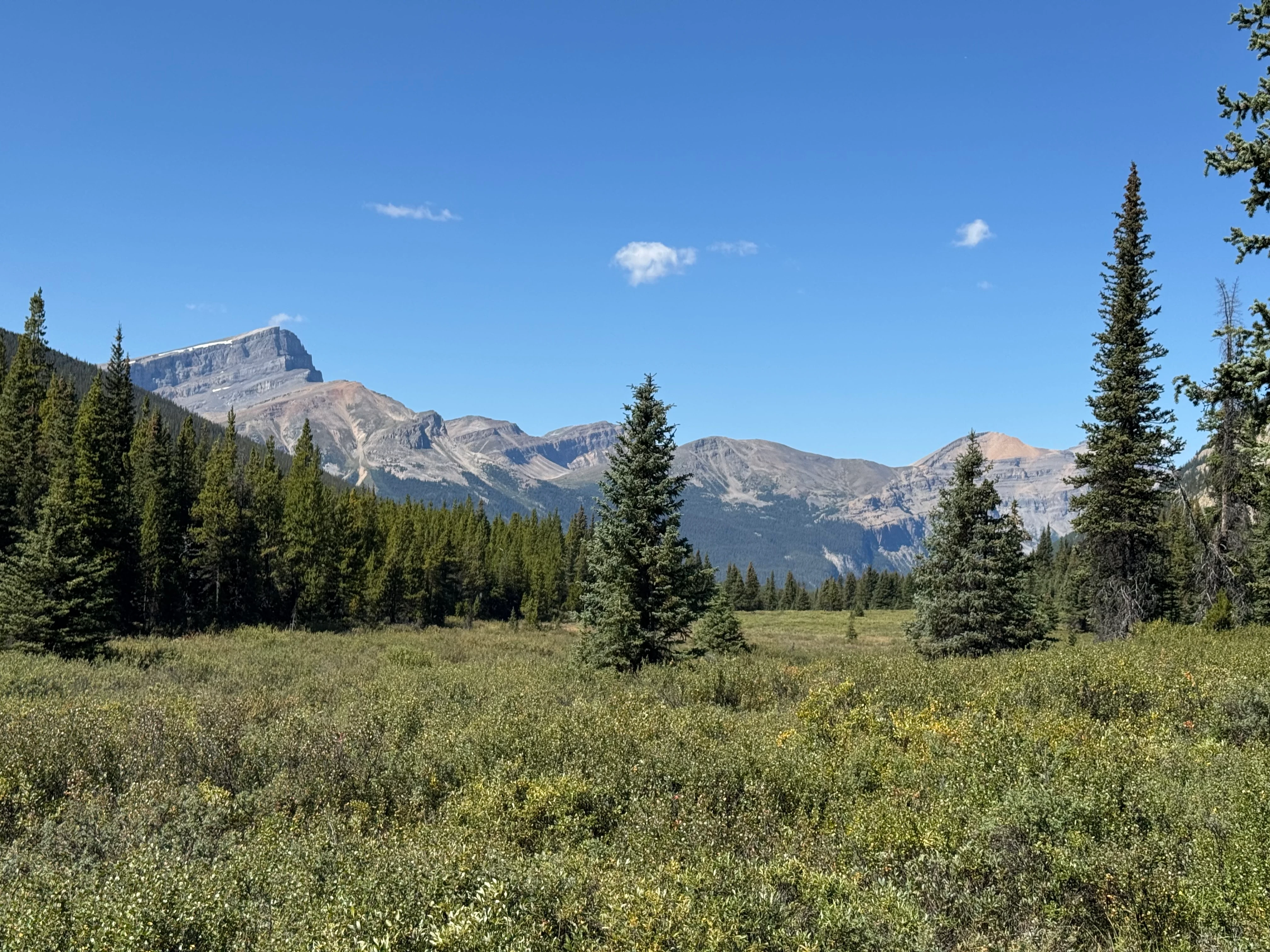
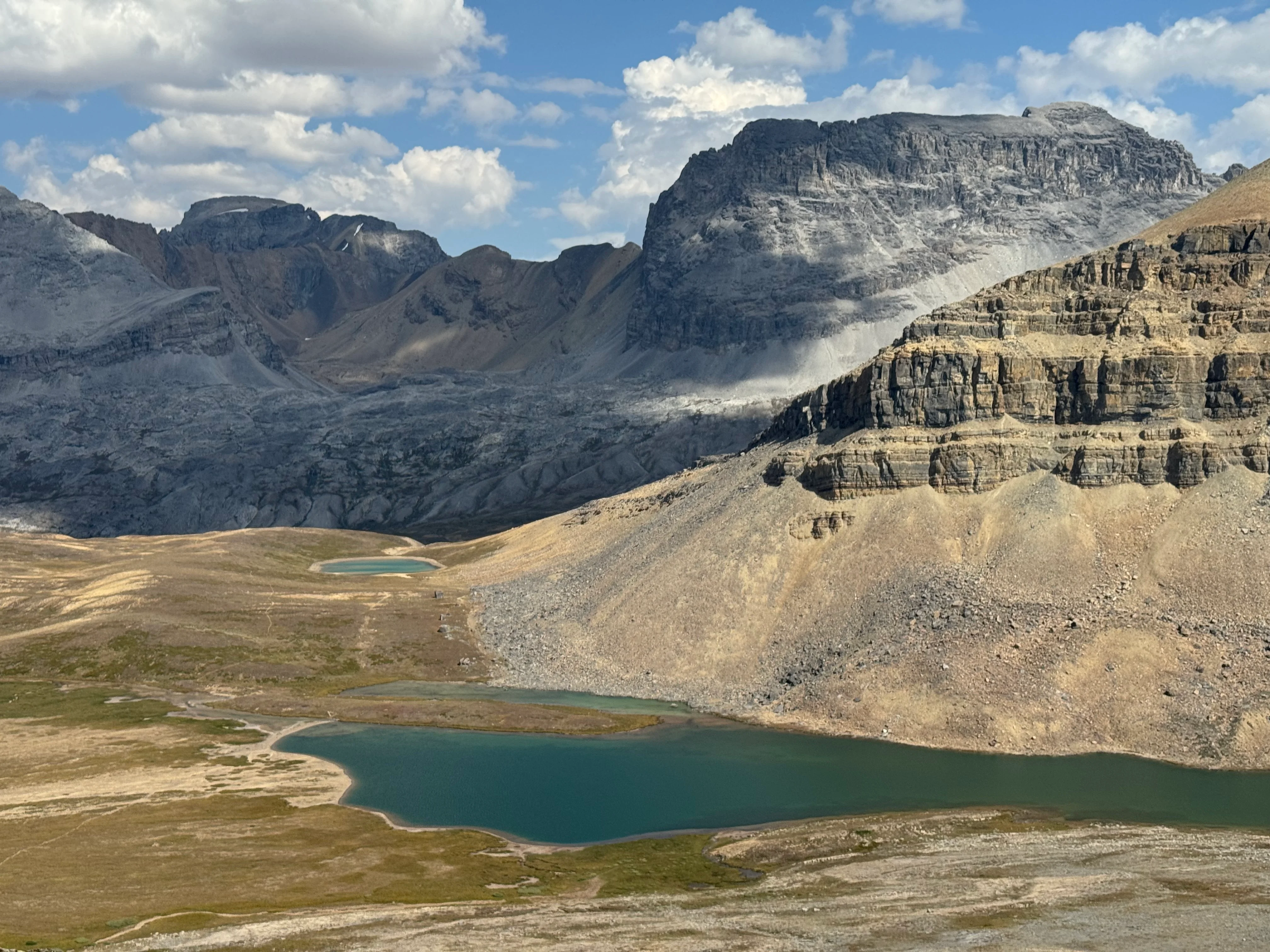
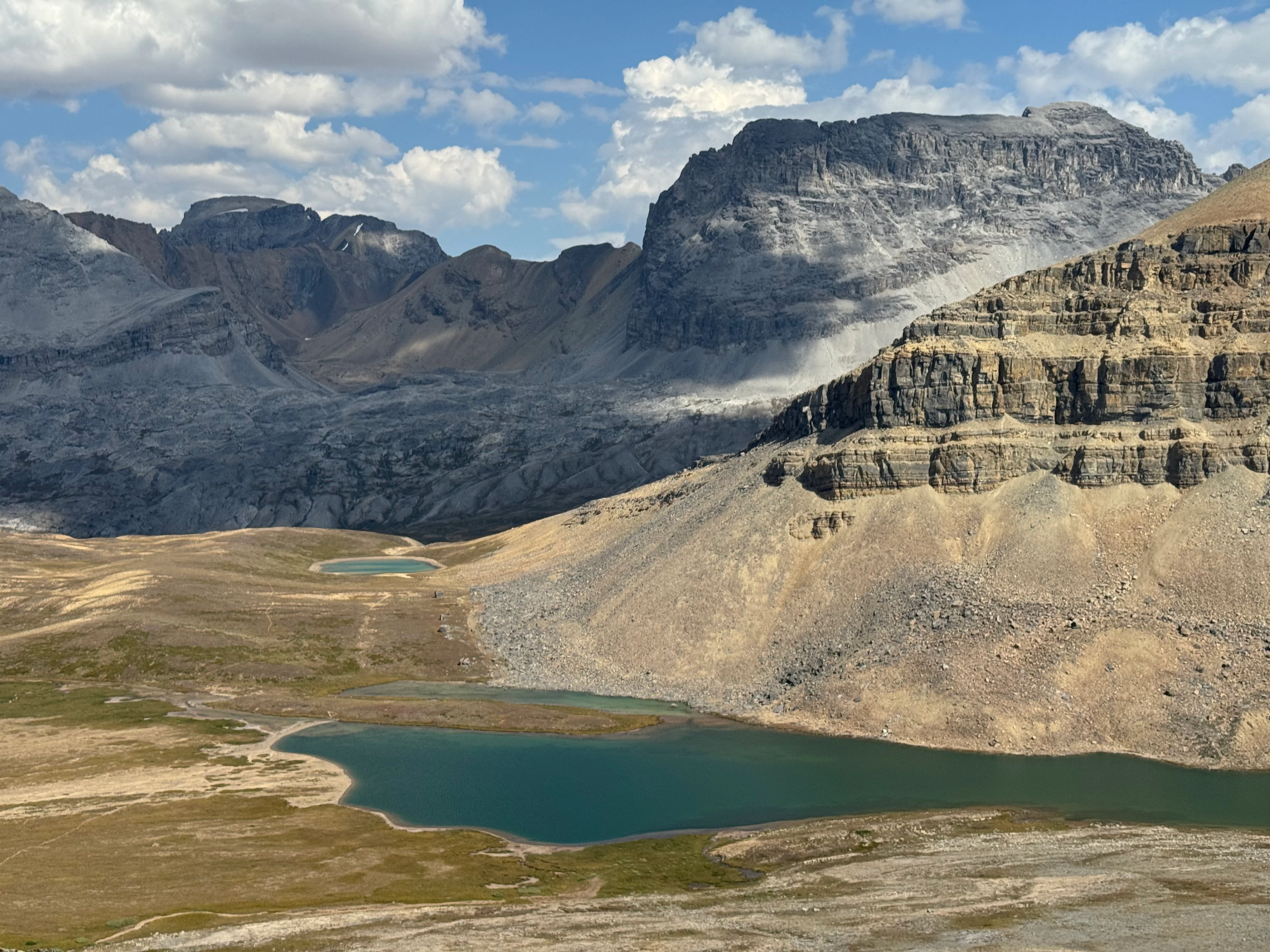
Above the lake, the climb to Pipestone Pass got warmer, but the views got better: Cataract Peak (3333 m / 10,935 ft), Cyclone Mountain (3050 m / 10,007 ft), and the white tongue of Drummond Glacier across the horizon.

Cyclone Mountain and Drummond Glacier behind
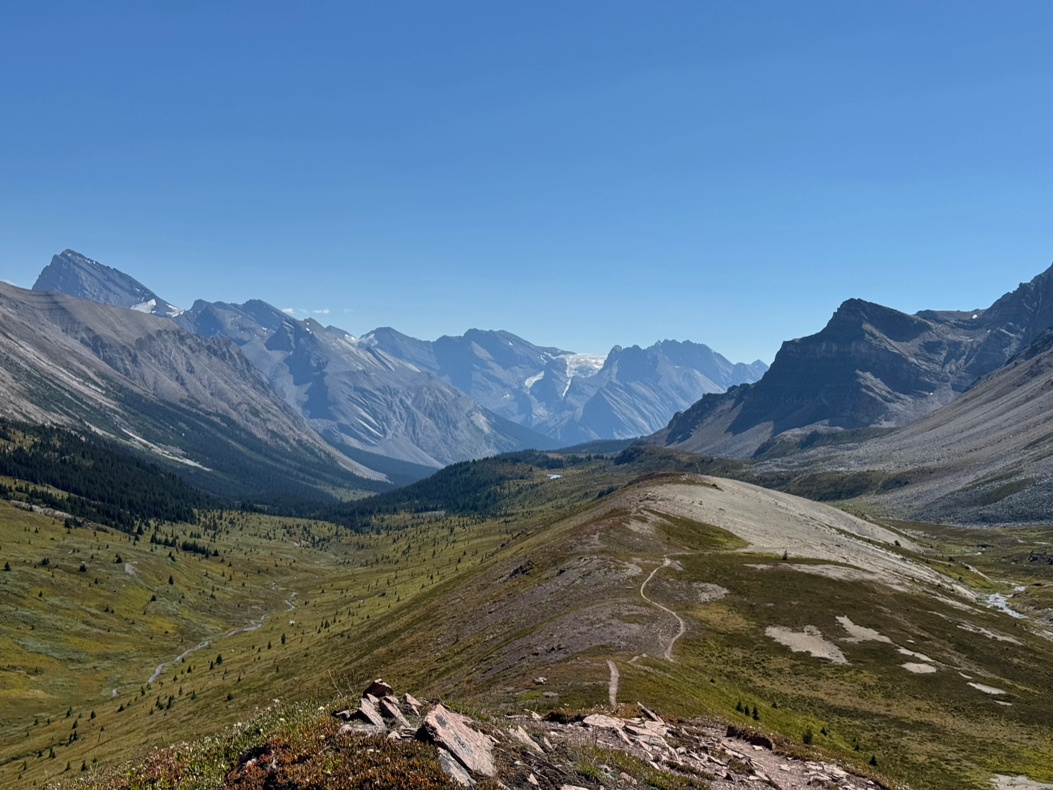
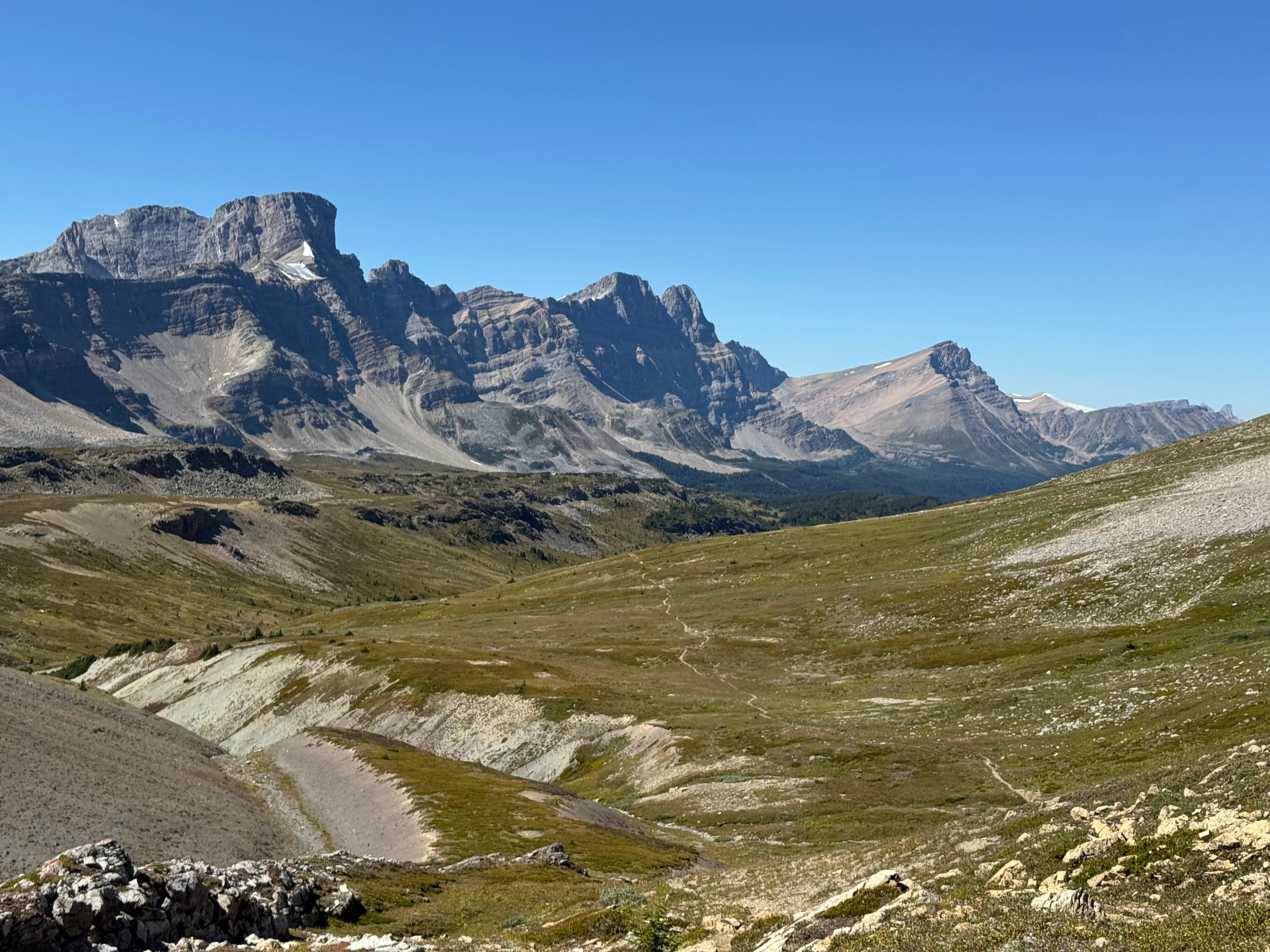
The ridge was easy walking, trail weaving along the crest. Big sky, endless mountains.
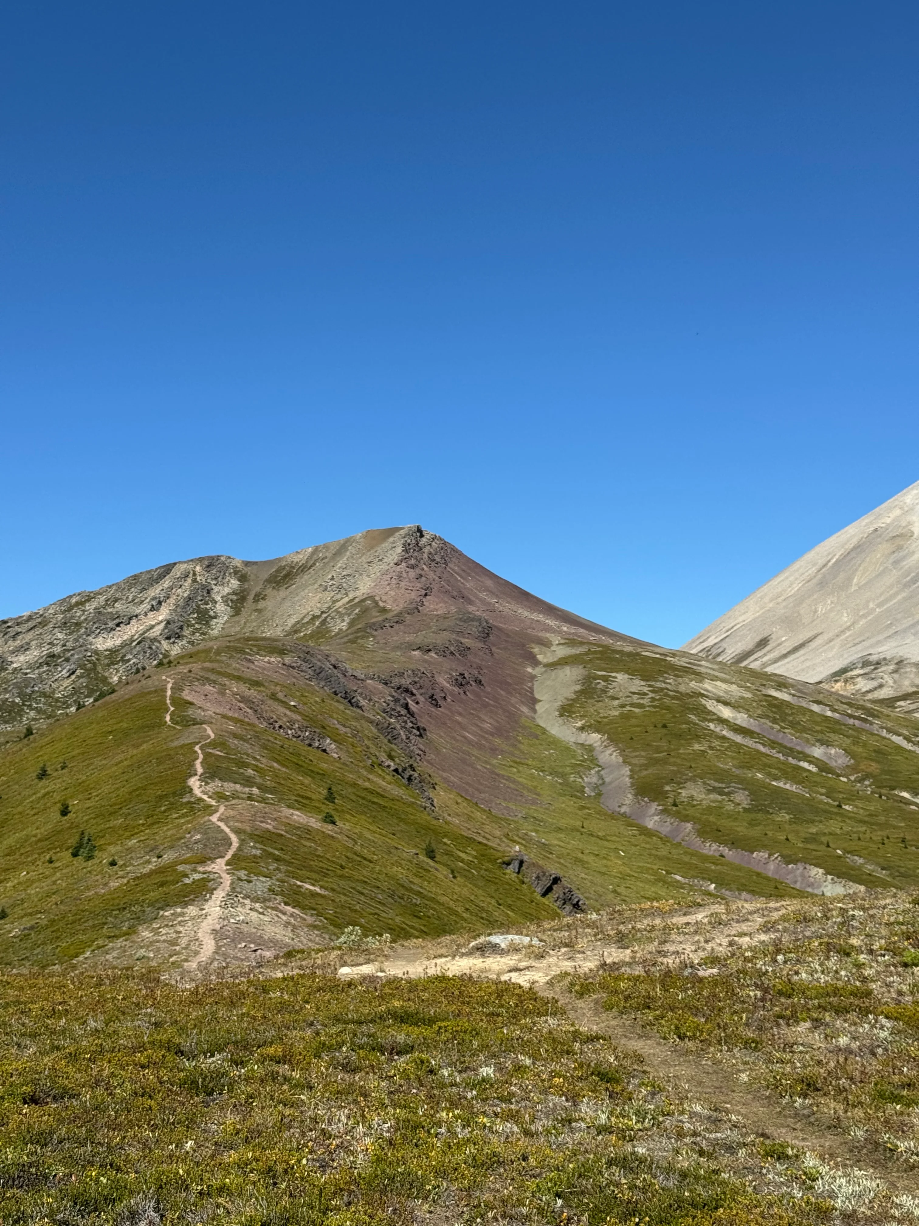
Ridge walking above Pipestone Valley

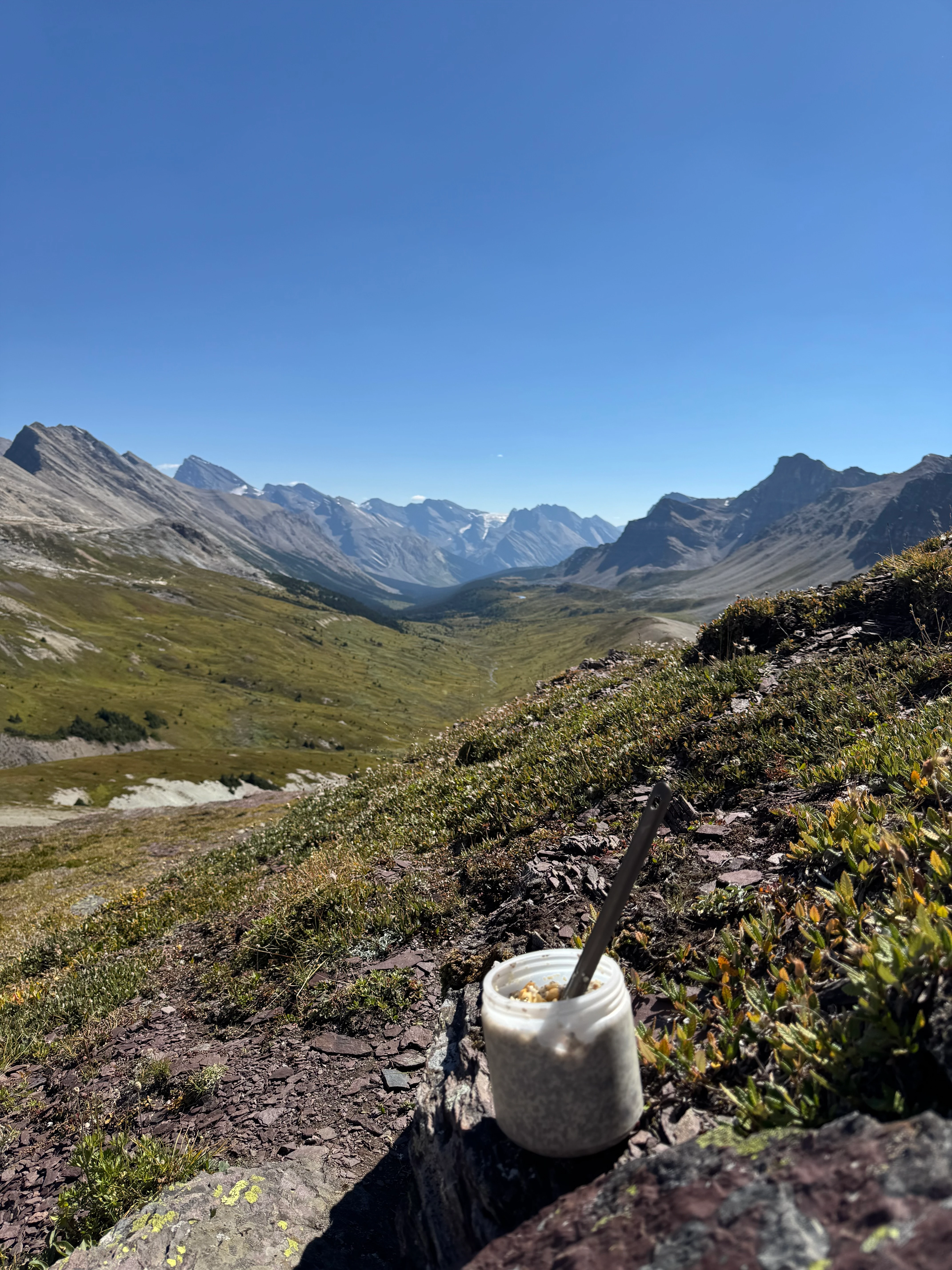
I stopped for lunch, ate what I’d soaked earlier. The whole pass was right there below me.

Lunch with a pass-wide panorama
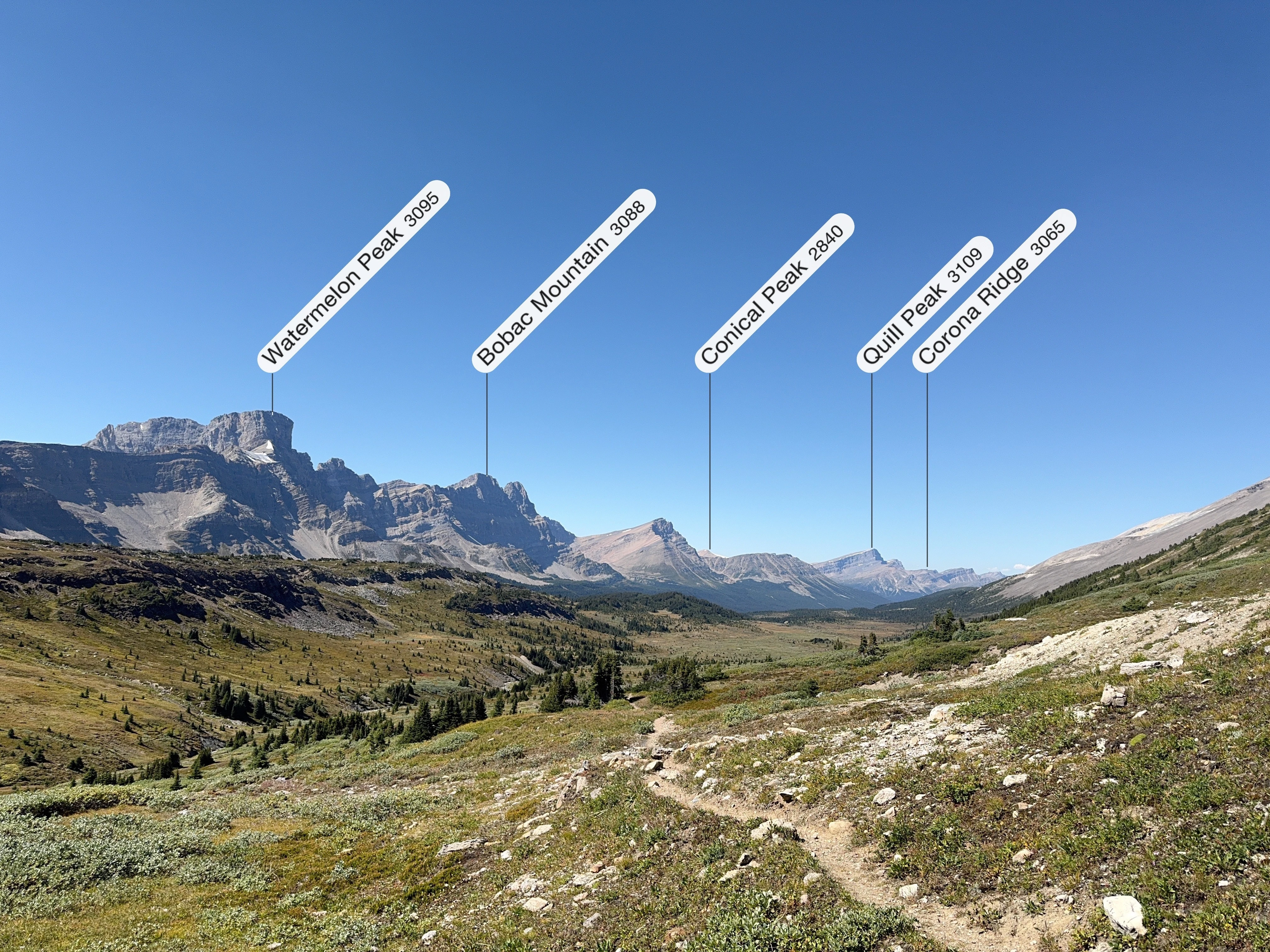
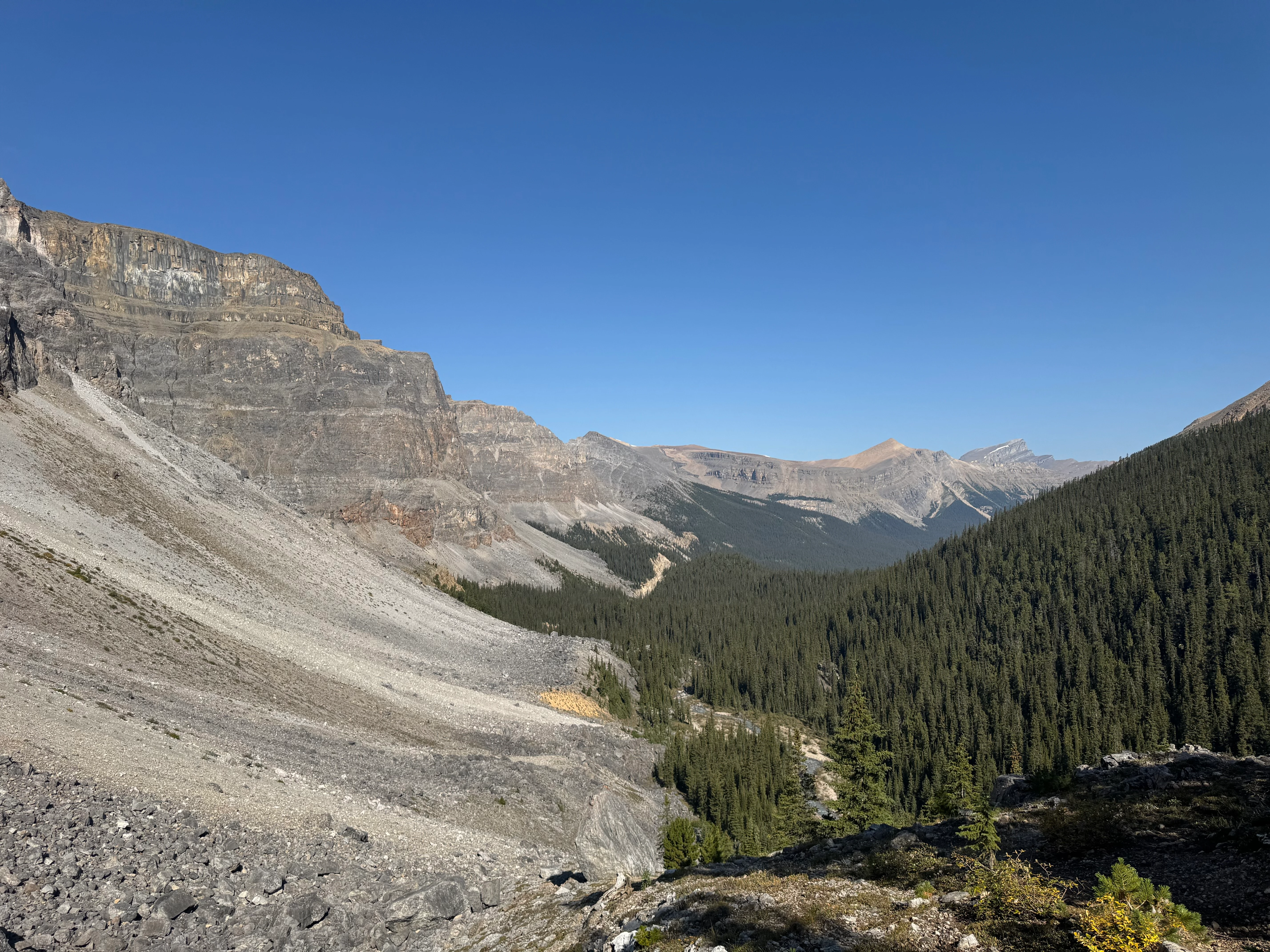
Past a recent landslide, the route continued toward tomorrow’s terrain: Watermelon Peak (3095 m / 10,154 ft), Bobac Mountain (3088 m / 10,131 ft), and the ridges toward Dolomite Creek.
Peaks marking tomorrow's route

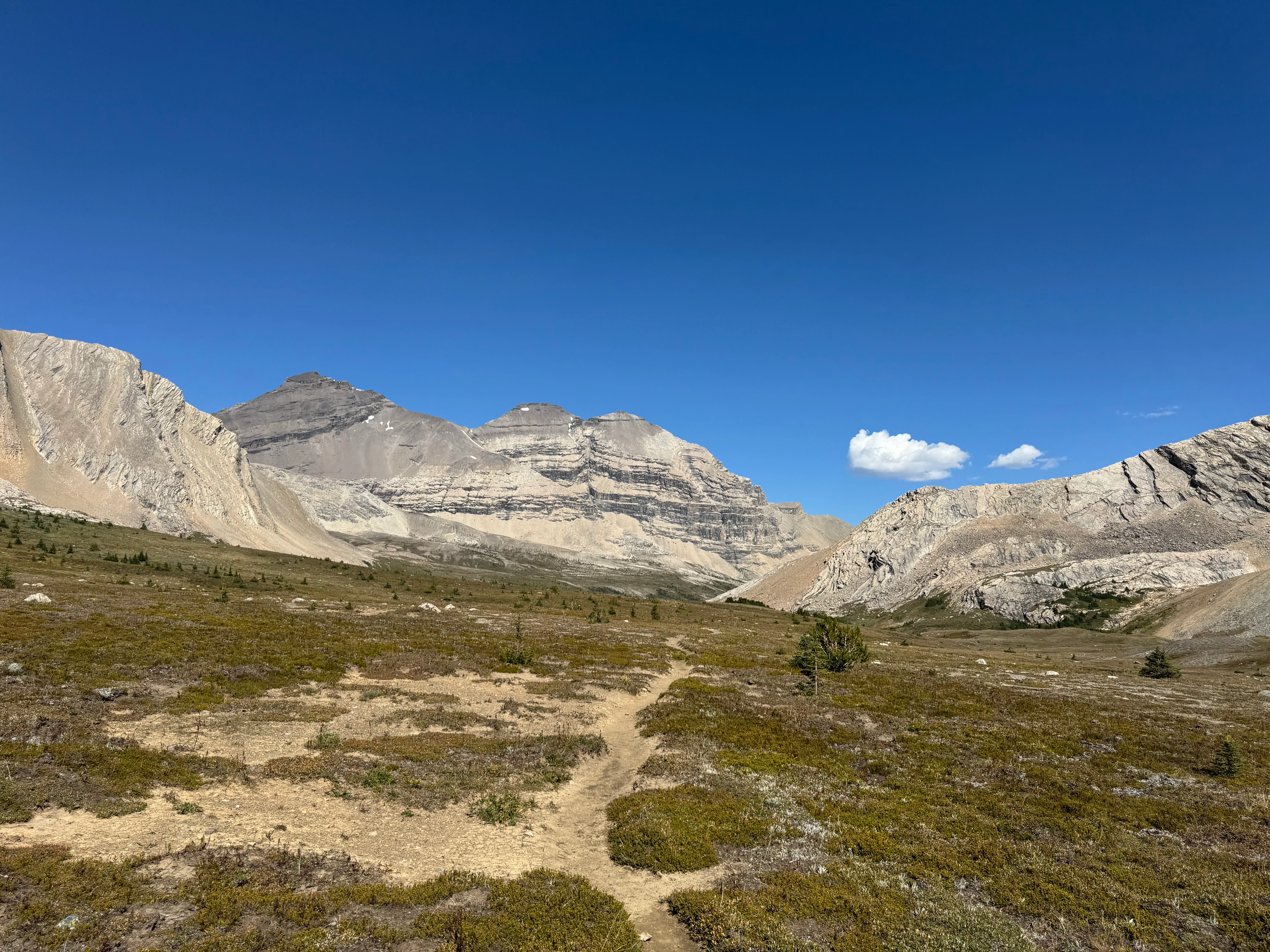
I tested PeakFinder on the descent, pinning names to peaks. Useful app. (Not sponsored, I just like it.)

Labeling the skyline with PeakFinder
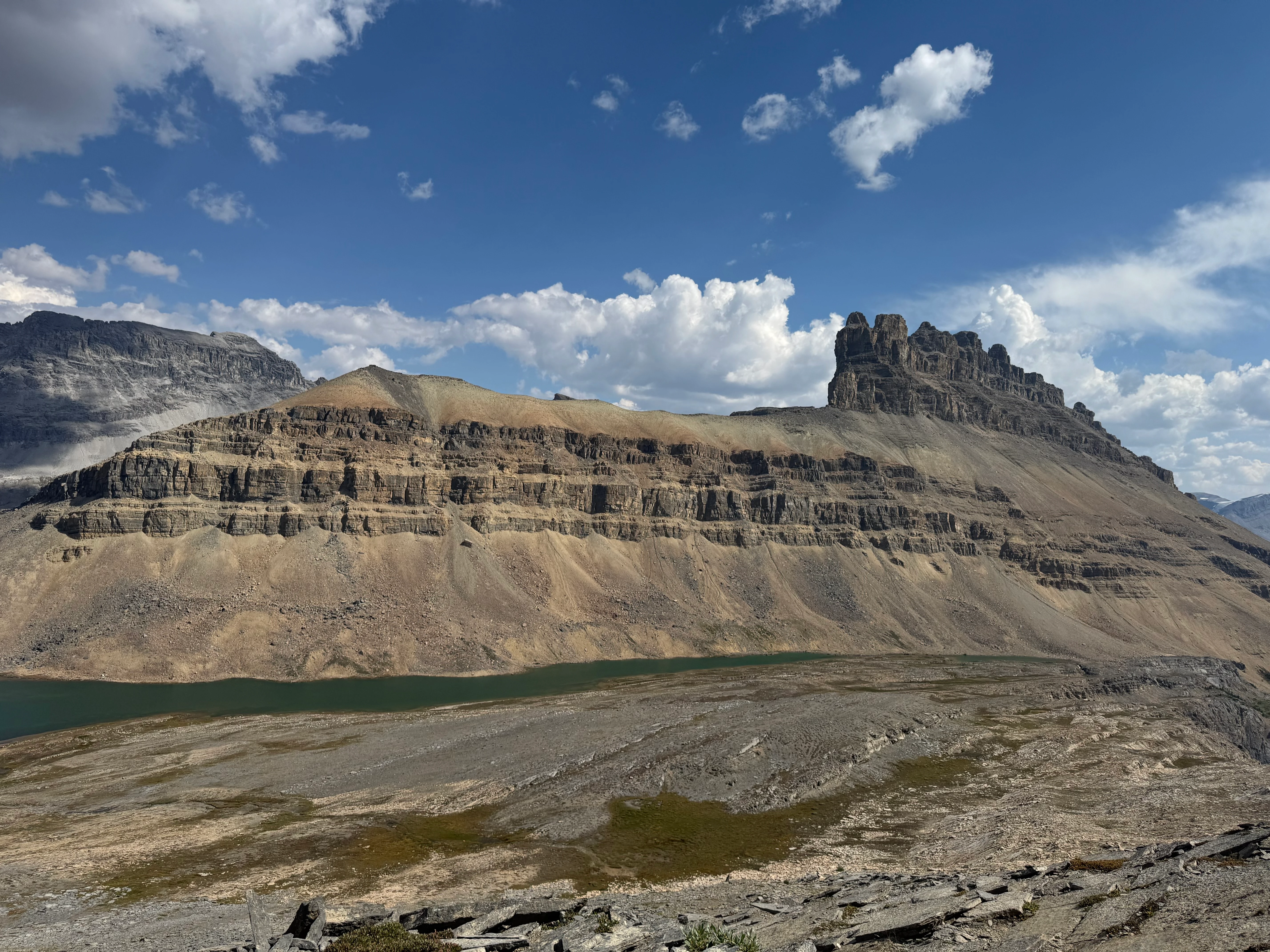
After Quartzite Col (a good but technical route to Devon Lakes, off to the left), things opened up near Devon Lakes. Mount Willingdon (3376 m / 11,076 ft) and Crown Peak (3355 m / 11,007 ft) came into view above meadows full of marmots and bear sign.

Approach to Devon Lakes
I passed Upper Devon Lake first, Devon Mountain rising steeply behind. The basin felt exposed, windy on most days, so I kept going.

Upper Devon Lake under Devon Mountain
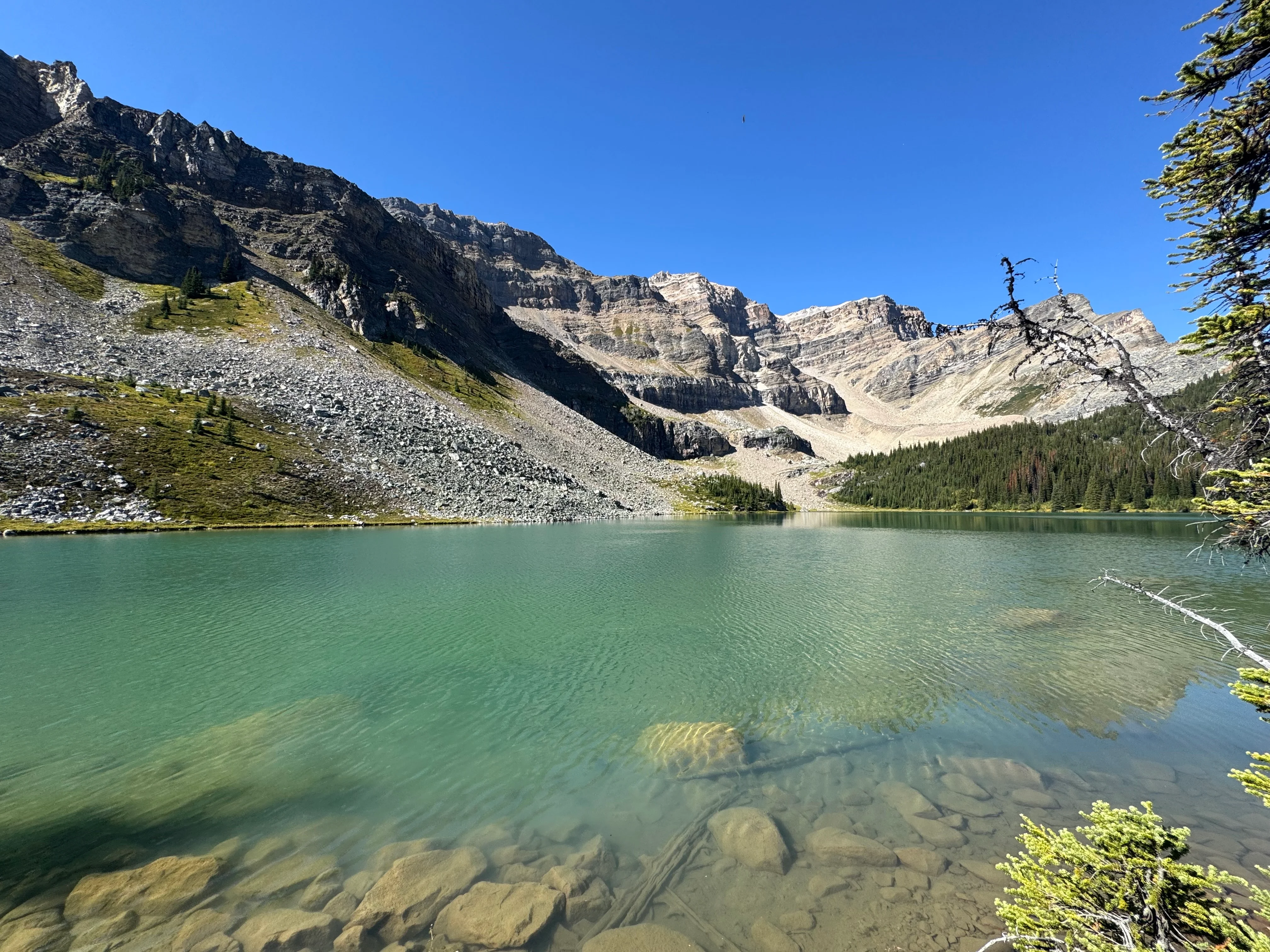
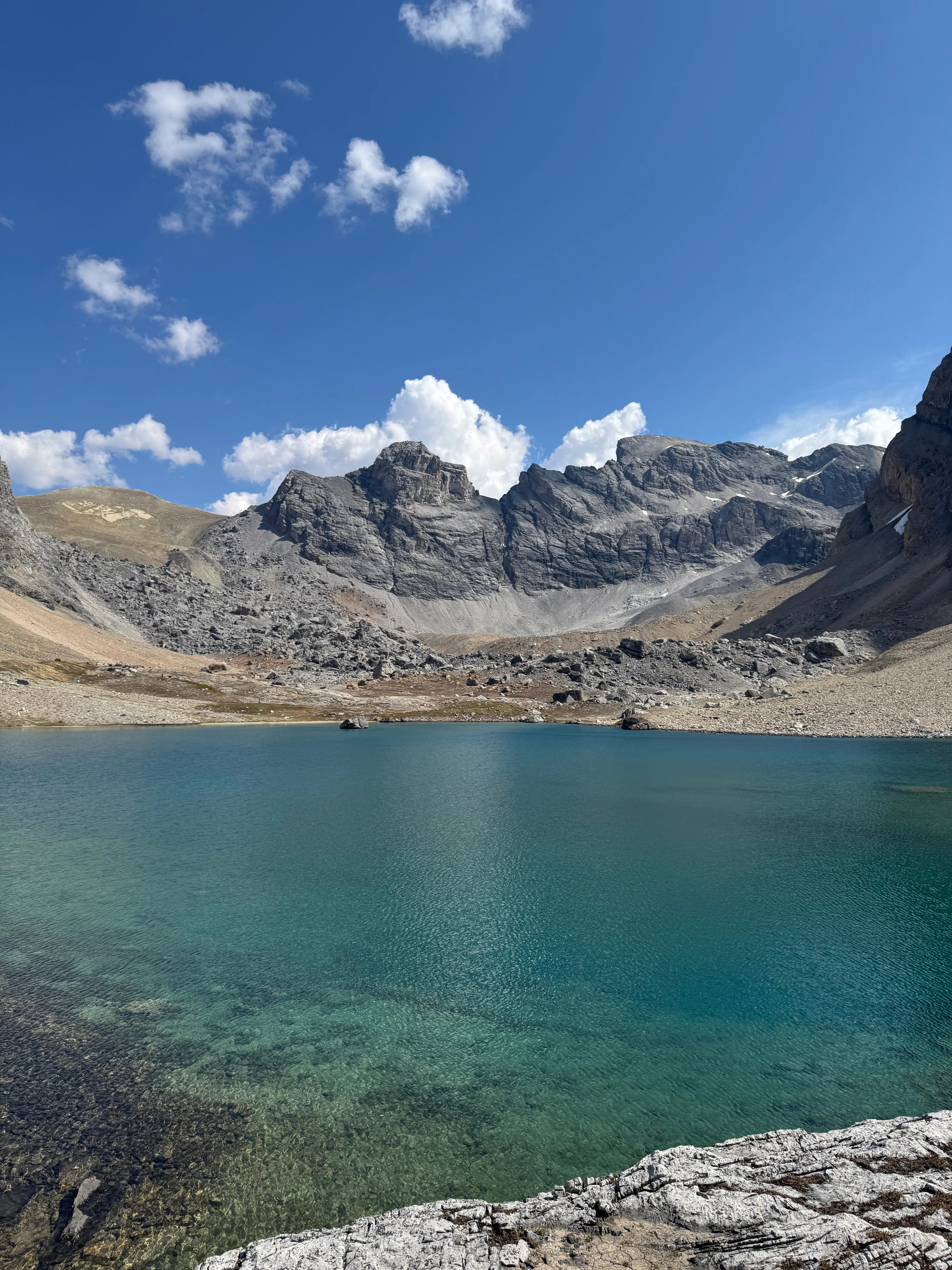
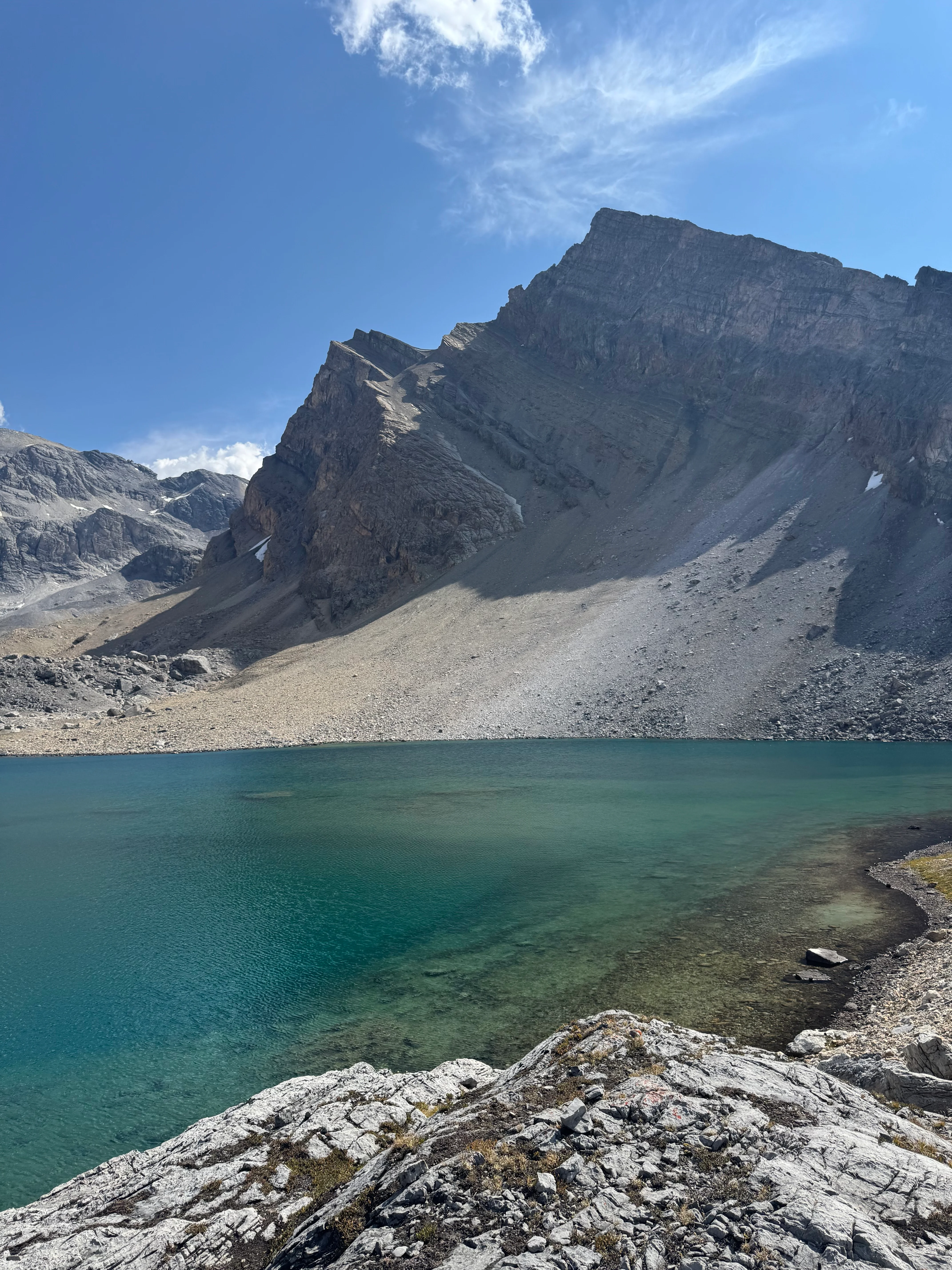
Pushing through willows and rough ground, the Lower Devon Lakes came into view - turquoise water filling a huge amphitheater of stone. Damn.
The cherry on top.

Lower Devon Lake — turquoise perfection
I swam, stretched out in the sun, cooked dinner by the shore. One of the best evenings I’ve had in the backcountry.
A small rise above the lake had the perfect tent site. Quiet, wild, unforgettable.
Woke up to this.
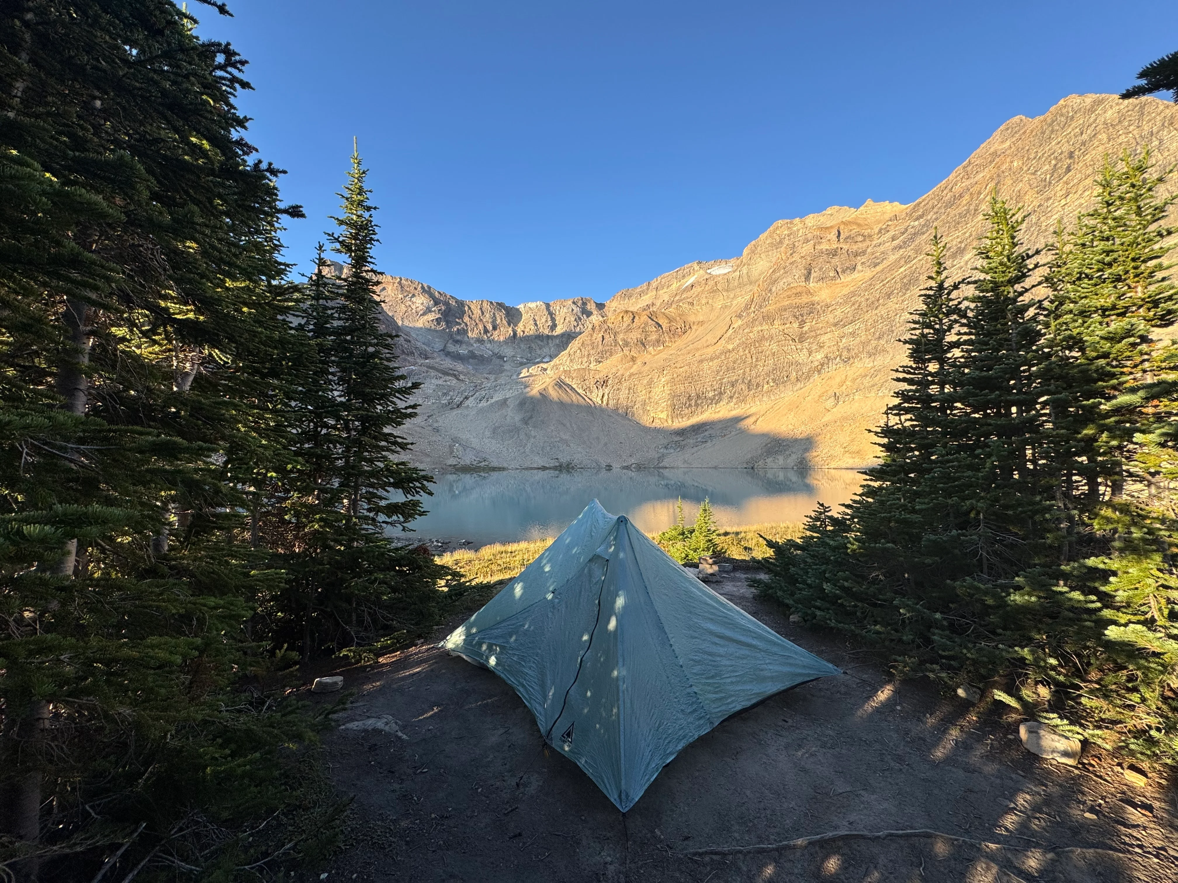
Morning light from camp at Lower Devon Lakes

Day 3

Day 3 route overview
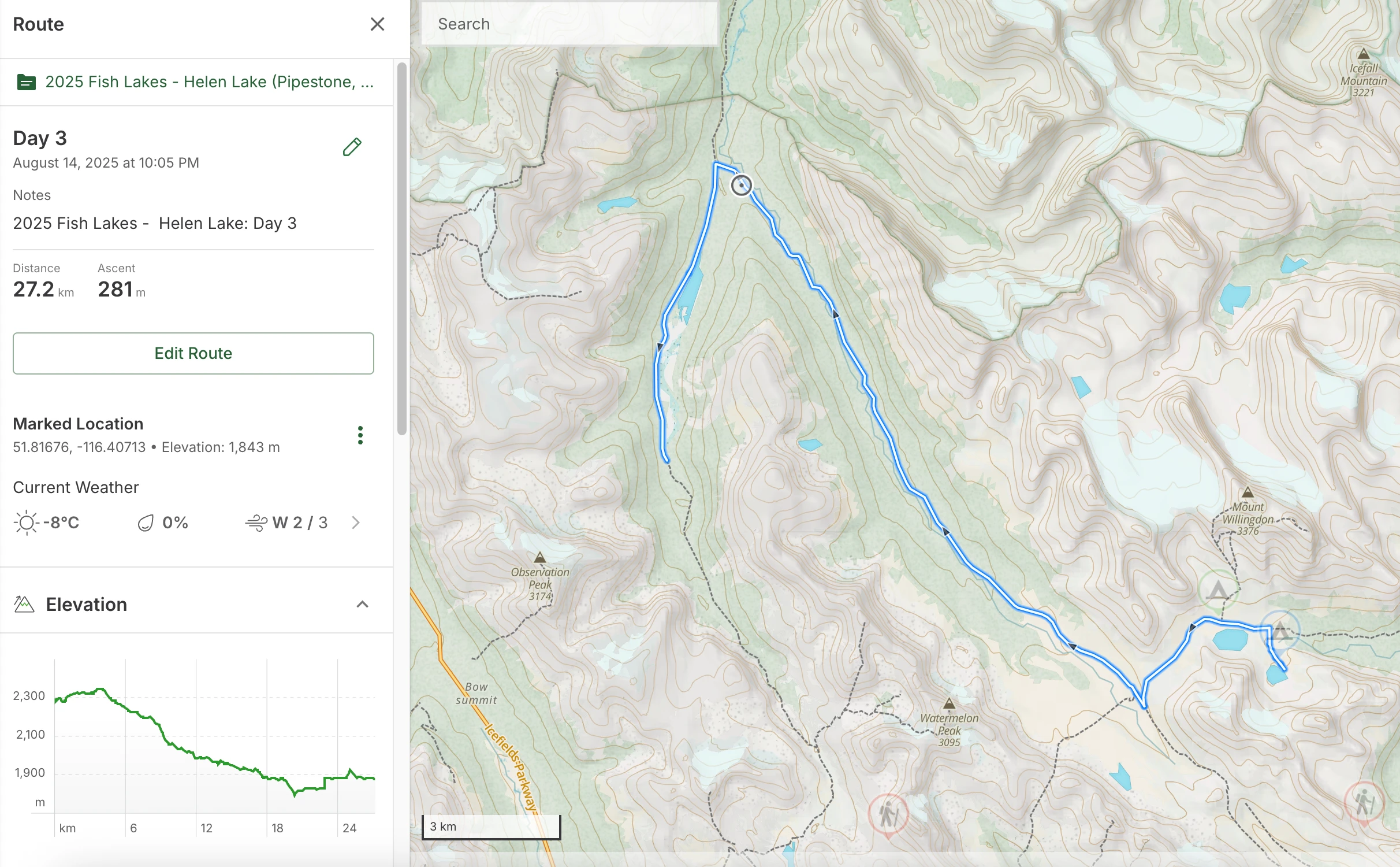
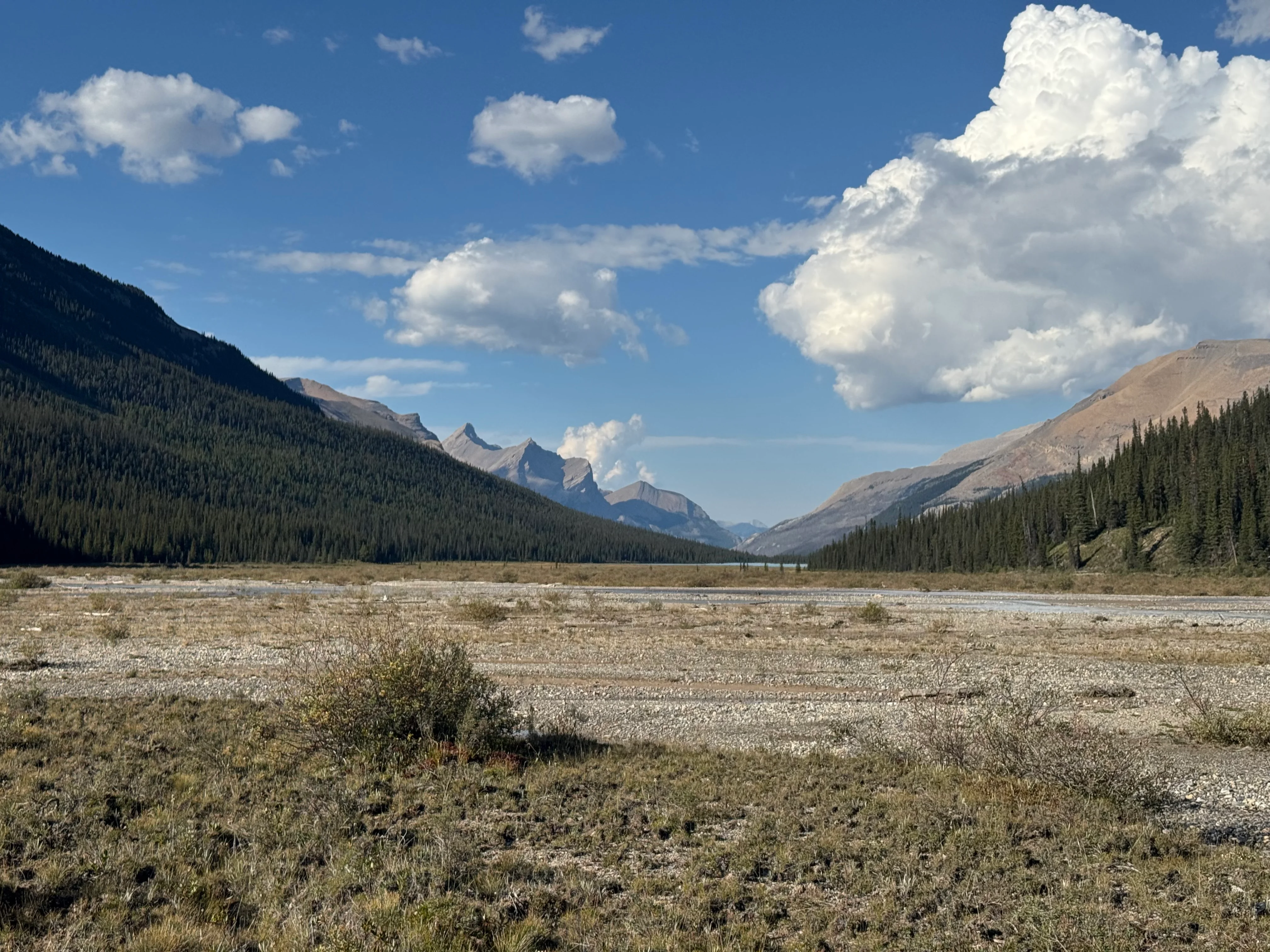
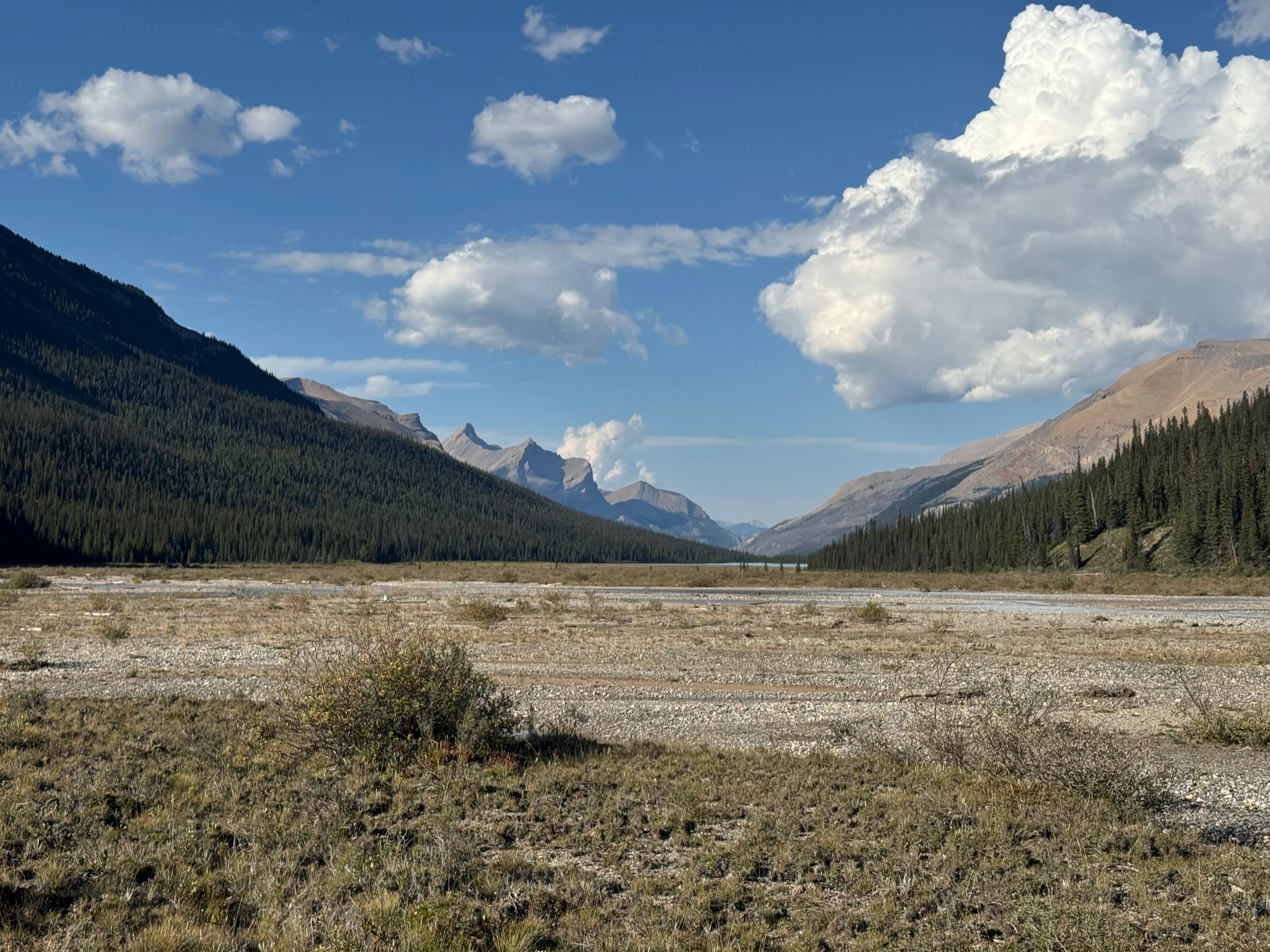
Today’s route: along the Siffleur River to Dolomite Creek. Crossing both is required. Most of the trail is in the forest, not much to see. Random camping isn’t well established here, but other trip reports mentioned a campsite called Confluence - that’s where I’m headed. One of the longest days, but mostly flat.
Sunrise at Lower Devon Lakes

Hit the trail right after breakfast, heading back the way I came yesterday, and then turning right toward Siffleur Wilderness Area.
Turning right toward Siffleur Wilderness Area

Down into the valley, then along the Siffleur River.
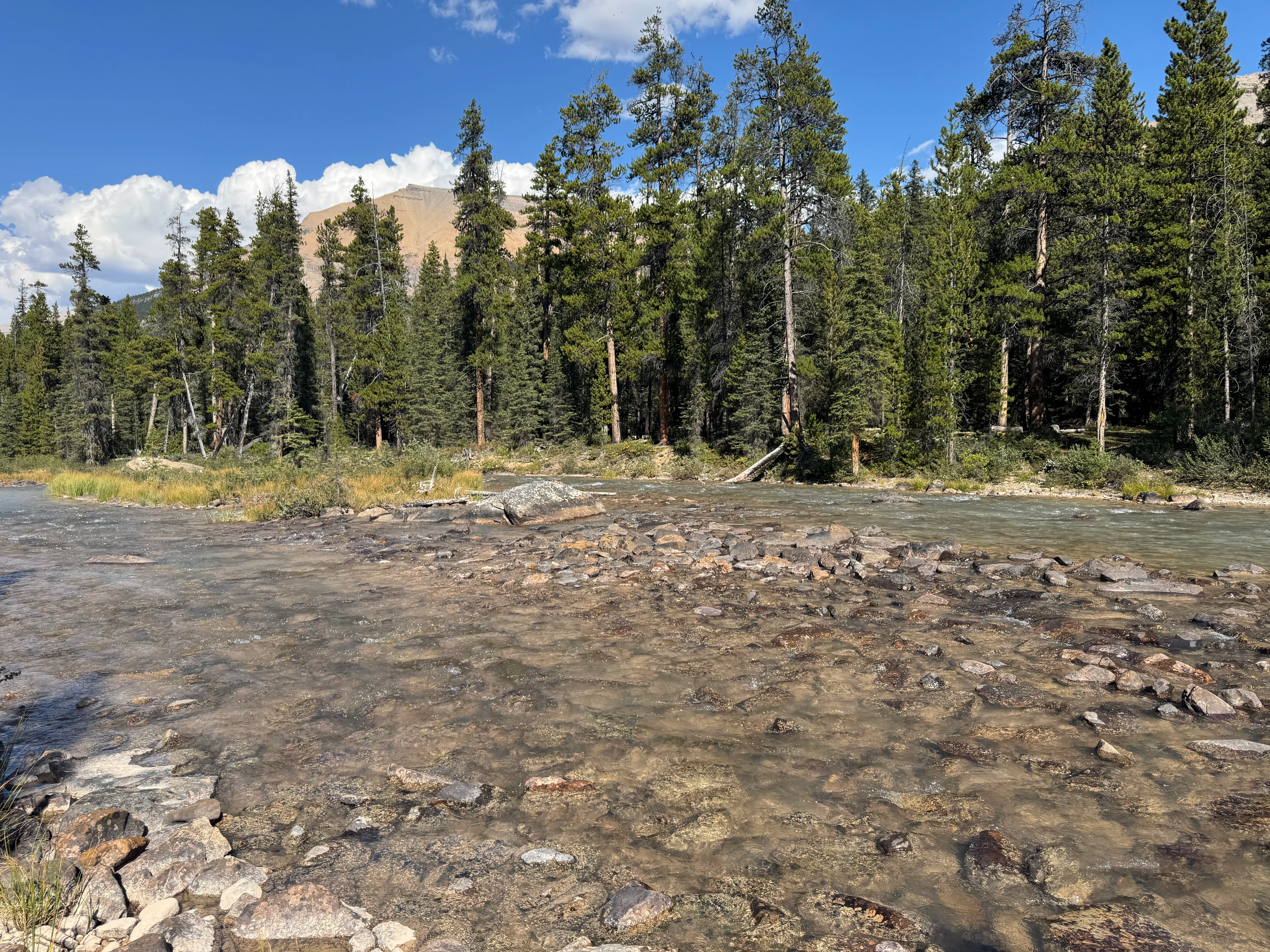
Not much going on here. Just river and trees. The trail isn’t well marked - this is the least travelled section.

Vegetation along the Siffleur River
I came across an abandoned ranger cabin and a well-established hidden campground. Didn’t take any photos though, sorry. Had lunch and kept going until I hit the Siffleur River crossing. Ankle deep (I’m 6’2”) and not very cold.
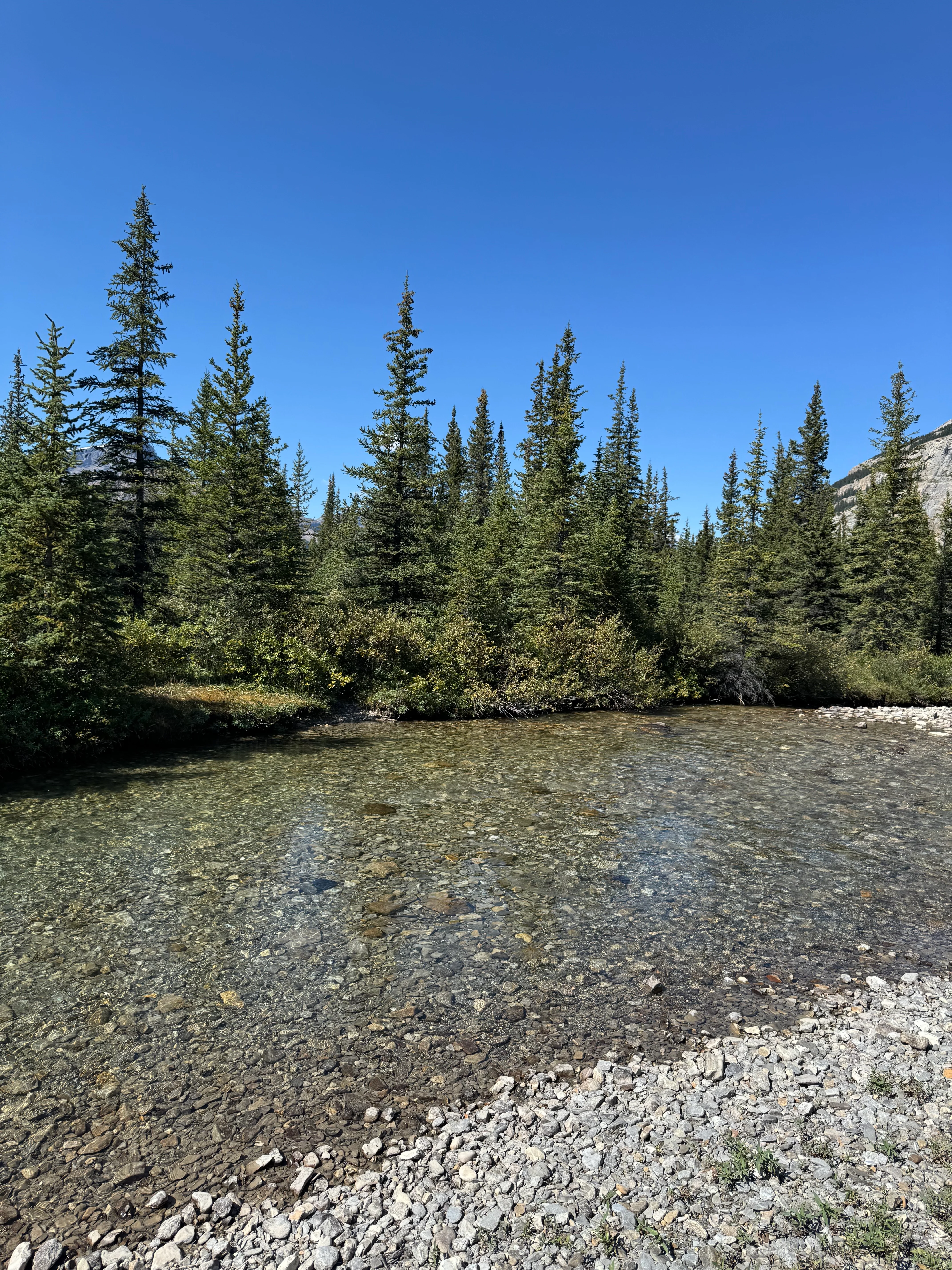
Siffleur River crossing - ankle deep

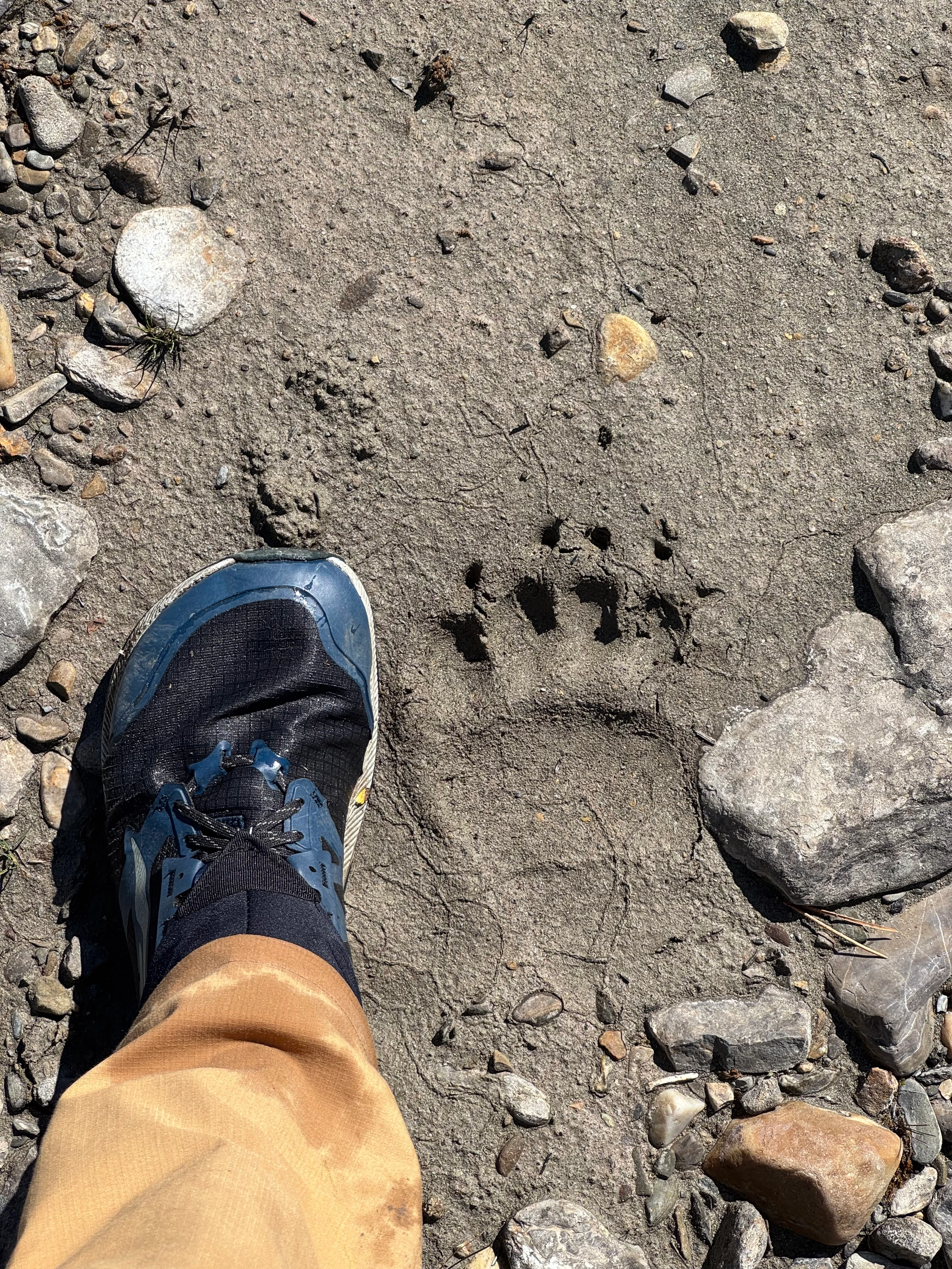
Fresh bear tracks in the mud. Good reminder to stay alert - we are not alone.

Bear tracks
A few km later, the Dolomite Creek crossing. The creek is way rougher than the Siffleur River. Other people left sticks for balance - use them. I had my trekking poles.

Dolomite Creek crossing - rougher water
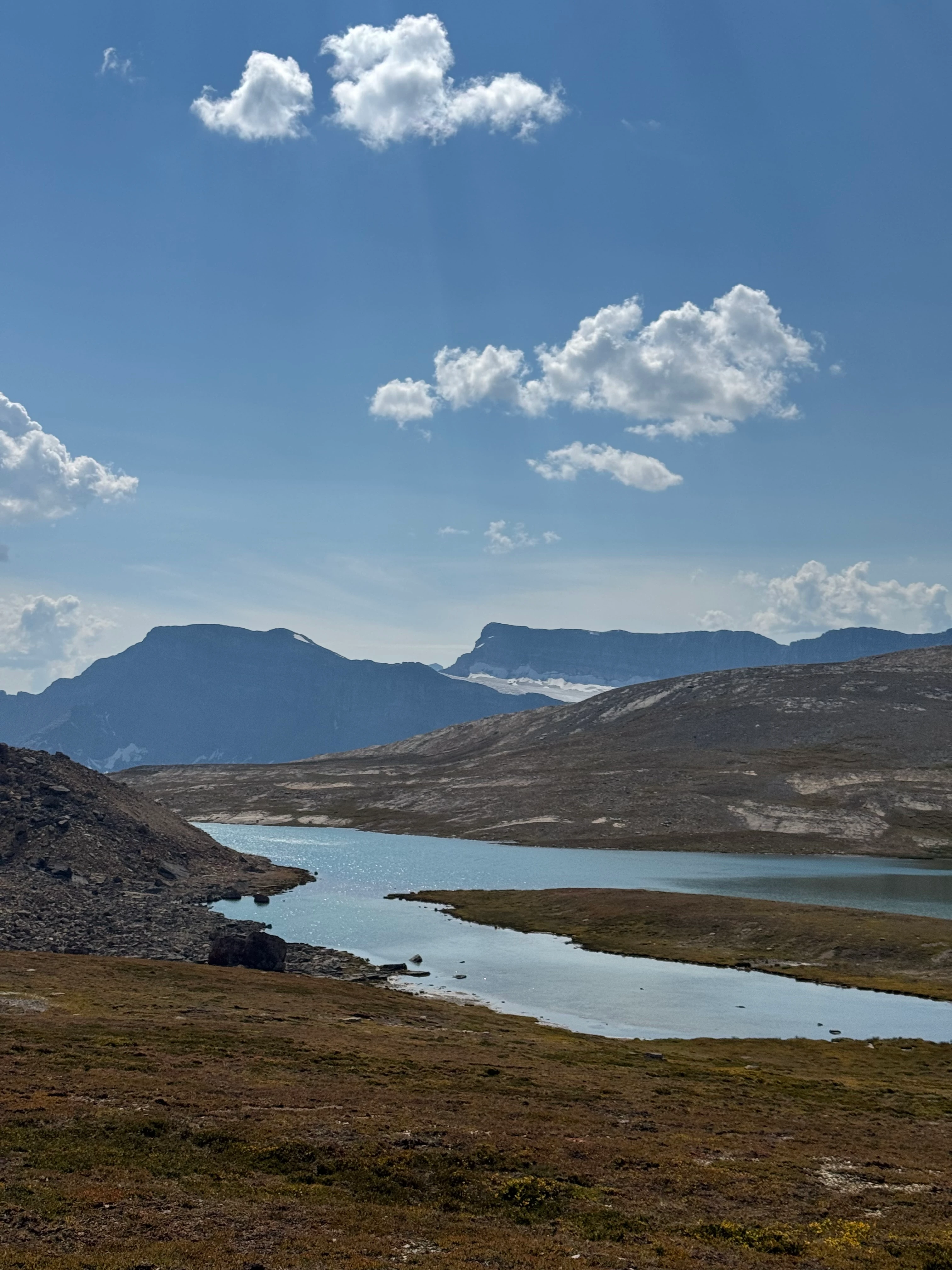
Kept pushing until the calm waters of Isabella Lake.
Isabella Lake

There’s a well-established ranger cabin here where you can camp. But it was too early, and I’d rather walk than sit around at camp doing nothing. Pushed on toward Confluence campsite.
Looking back at Dolomite Creek valley
Someone tried to mark this trail, but the riverbank is huge and the edges are washed out. Instead of jumping like a mountain goat through the markings, I just walked through the riverbank. My feet were already wet from the crossings anyway. Good decision.
Washed-out trail along the creek

I didn’t have the exact location of Confluence campsite, so I walked in circles for a bit, couldn’t find it. Eventually found a suitable spot for the night. Later discovered a forgotten tent stake, so someone definitely camped here before.

Camp for the night - not Confluence, but it worked
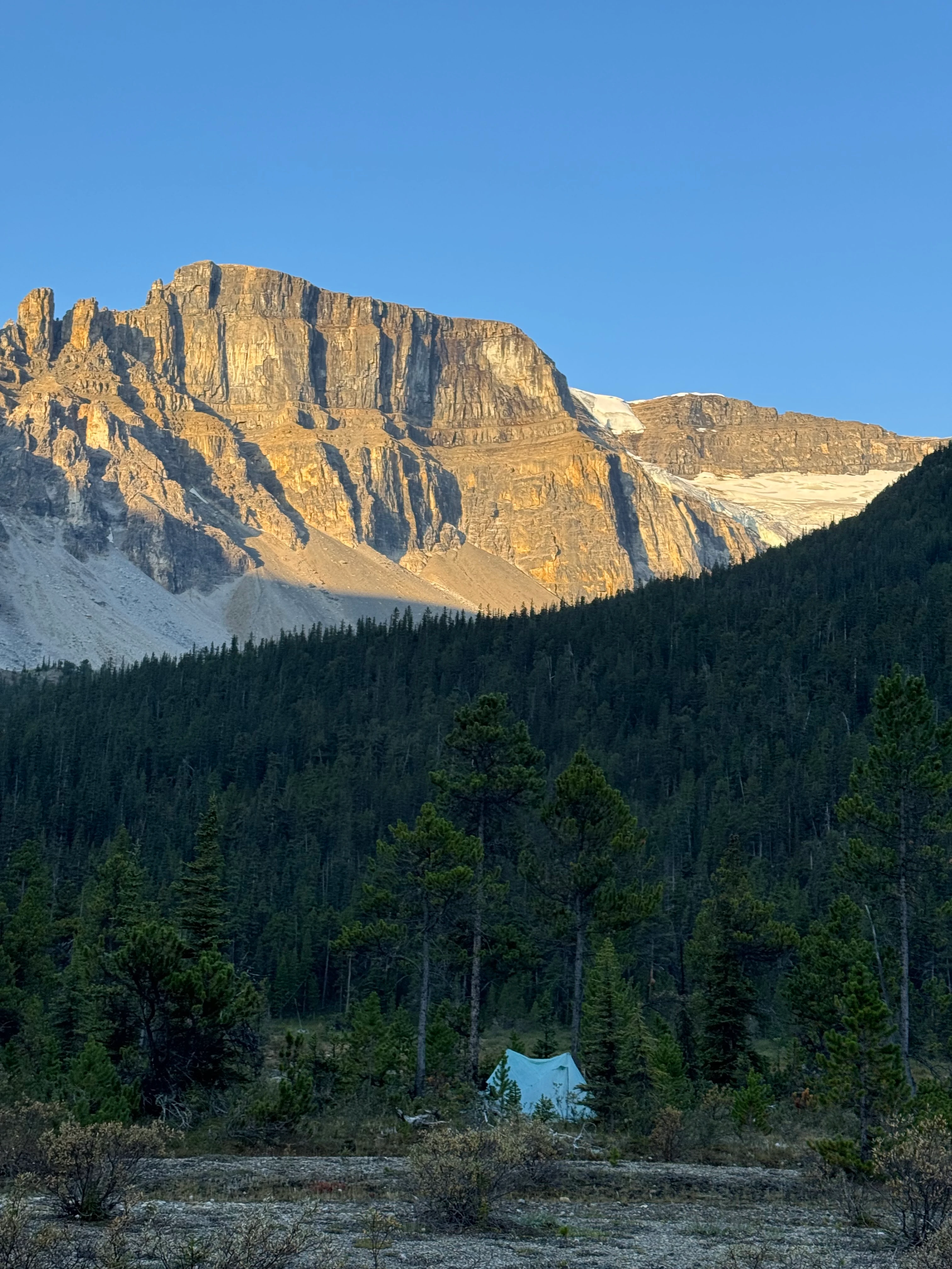
Not the best spot for a tent. My X-Mid Pro 2 barely fit, but I managed to pitch it and slept well. One concern was that the spot is squeezed tight between mountains - might be cold in the morning. Which turned out to be right.
Day 4
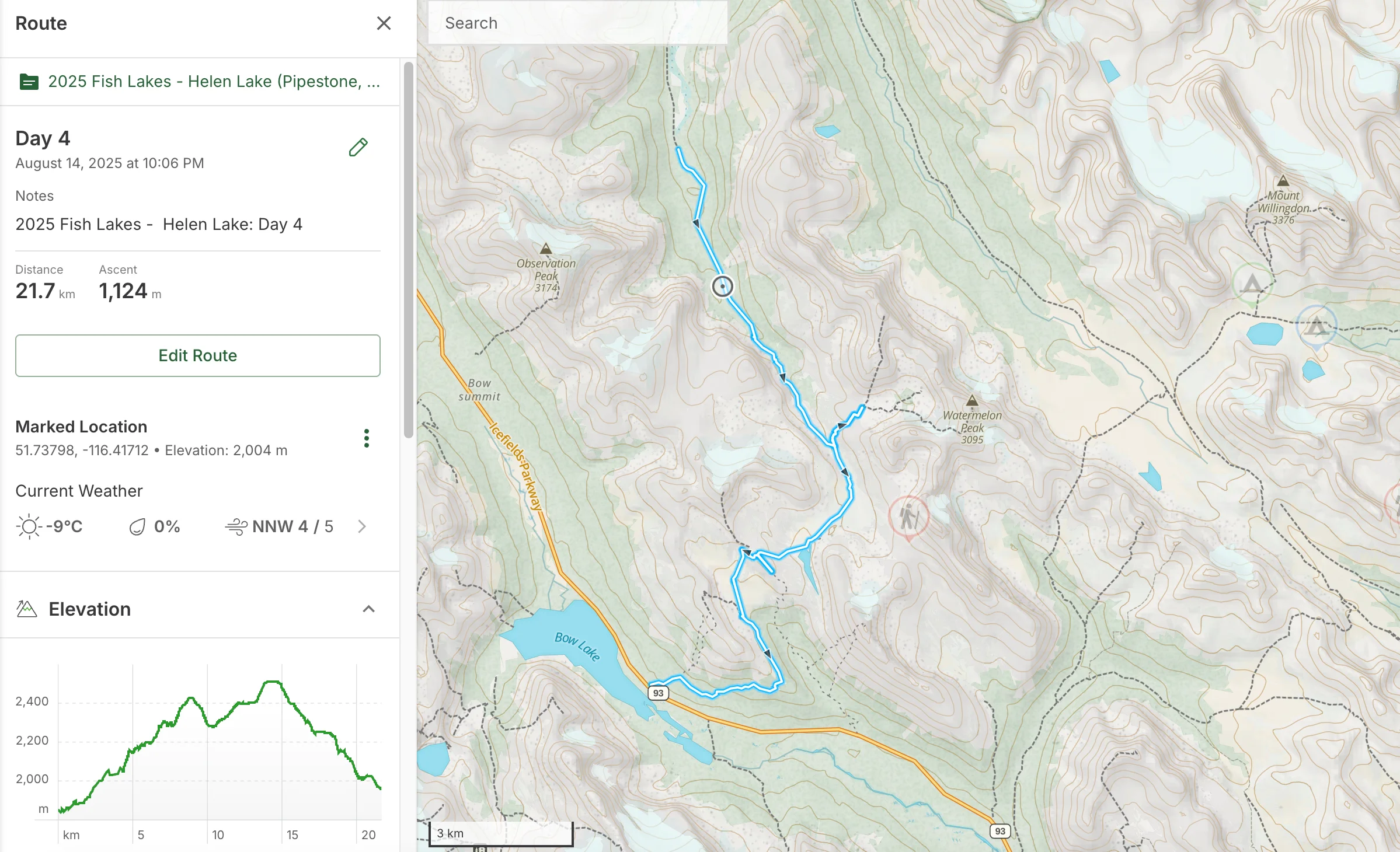
Day 4 route overview
Plan for today: up to Dolomite Pass, over to Lake Alice, down to Lake Katherine, up through Helen Lake Ridge, then down to the trailhead where I parked.
Cold morning. 1°C / 33.8°F. Around 4-5am I woke up shivering, but managed to tuck in my quilt better and slept another 2-3 hours.
Sun won’t reach this spot for another 3-4 hours because of the mountains, so I ate breakfast quick and headed out.
Cold morning - sun won't reach here for hours

Hiker Trash tip of the day: Cross rivers wearing your trail runners - they dry out fast while you walk. Keep separate dry Alpha Direct socks for camp (very light) and bread bags over them to keep your feet warm and dry.
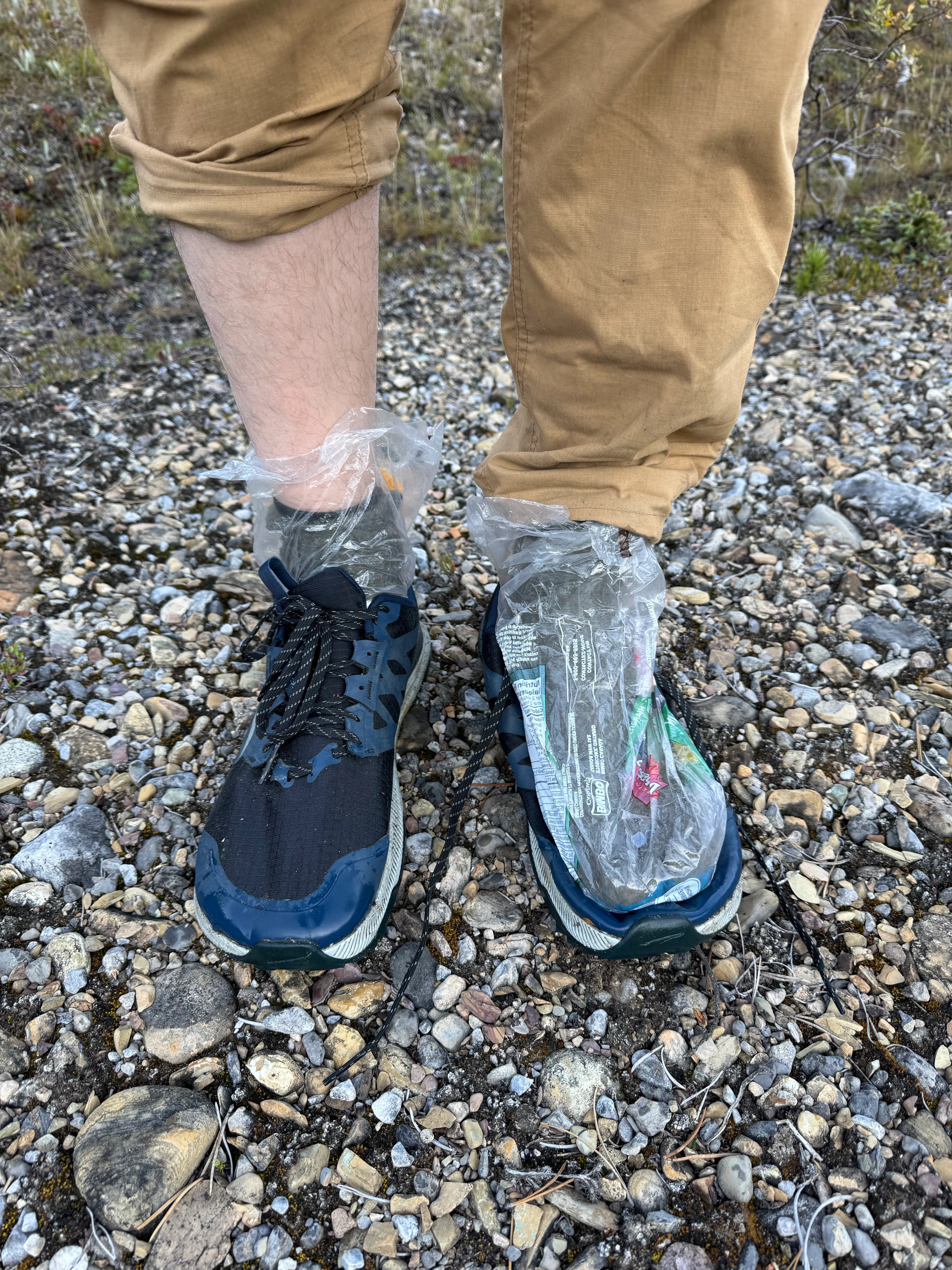
Bread bags over Alpha Direct socks for camp

Ancient campfire pit marks the spot. Someone stayed here a long time ago.
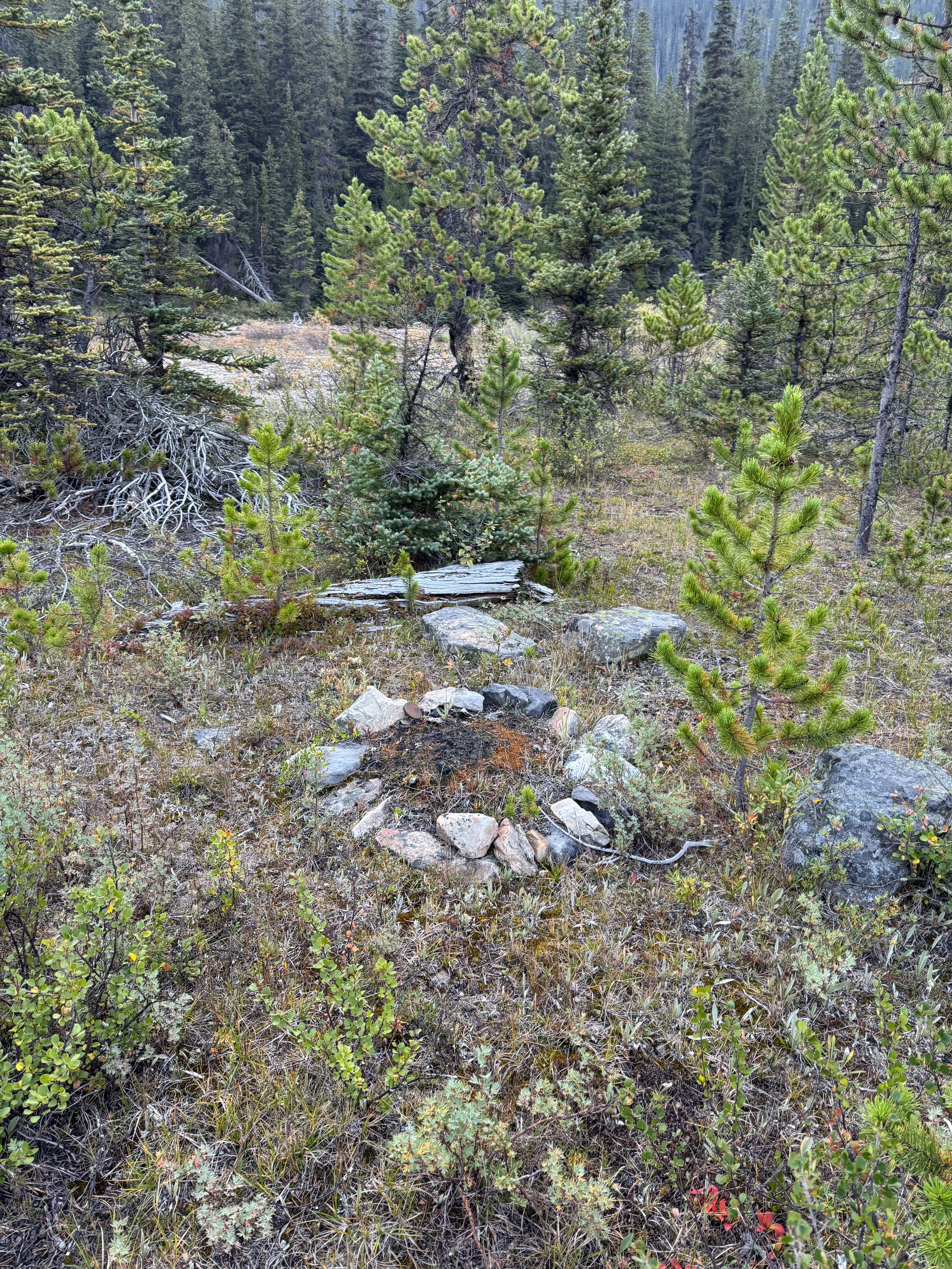
Ancient campfire pit - someone camped here long ago

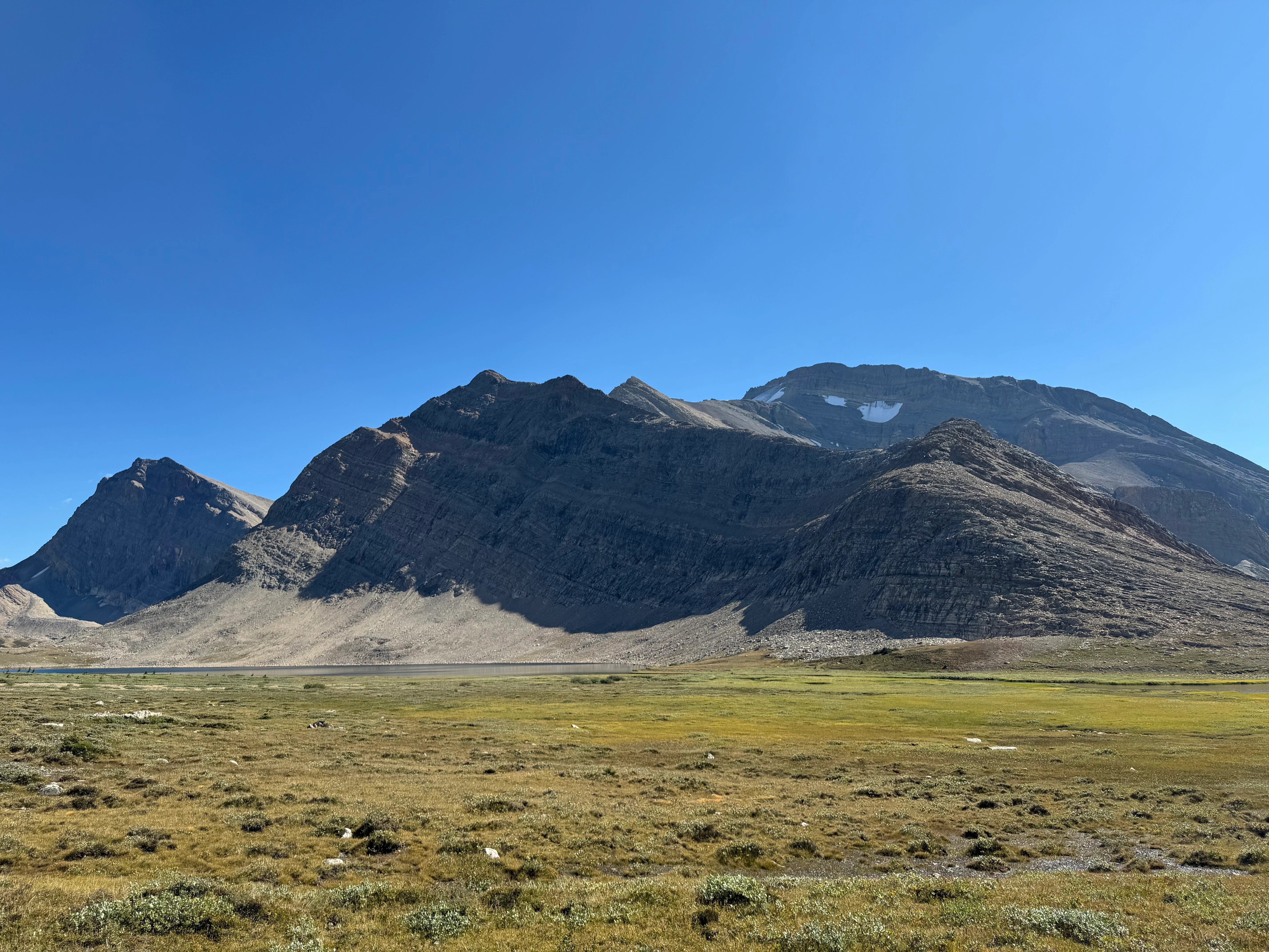
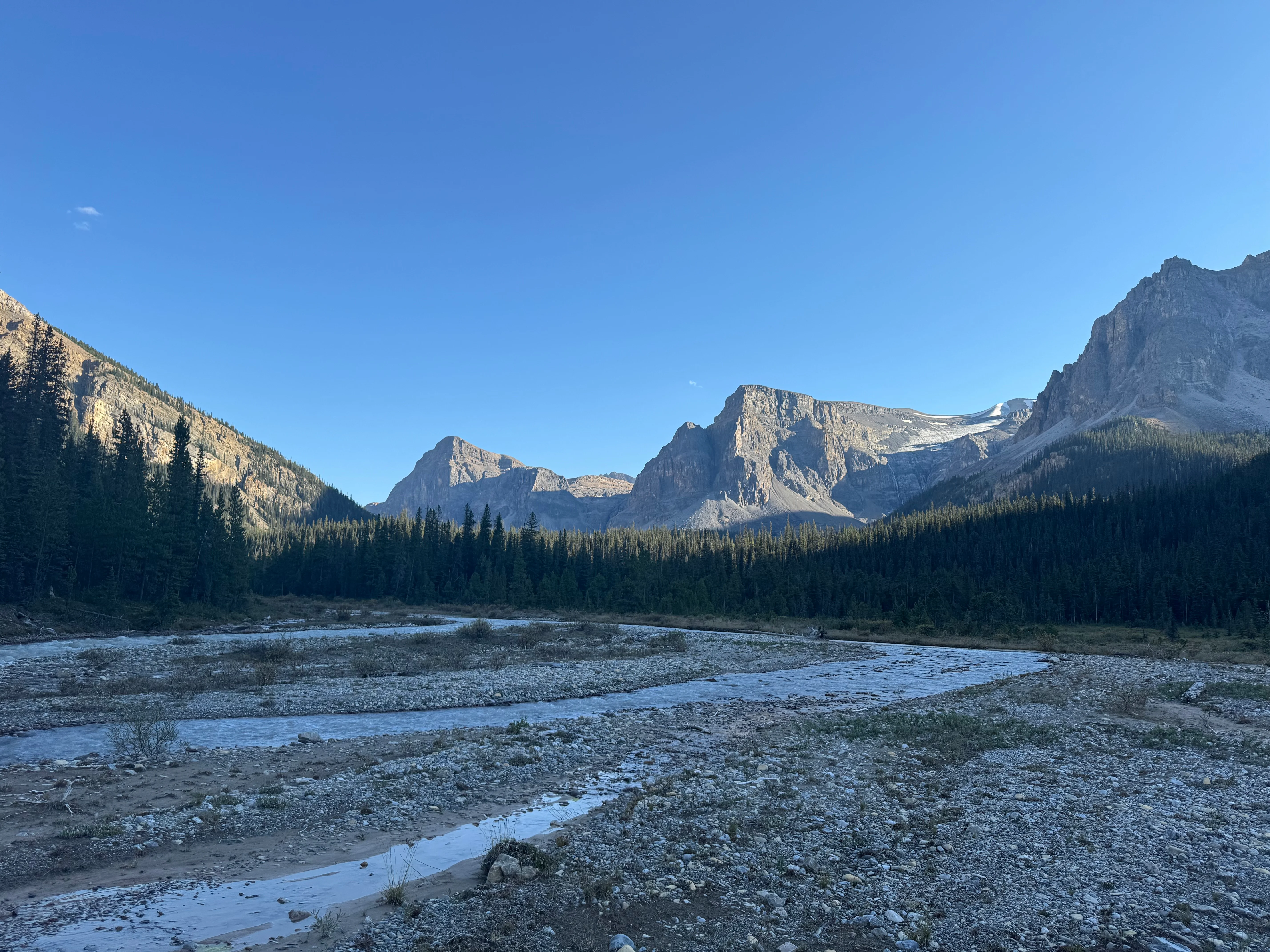
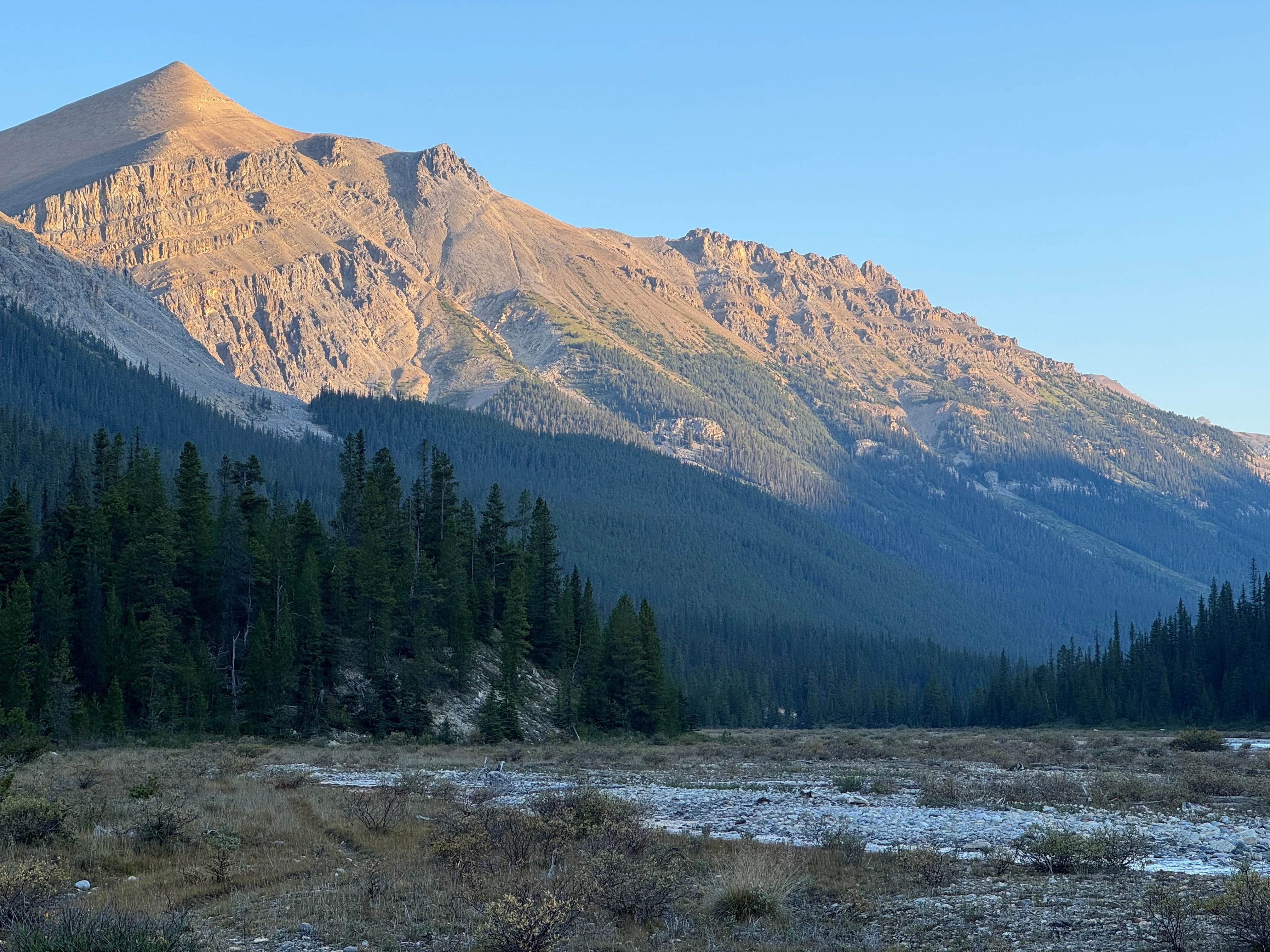
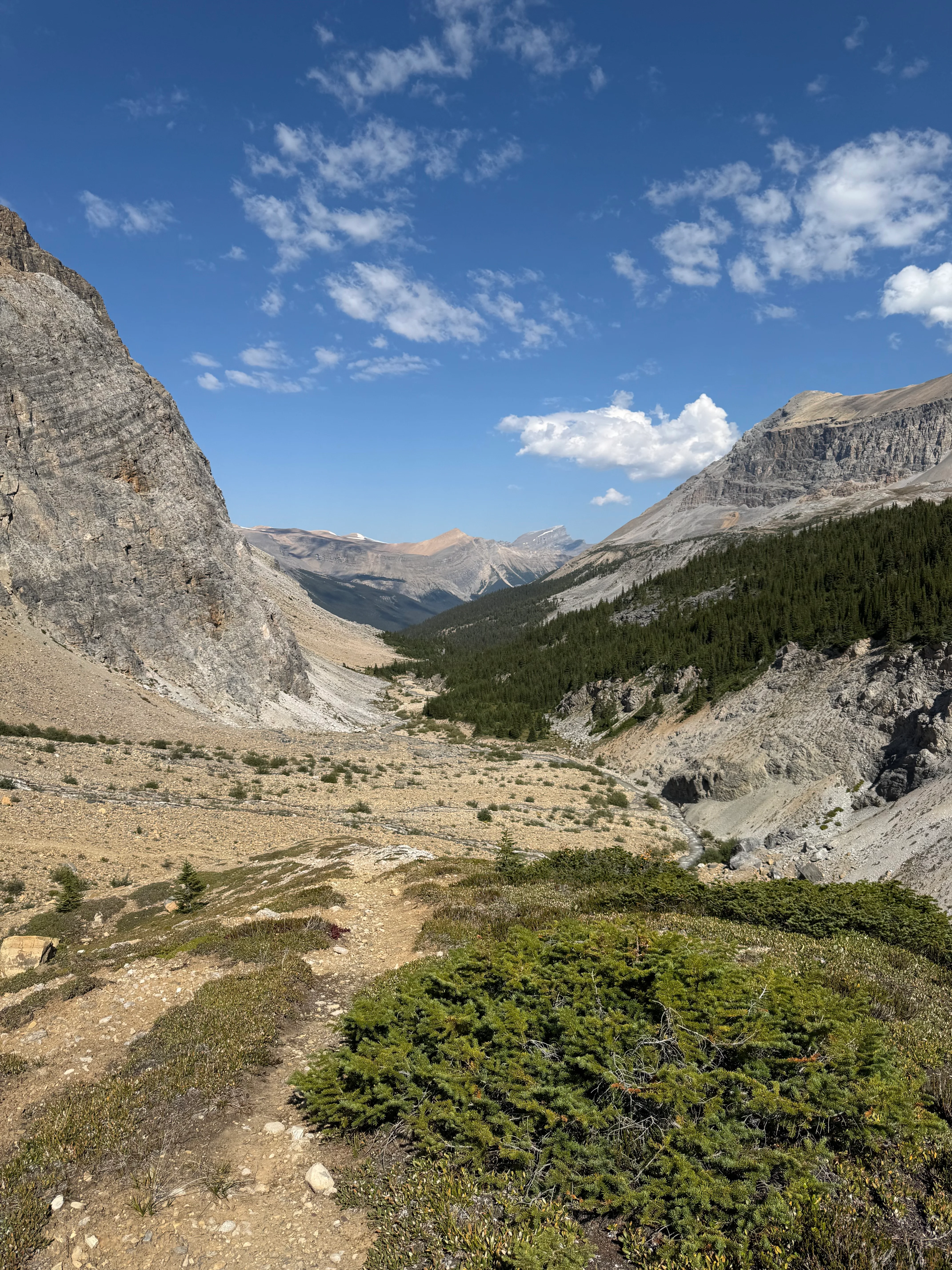
The valley opened up here. Dolomite Creek with a big unnamed peak behind. I couldn’t find it on the map.
Dolomite Creek valley with an unnamed peak rising above

A few kilometers later, I reached Confluence Camp. 2-3 km from where I’d slept. North side of the river, so one more crossing.
Designated campsite at the confluence

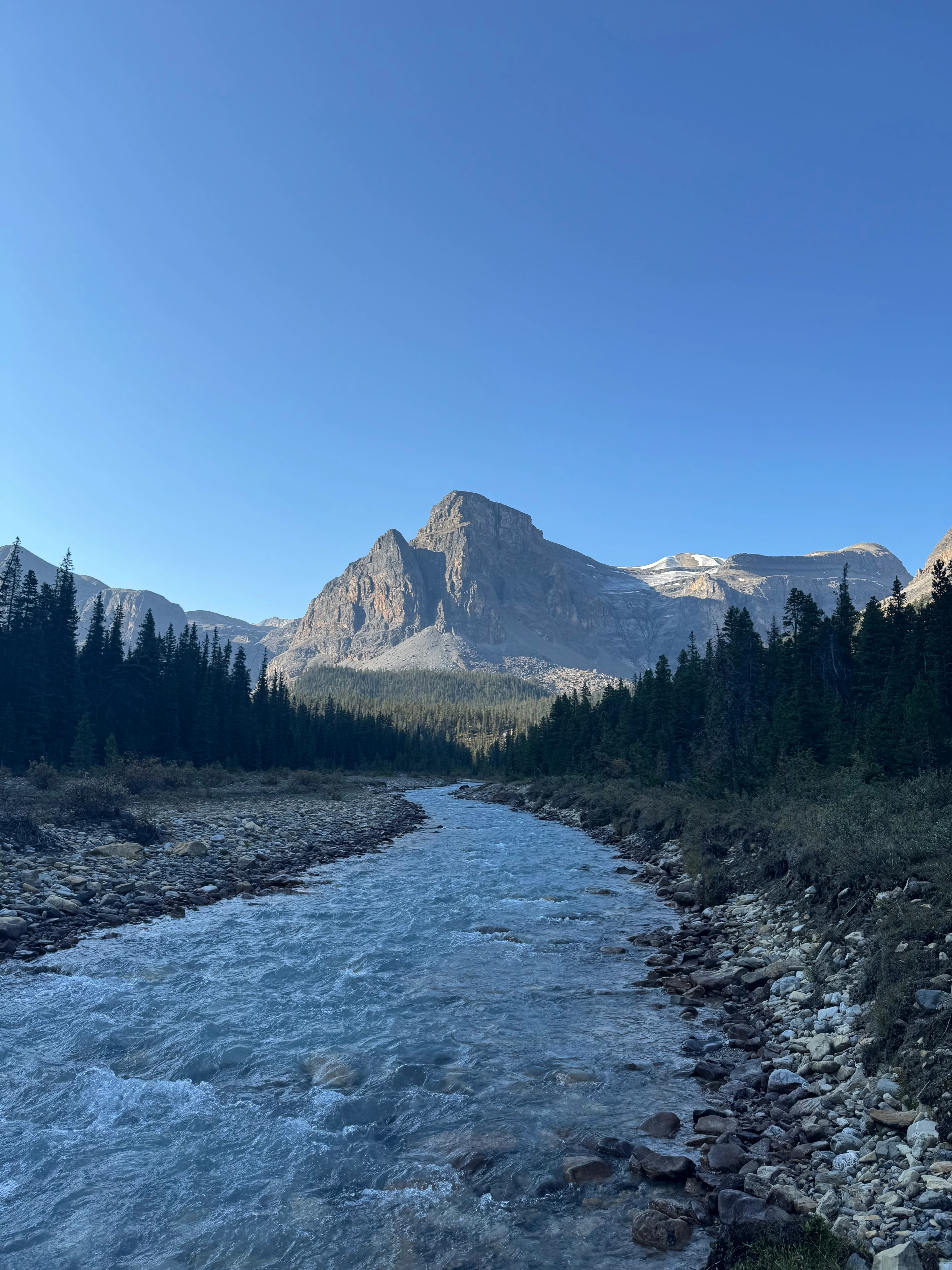
Steady uphill through forest. Few more river crossings. I looked back down at the valley.

Dolomite Creek valley from the climb toward the pass
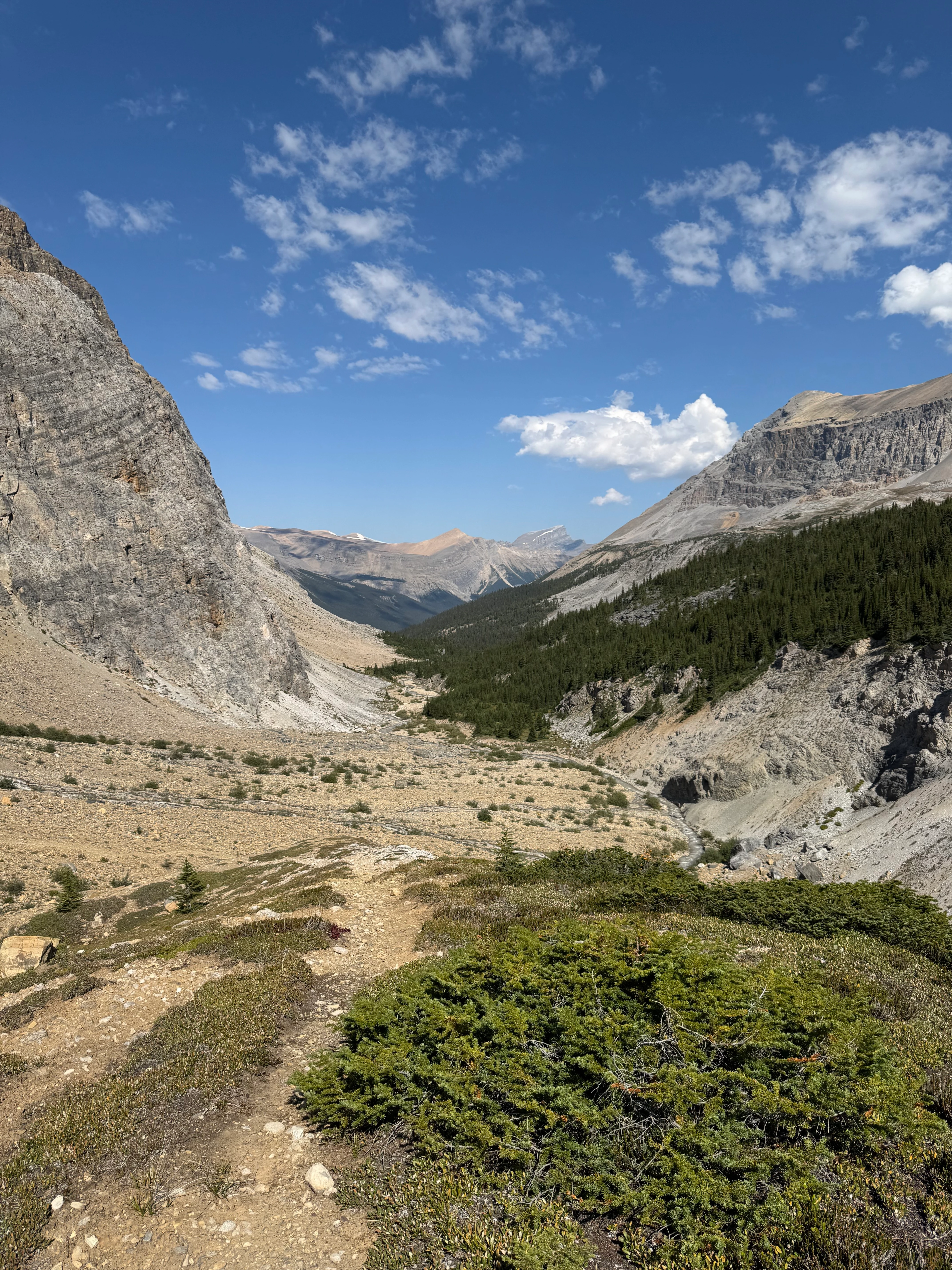
Higher up, waterfalls everywhere. Sun came out. I stopped at the pass for a dip in the creek.
Dolomite Creek valley view from above
After the pass, I dropped down to a flat plateau. Lake Alice was ahead - steep climb. I took a break to get ready. The plateau below was beautiful.

The climb to Lake Alice from the plateau
Looking back at the plateau from the climb to Lake Alice.

Looking back at the plateau from the climb to Lake Alice
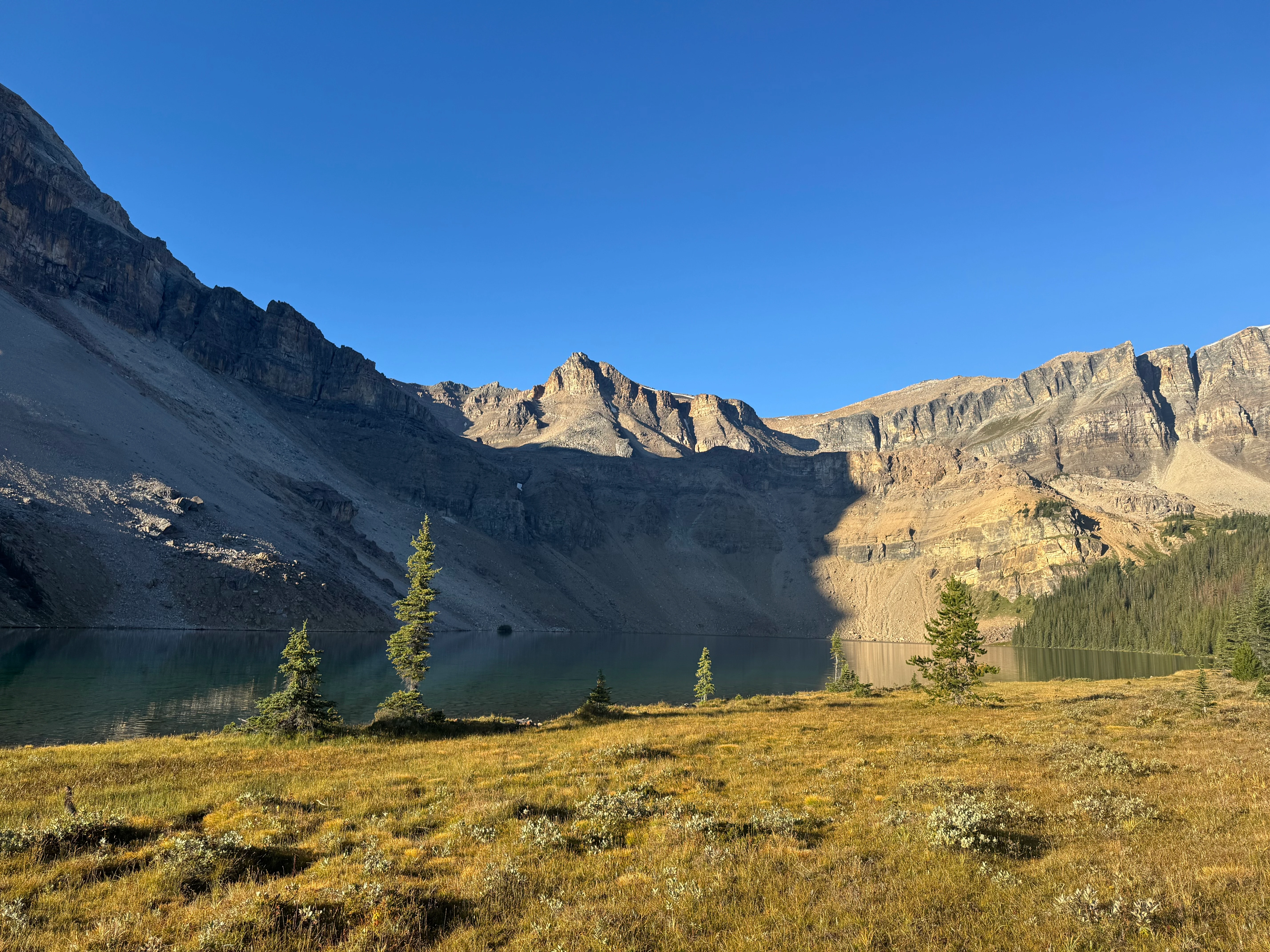
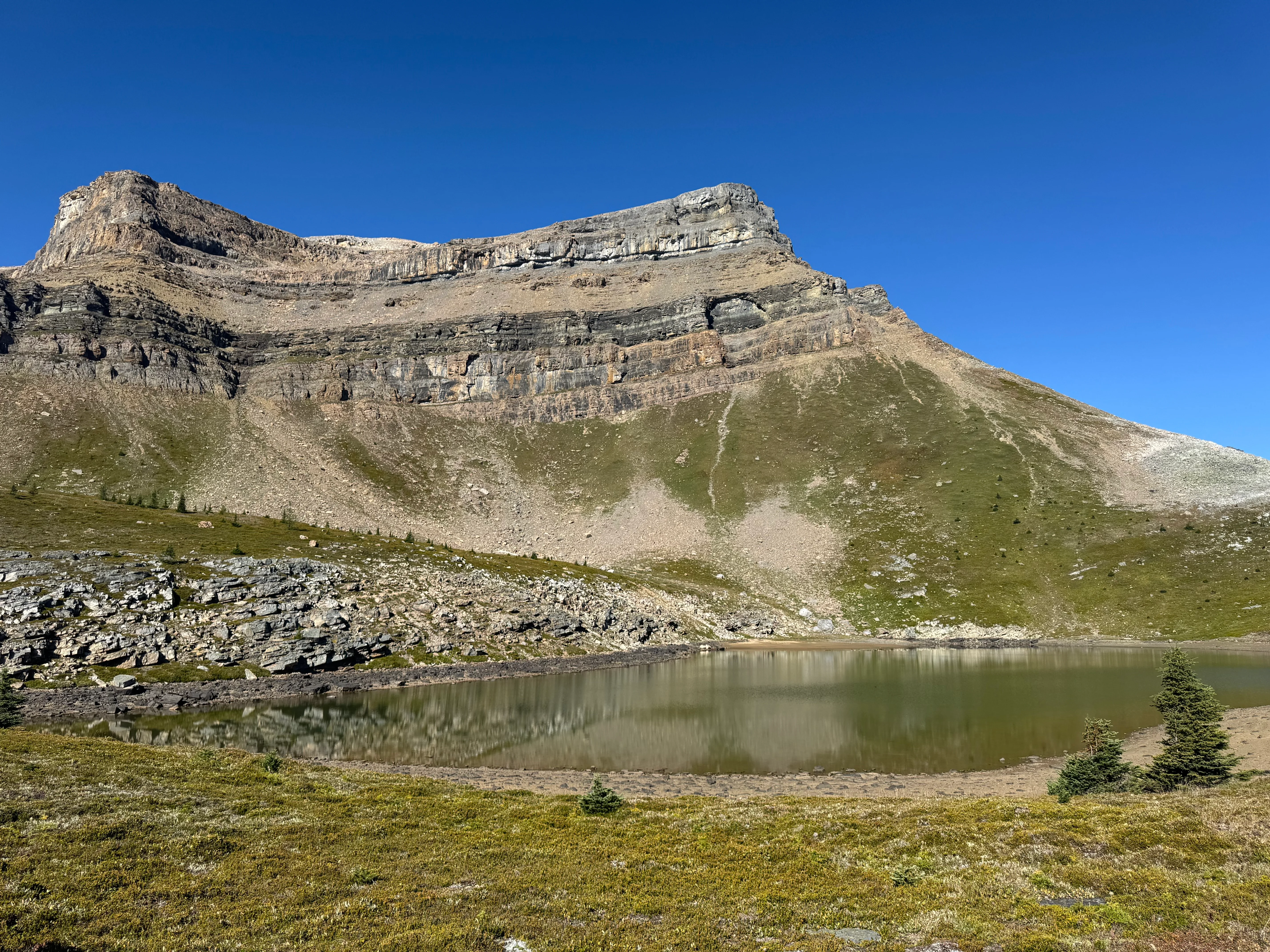
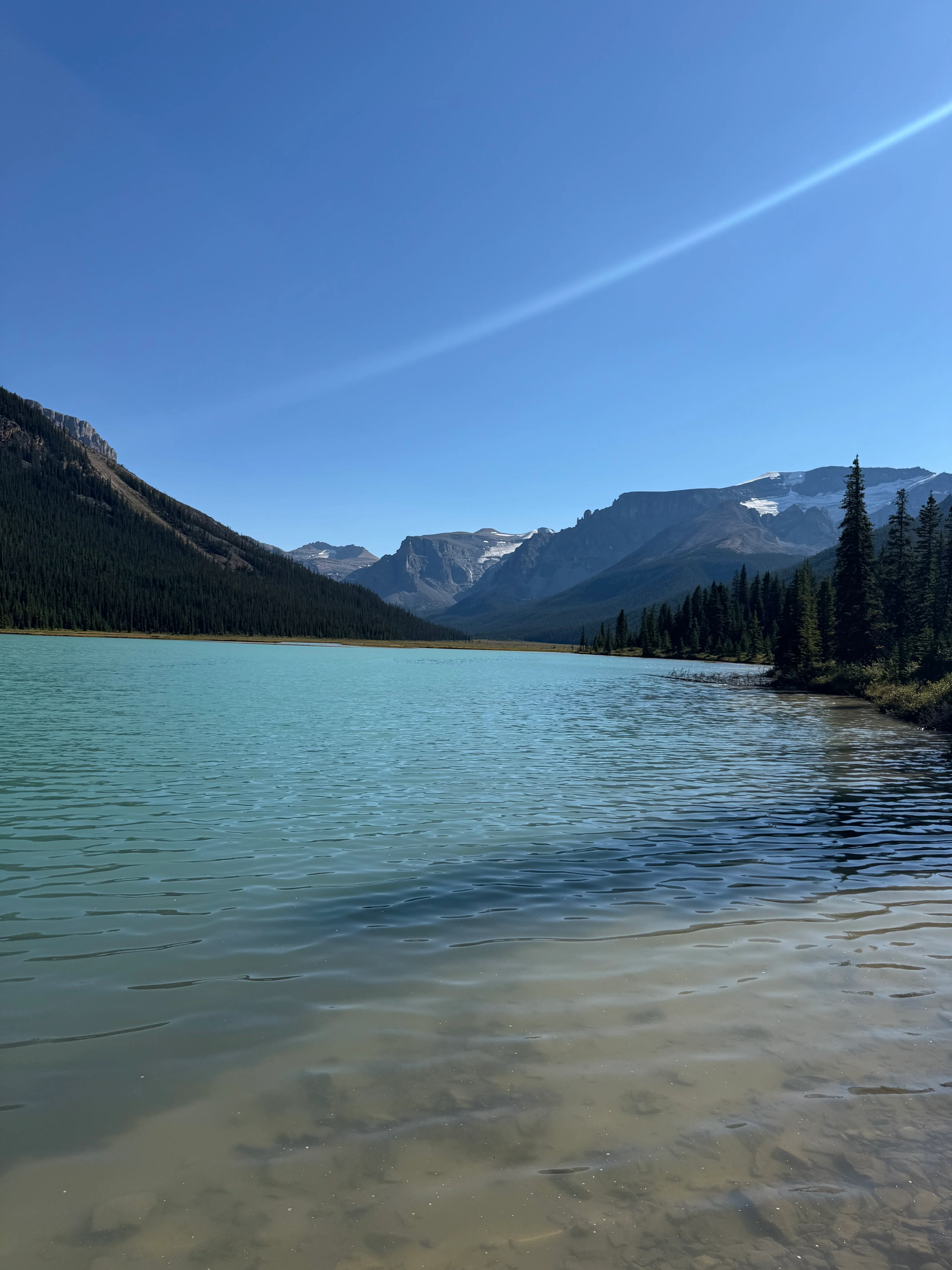
The climb paid off. Lake Alice was turquoise, mountains all around. Few flat spots for tents. Perfect.
Alice Lake
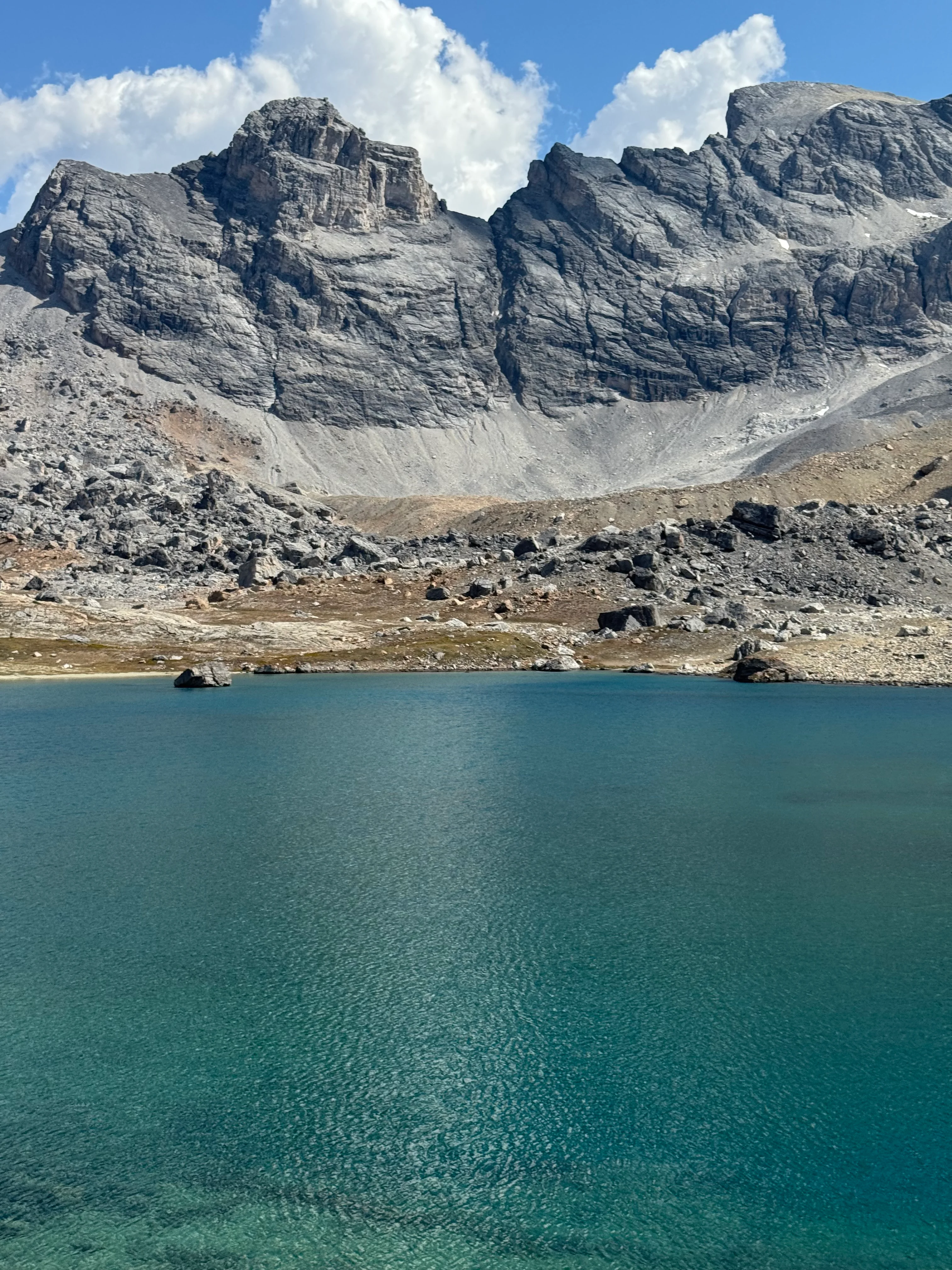
Turquoise waters
Many campspots along the lake shore


Dolomite Peak to the north. There’s a route back to Mosquito Creek via Dolomite Circuit. I’ll explore it next time, but for now I turned southeast toward Lake Katherine.

Dolomite Peak from the route to Lake Katherine
Almost Martian except for small lakes and a little bit of vegetation.
Approach to Lake Katherine

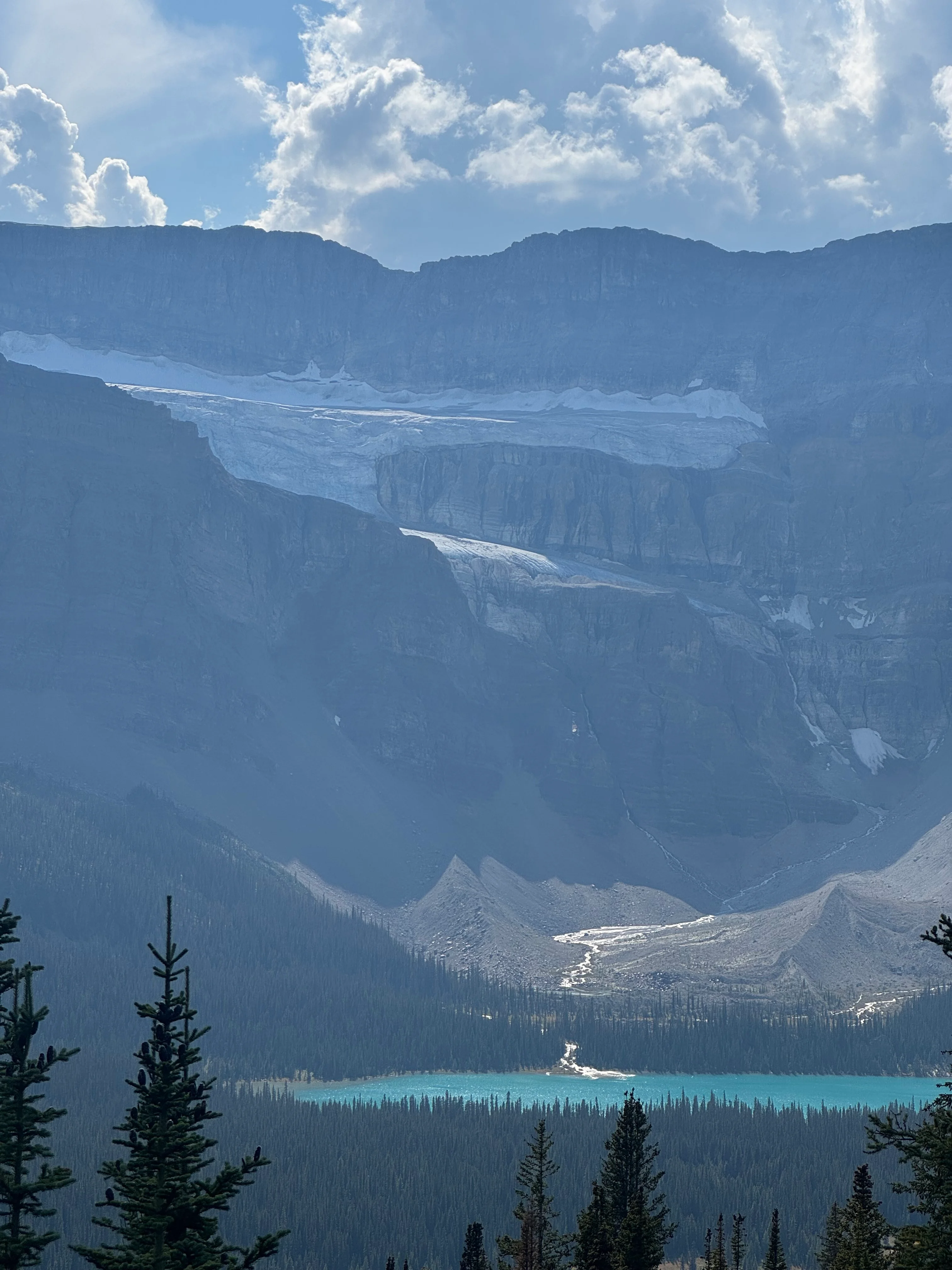
Easy climb to Lake Katherine. The lake is bigger than I expected. Crowfoot Glacier shines in the background.

Lake Katherine with Crowfoot Glacier beyond
I scrambled up to Helen Lake Ridge viewpoint. Not technical, just steep. Worth it for the views.
Oxo Peak from Helen Lake Ridge

Dolomite Peak and the Mohawk
Looking south at Banff backcountry. Peaks everywhere.
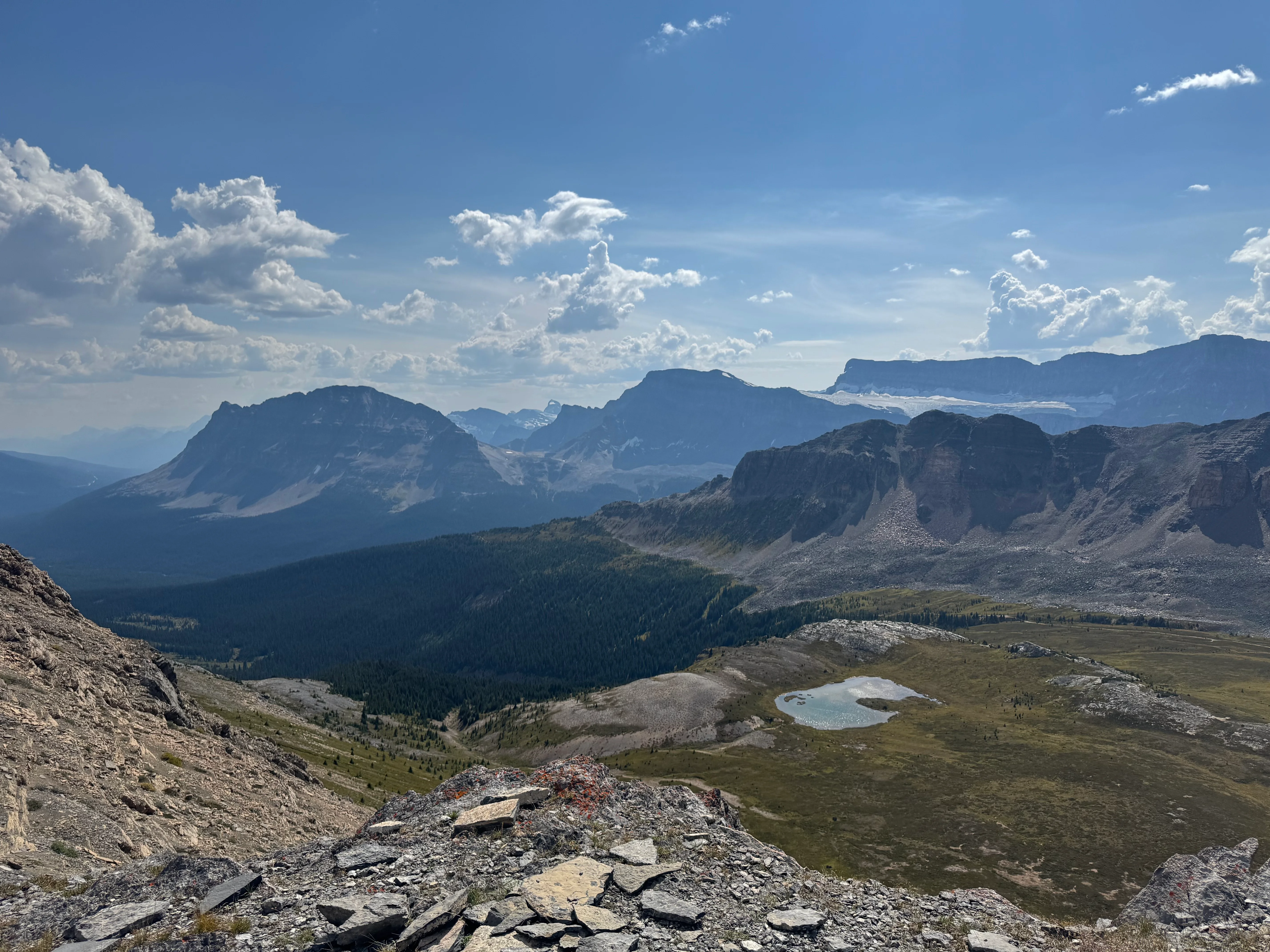
Banff backcountry from Helen Lake Ridge viewpoint

Helen Lake is a tourist trap, so it was packed - families, kids, selfie sticks. I didn’t stop, straight down to the parking lot.
I saw Mt Assiniboine in the distance on the way down. Tiny, far south.

Final descent from Helen Lake to the parking lot
Back at the car. I sat on the tailgate eating pretzel sticks, looking at Bow Lake and Crowfoot Mountain. Four days, good trip.
Bow Lake and Crowfoot Mountain from the parking lot

Next time I’ll loop around Devon Lakes and Dolomite Circuit.